case study
Seattle Implements Accessory Dwelling Unit Strategy with GIS to Expand Housing Choices
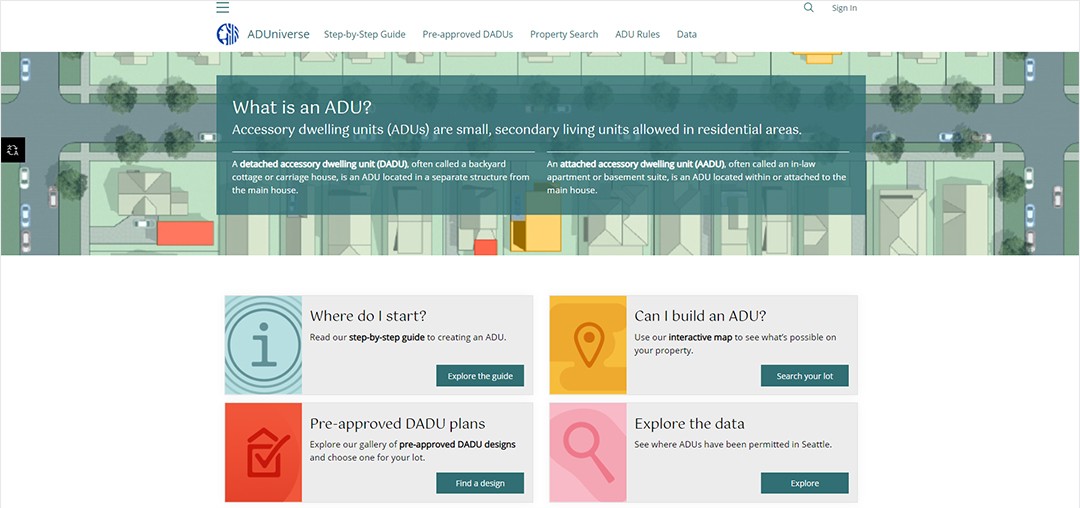
Seattle, Washington, has proved to be one of the fastest growing large cities in the US, having shown increases of 25 percent in population and 34 percent in jobs, all since 2010. Due to the rise in population, the number of housing units also went up 22 percent since 2010. For middle- and low-income communities in Seattle, finding access to more housing choices has been a challenge due in part to a lack of available affordable housing units. To combat this issue, Seattle's Office of Planning and Community Development (OPCD) promoted accessory dwelling units (ADUs), a small, secondary living unit that can be built on a homeowner's property. OPCD used ArcGIS Hub, a location-based community engagement tool, to develop ADUniverse, a website that helps residents learn more about these ADUs to provide diverse housing options in Seattle.

Creating Enough Housing to Meet the Demand
A wide range of people looking for a home within their budget were older adults looking to downsize, seniors with fixed incomes, homeowners with disabilities, multigenerational families, or other lower- and middle-income households. The housing options in Seattle were limited in terms of affordability, availability, location, and convenience, so finding a way to provide easy access to those in the population that were struggling financially was a key factor for Seattle to consider. The OPCD needed to make sure that the housing solution it provided took these factors into account while also diversifying housing options to offer more housing choice and improving housing outcomes.
New Tools to Promote ADUs
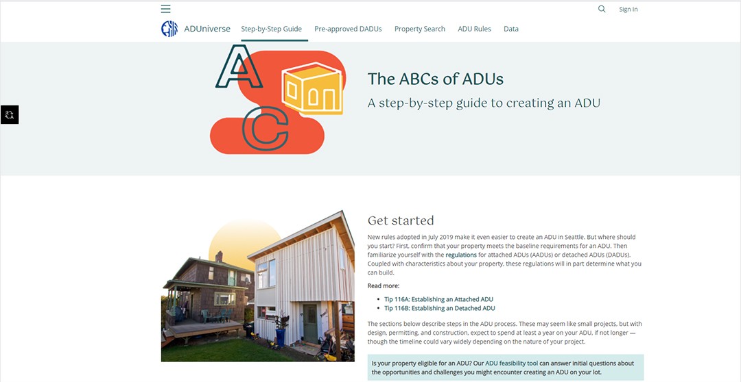
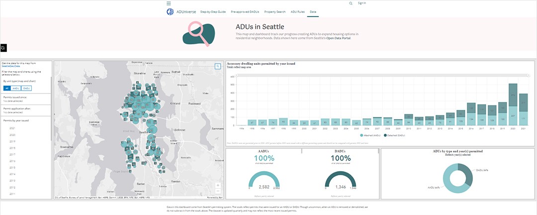
As part of a comprehensive strategy to respond to the housing crisis in Seattle, OPCD decided to promote ADUs, a housing option that would benefit those looking for something more affordable and current homeowners looking to make supplemental income. To provide more information about ADUs to the public and how to get started on building them on a resident's property, OPCD and the Seattle Department of Construction and Inspections (SDCI) created ADUniverse, a website that they built using Esri's ArcGIS Hub. The ADUniverse site included information on what an ADU is, what types of ADUs exist, how to get started on creating an ADU with a step-by-step guide, an interactive map to show people which ADU is possible on their property, preapproved detached ADU designs that can be used for a resident's lot, and a map to explore currently permitted ADUs in Seattle.
"We do a lot of GIS work on where development is happening in Seattle in general and analyze that as well as housing affordability data we get. Many of our projects use GIS," said Nick Welch, Senior Planner for City of Seattle, OPCD.
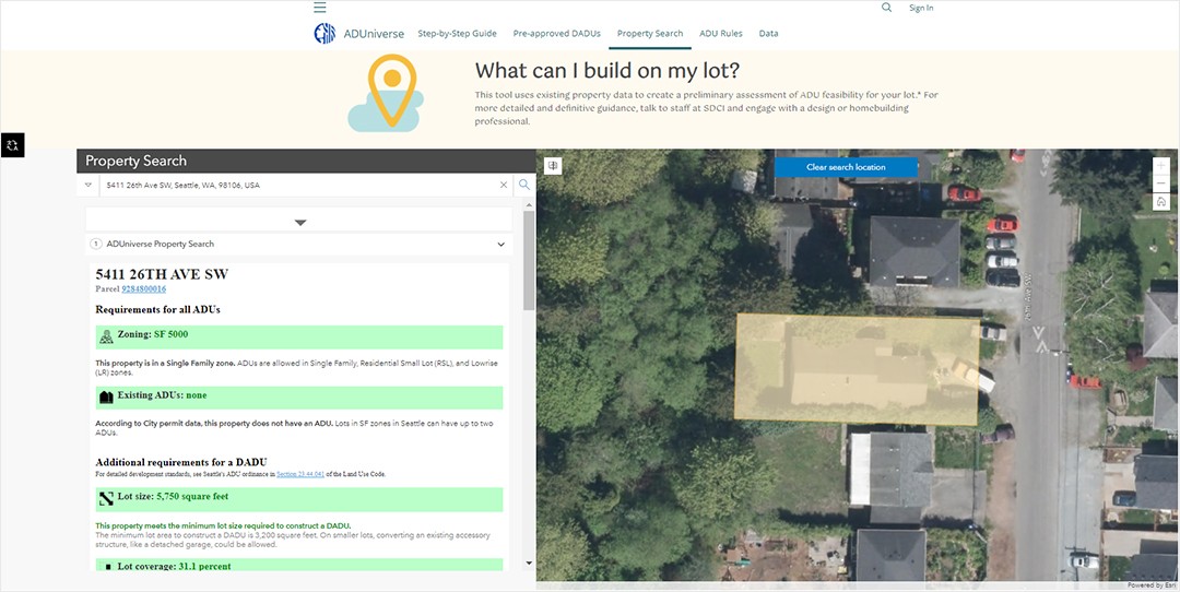
On the ArcGIS Hub website, the property search tool uses existing property data to create a preliminary assessment of ADU feasibility for a lot. It allows potential customers to search their address and learn about the feasibility of creating an ADU on their property given its zoning, location, and property characteristics. With geographic information system (GIS) technology integration, residents can see information based on their address to get them started on building an ADU.

The goal of ADUniverse was to make it as easy as possible for residents to get a permit to build an ADU. The ADUniverse hub site makes the process of getting an ADU simple to understand. By including a step-by-step guide for ADUs on this hub site, OPCD can walk a customer through the entire process for building an ADU, creating more efficiency in providing more housing to the public. OPCD is also able to communicate the importance of ADUs, why it encourages them, and how building one on the resident's property is helping to address the much larger housing crisis in Seattle.
"The ability to present all this in one place with Hub, and to do so without needing much technical coding expertise, was attractive," Welch said.

Policy Changes and Resources Lead to Rising ADU Numbers
After 2019, the OPCD reformed its ADU regulations and launched ADUniverse in 2020. They have been monitoring the hub site to see if it was making a difference in ADUs being built. Within a week of its public launch, ADUniverse had brought in approximately 8,000–10,000 people to its site. By implementing more flexible regulations, providing a centralized source of information on ADU construction and plans, and employing a geographic-based approach using ArcGIS to create ADUniverse, the OPCD has seen a big jump in permitted ADUs—roughly 60 percent. Since ADUniverse launched, the traffic and attention to the hub site have contributed to almost 4,000 permitted and built ADUs, including attached and detached units.
"GIS helps us understand how development is playing out and affecting socioeconomic and demographic conditions in Seattle," said Welch. "It is a useful tool that helps us visualize how growth and change interact spatially with neighborhood conditions, which we assess through zoning information, historical context, and census data."

In addition to improving the options for affordable housing, Seattle is also moving in a more equitable direction. The GIS data collected for residents from the Seattle GeoData portal allowed OPCD staff to see information spatially at the neighborhood scale so that they could see who benefits from the ADUs. By using Esri's ArcGIS Hub and dashboard technology, OPCD can provide a repeatable example to other cities around the world enduring a housing crisis.
"I can't think of a project or policy effort related to housing where we haven't been asked to analyze things spatially or consider how a proposal would affect a certain area. It's totally part of our process to understand that spatial dimension," Welch said.