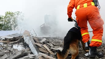
Defense Support to Civil Authorities (DSCA)
The US Department of Defense can help civil authorities in times of crisis, with GIS tools being critical enablers for success.

Discover new insights, innovative best practices, and the latest advancements in GIS technology.

| Date | Event | Location |
|---|---|---|
| April 28–30, 2026 | Modern Day Marine 2026 | Washington, District of Columbia |
| May 3–6, 2026 | GEOINT 2026 | Aurora, Colorado |
| May 18–21, 2026 | SOF Week 2026 | Tampa, Florida |
| May 19–21, 2026 | SAME JETC 2026 | Portland, Oregon |
| September 14–16, 2026 | AFA Air, Space & Cyber Conference 2026 | National Harbor, Maryland |
| October 12–14, 2026 | AUSA Annual 2026 | Washington, District of Columbia |
| October 27–29, 2026 | AFCEA TechNet Indo-Pacific 2026 | Honolulu, Hawaii |
| November 4–6, 2026 | SAME Small Business Conference 2026 | Charlotte, North Carolina |
| November 17–19, 2026 | NCIA NATO Edge 2026 | Izmir, Turkey |
| November 30 – December 4, 2026 | I/ITSEC 2026 | Orlando, Florida |
| December 7–10, 2026 | DODIIS 2026 | Fort Lauderdale, Florida |
| Date | Event | Location |
|---|---|---|
| July 11–14, 2026 | Esri Safety & Security Summit | San Diego, California |
| July 13–17, 2026 | Esri User Conference | San Diego, California |
| July 14, 2026 | Defense and Intelligence Summit @ Esri UC | San Diego, California |
Defense Support to Civil Authorities (DSCA)
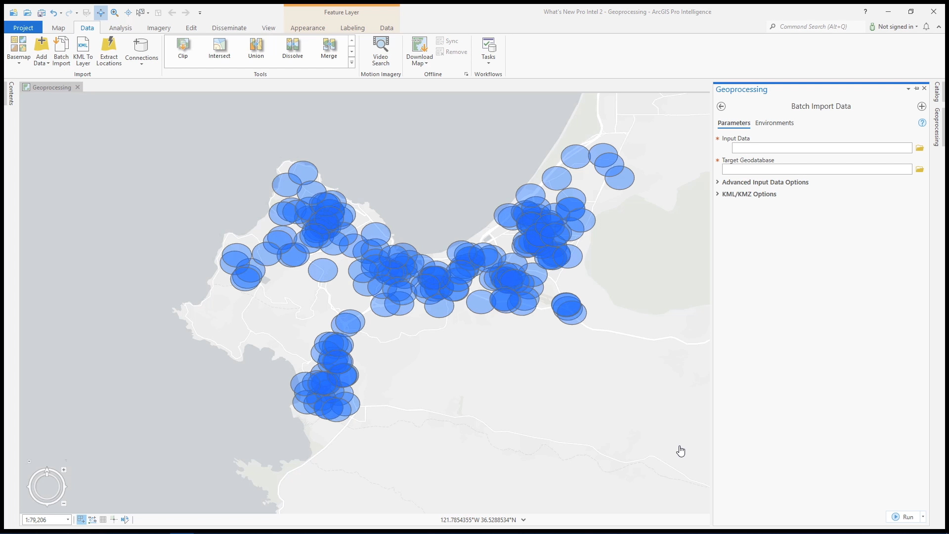
What's new in ArcGIS Pro Intelligence 2.8
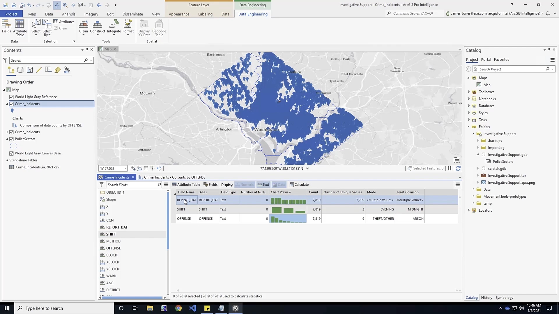
Investigative Support
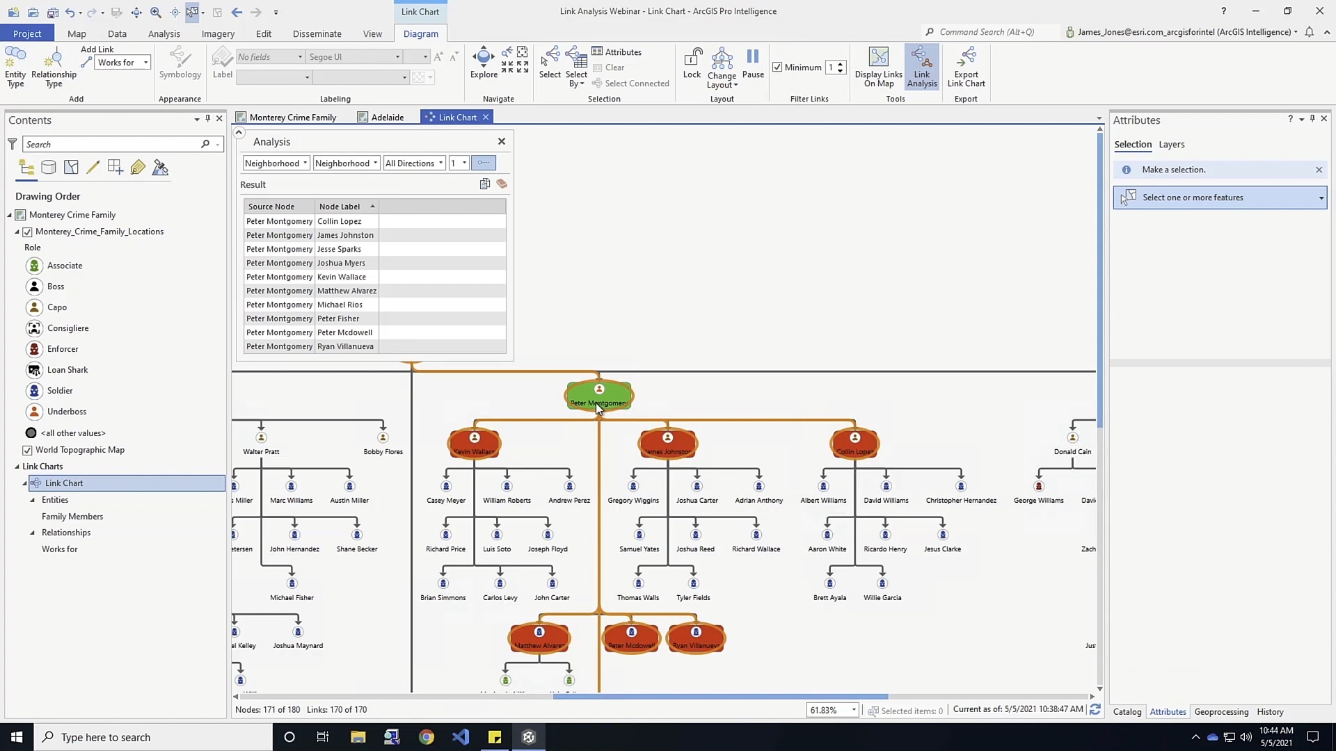
Link Analysis
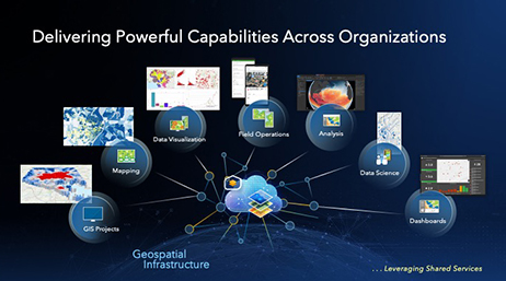
GIS Applications for Defense and Intelligence
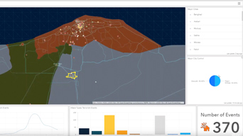
Intelligence Operations Overview
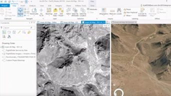
Imagery Tools for Intelligence Production

Intel Ops and Analysis with ArcGIS Pro