User Story
Guaranteeing Business Continuity in Transportation
Now let me back up for a quick minute and tell you about TSCG. Since 1984, our retail-only real estate platform has provided a full assortment of advisory services to tenants, landlords, developers, investors, and financial institutions throughout our territory. Our work on their behalf is dedicated to the validation of those descriptions. Headquartered in Atlanta, Georgia and with 22 offices from New York to Southern California, we are the largest firm in our field in the United States.
February 12, 2015

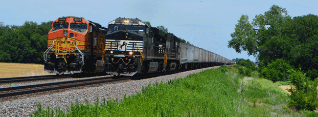
Norfolk Southern Railway is a subsidiary of Norfolk Southern Corporation operating close to 21,000 miles of railway in 22 states. The company is a major coal and industrial products transporter serving every major container port in the eastern United States. Norfolk Southern operates the most extensive intermodal network—freight transferring between trains, ships, and trucks without handling the freight—in the East.
What did they do?
To further streamline its operations during adverse weather, Norfolk Southern adopted AccuWeather’s SkyGuard track specific storm warning service. It provides precise advance warning of dangerous conditions that could blow over a high-profile train or cause a train to derail due to a washout. When flooding is forecast to occur, Norfolk Southern’s engineering department consults ArcGIS to precisely locate vulnerable track segments. For example, when Accuweather issued a tornado warning for a span of track in North Carolina, the railroad was able to ensure that no trains were in the area. When a flash flood warning was issued in upstate New York, four trains were held out of the area. Railroad personnel found 100 feet of roadbed had washed away as water and debris were flowing over the rails.
Do I need this?
When severe weather endangers lives, facilities, or business operations, SkyGuard warnings in ArcGIS will notify you of urgent threats for specific locations—24/7, 365 days a year. With ESRI geospatial intelligence, you can quickly size up the implications extreme weather will have to your operations. For more information, visit esri.com/transportation. “Using Accuweather and Esri, we have gone from spinning our wheels wasting a lot of time, energy, and money looking at miles of railway, to being able to pinpoint extreme weather and the threat of danger to a relatively small area.” John Irwin Assistant Vice President Transportation Network Norfolk Southern Corporation