Transportation
Keeping Air Travel Safe and Secure - Real-Time, Integrated Information Sharing Strengthens Incident Management at LAX

Airports are a lot like miniature versions of cities—dynamic and expansive. Safety, security, and operations are all critical functions for daily operations. With more than 70 million people passing through Los Angeles International Airport (LAX) each year, managing all the moving parts associated with safety, security, and operations can be challenging. In this regard, situational awareness is especially important, so much so that the mayor of Los Angeles made it priority to attend the ceremonial opening of the LAX command and control facility, known as the Airport Response Coordination Center (ARCC).
ARCC supports 24/7 shifts of field personnel who work airside and landside. ARCC staff have used NICE Situator and the NiceVision video management system (VMS) from NICE Systems to manage airfield, terminal, and landside incidents and security since 2011. NICE Situator integrates security and operational intelligence, including video surveillance and closed circuit TV (CCTV), and generates automated, adaptive response plans.
But even with the deployment of these state-of-the-art solutions, until recently, much of the collaboration that took place between the ARCC and LAX field personnel was manual. ARCC staff communicated what they could see in the NICE Situator to the field and back via radio communications and phone calls.
In 2012, LAX identified a need for faster communication. Airport officials envisioned a common ARCC operating picture that personnel could also access in the field.
LAX collaborated with NICE Systems and consultant AECOM to develop a solution to extend that common operating picture by leveraging its existing NICE Situator in conjunction with ArcGIS for Server, an Esri solution that allows maps and geographic information to be accessed anywhere, anytime, on any device.

A NICE Enhancement
The team created the NICE Situator EGIS Web Viewer, an enterprise geographic information system (EGIS) web application. The NICE Situator EGIS Web Viewer is a two-part solution that spatially enables and web enables LAX’s prior NICE Situator iteration. The team designed the solution over two years’ time, customizing the final deliverables to various stakeholders’ needs.
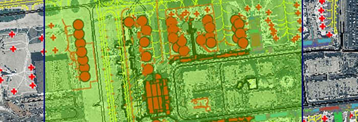
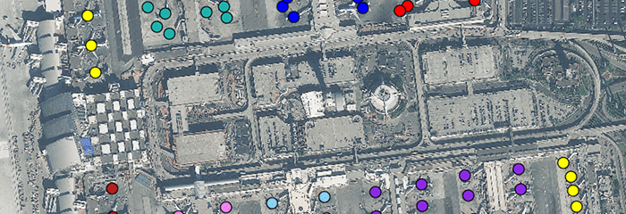
EGIS pulls in layers including airport buildings, property, infrastructure, and airport security sensors. In addition, the system integrates with mission-critical information, Maximo for work orders, and PROPWorks for lease and property management.
“You can’t separate operational events and incidents from the infrastructure you’re trying to protect or enhance,” said Dom Nessi, executive director and chief information officer at Los Angeles World Airports.
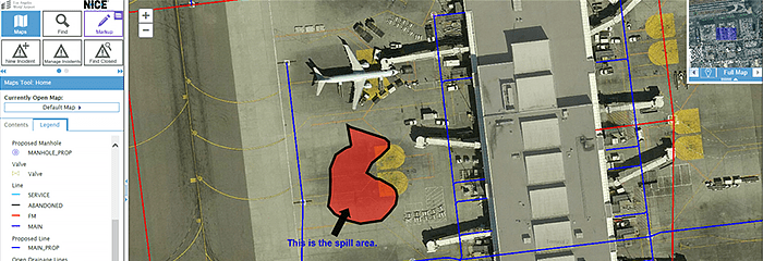
ARCC staff access EGIS data through the Situator EGIS Web Viewer, which provides visualization of mission-critical information on a desktop map application. As incidents unfold, the Situator EGIS Web Viewer displays highly visual geographic information in real time. A collapsible, functional panel on the side of the map tracks annotations from the field so ARCC staff can gain insight and engage in a spatially smart dialog with personnel in the field as incidents unfold. Comments are time-stamped to provide an audit trail of each event.
With Situator Control Room and the EGIS Web Viewer, ARCC staff can visualize where they need to send field personnel. They can evacuate travelers through the nearest exits or out of impact zones. Rather than verbally communicate incidents with the field staff, ARCC staff can share map annotations, such as evacuation routes, through visual drawing in real time.
In the field, personnel access the same operational view on iPads through the Situator EGIS Web Viewer. The app integrates all predefined workflows in NICE Situator, so users can pull up specific, preplanned procedures for event response. As they work on an incident in a terminal, they can check off each step. They can also see where to set up command posts. They can query nearby assets, such as the closest surveillance camera or an underground hydrant fueling line. Users can draw routes, spatially scope accidents (such as fuel spills), and add relevant notes. They can access lease information to view tenants in impact zones, their store hours, and contact information.
“Pulling that information out of the GIS and putting it into the hands of those who need it in real time was a big step,” Nessi said.
Before the Situator EGIS Web Viewer, field personnel had to call or radio in incidents. ARCC staff would then assign a technician through another call or radio. All information was conveyed verbally, without maps.
“You can say there is water leaking in Terminal 1,” Nessi said, “but until you have an exact picture of where the water is, you can’t do anything. Now they can not only report it, but they can take a photo of it and attach it to the work order so that people in the ARCC see exactly what they’re seeing in the field.”
When someone enters an incident from the mobile app, Situator EGIS Web Viewer automatically updates. ARCC staff can place first responders and operations personnel immediately, with all the information needed to tackle the event.

Faster Response, Positive Feedback
Currently, more than 200 airport staff have access to the EGIS across security, operations, property management, information technology, and airport development groups. Many of these include desktop users, as EGIS takes effect outside the control room and engages with more departments across LAX. In addition, field personnel have welcomed the move away from radio and phone calls. Employees who were unfamiliar with the iPads were trained in their use.
“They have everything they need to respond to a field event at their hands,” said Kevin Carlson, vice president of national aviation technology at AECOM.
The app brings EGIS to daily operations—including examination of pavement markings, lights, signs, and safety areas—as well as emergency situations, such as a wildlife strike or baggage cart separating from a tug.
The NICE Situator EGIS Web Viewer and mobile app have saved LAX time and money. The airport has enhanced compliance through better audit trails of event response. In addition, historical data records enable staff to spot incident trends, such as recurring electrical issues that might have long-term solutions.
The EGIS is no longer an archive of engineering data at LAX. It conveys critical information spatially, in real time, from control center to field and back. The EGIS has optimized daily operations across the airport while enabling the airport director to stay abreast of operational status.
Through its deployment of the NICE Situator EGIS Web Viewer, LAX has really raised the bar in terms of empowering personnel in their daily management of airport safety, security, and operations,” said Moti Shabtai, general manager of physical security for NICE Systems Security Division. “LAX has been able to elevate collaboration by providing a common interactive canvas for sharing pertinent information, and by extending information that used to only be available within the walls of the operations center, to its field personnel. With this situation management ANYWHERE capability, people outside the control room can be part of [the] incident management process by initiating incidents from the field when they see something happening. They can get real-time geospatial information and receive adaptive response plans as well. All of these capabilities enable LAX to contain incidents faster. It’s a great success story that other airports will surely want to emulate.”