case study
How Maryland DOT is Making Its Infrastructure More Resilient
The Maryland State Highway Administration is leveraging geographic information system (GIS) technology to show how, with just small changes to existing processes, infrastructure resilience can be improved and help the state better prepare for an uncertain future.
The State of Maryland has much to contend with in terms of the threat posed by weather and climate. Situated on the East Coast, it is densely populated and has some of the oldest, most complex infrastructure networks in the US. That includes upward of 70,000 lane miles of road and 5,000 bridges.
Maryland's transportation engineers must take account of some widely varying geography, each with its unique challenges. This includes some 3,100 miles of coastline on an eastern seaboard vulnerable to sea-level rise, storm surges, and extreme high tides, in addition to hurricane and tornadic events. To the west, mountainous terrain includes significant areas of karst where subsidence and erosion are common.
The state has already experienced the effects of climate change, according to Toria Lassiter, assistant chief, Innovative Planning & Performance Division (IPPD) with the Maryland Department of Transportation (MDOT) State Highway Administration (SHA). Over the last 20 years, the state has lost around 100 islands to sea-level rise. Now state officials like Lassiter are working to identify, address, and mitigate threats in both the near and longer term.
Making resilience mainstream
Making resilience a consideration every day, rather than after the fact, is currently a major focus of any number of state departments of transportation (DOTs). However, the MDOT SHA has already been taking this approach in various forms for several years.
As far back as 2014, MDOT SHA staff carried out a pilot climate change vulnerability assessment. This identified the threats posed to specific roads and bridges in Anne Arundel and Somerset Counties. In 2018, with funding support from the Federal Highways Administration (FHWA), they carried out further work to expand coverage, including bridges and roads statewide. The SHA was also to identify and implement specific opportunities to integrate vulnerability assessment results and other climate risk information into existing asset management, planning, and other processes. The process and results were documented in the final report, Integrating Extreme Weather and Climate Risk into MDOT SHA Asset Management Planning.
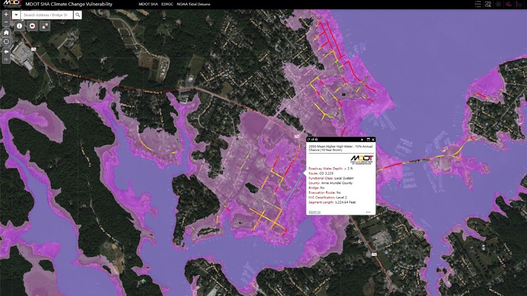
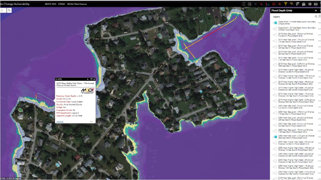
The work matured into a Climate Change Vulnerability Viewer (CCVV), a support tool designed for MDOT SHA senior managers and planners, along with other state transportation agencies, including metropolitan planning organizations (MPOs), municipalities, and local transportation partners. The CCVV is an Esri ArcGIS Online web application that showcases geospatial data products related to climate change. In particular, it shows sea-level changes and the potential effects on the State of Maryland's transportation infrastructure.

Visualization tool
"The CCVV visualizes our analyses," says Lassiter. "We have completed a statewide road vulnerability assessment for all state-owned roads, the results of which include a Hazard Vulnerability Index Analysis." The FHWA's Vulnerability Assessment Scoring Tool (VAST) has been used to assess the vulnerability of bridges statewide to the effects of sea-level change.
"Among other things, the CCVV models show flooding associated with sea level in the year 2015 and projected sea levels in the year 2050 and 2100 under four different storm scenarios—the 10-, 25-, 50-, and 100-year storms. The CCVV also shows the projected flooding impacts in the event of a category 4 hurricane."
The goal of the IPPD is to provide data and information to various departments within MDOT SHA to support better decisions throughout the infrastructure life cycle. This includes incorporating information into the project planning and design processes and ultimately helping asset managers build climate resilience into their maintenance processes. In addition, the division hopes the information can be shared with other agencies in Maryland to help them better prepare for future resiliency.
"Where we'd like to get to," continues Lassiter, "is a point where for the life cycle of an asset, every division is considering risks and resilience. We've worked across seven overarching offices in MDOT SHA to get them to look at processes and gain buy-in, get them to look at what they do, and perhaps consider incorporating something else."
A challenge for the Innovative Planning and Performance Division and MDOT SHA more broadly is designing or mitigating for a potential event based on projected data with little to no national regulation, guidelines, or policy to guide decision-making. In that context, funding decisions to support resiliency efforts are more problematic.
"Some of our work is to show why resilience is important, and the best way to do that is to put a dollar figure on it," Lassiter states. "It comes down to, 'This is what you do now, but if you don't consider certain other things, this is how it could play out in the long run.' Often the suggested changes are only minor."
She describes it as "having one hand wash the other," with changes for instance in the planning offices filtering through to design and construction. It requires a lot of visualization work to make the information actionable, together with easy-to-understand public-facing tools. For this, says Lassiter, an online GIS platform makes a lot of sense.
As an example, she points to a recent MDOT SHA pilot study of a particularly congested corridor. The staff worked with the design, construction, and maintenance divisions in addition to the district offices to develop metrics for a GIS-based methodology to determine the criticality of the roadway network. The work was based on the weighting of five different variables—such as annual average daily traffic and a social vulnerability index—and visualized as a layer in the CCVV.
Combining the flood risk results from the CCVV with the criticality assessment helped staff identify the study location on the US 50 MD 450 corridor. They could also identify potential improvements and treatments to mitigate the risk and reduce the cost of future flooding events.

The result, Lassiter says, was in large part not only an affirmation of boots-on-the-ground knowledge but also a great exercise in terms of knowing that the information is accurate.
Baselining change
The MDOT SHA uses the year 2015 as its sea-level baseline elevation. Changes after that date can illustrate risks along with nonintuitive or lesser-considered challenges.
"For instance, if you look at the 25- and 50-year storm scenarios and a location such as the resort town of Ocean City, then pretty much every traffic controller cabinet is going to be inundated. Signage is also going to be vulnerable to high winds," Lassiter explains.
The CCVV and the resiliency programs behind it are attempting to build greater awareness of these issues among transportation agencies statewide.
For MPOs within the state, the information sharing provides local transportation agencies with data to guide their risk and resiliency efforts. Since localities must develop their emergency management plans, suitable data and the CCVV have proven valuable resources. In line with this, the SHA is currently compiling statistics for 2050 and 2100 to show impacts over time on coastal areas.
The periodic evaluations of roads, highways, and bridges that require repeated repair under MAP-21 Part 667 requirements have driven many state DOTs to reexamine their data efforts. To assist in this analysis, they are looking at which data is needed and how it is processed, interpreted, and stored.
The work done by IPPD is having a wide-ranging impact, helping to bring greater internal coordination at MDOT, according to Lassiter. For many agencies, it has highlighted the siloed nature of their operations, and the work of the Innovative Planning & Performance Division has led to greater collaboration between MDOT's Office of Maintenance, Office of Information Technology, Climate Risk & Resilience Program Office, and Office of Planning and Preliminary Engineering. An outgrowth of that collaboration is that the Office of Maintenance is working to develop an application that will link directly to the CCVV. It will enable field engineers to enter information and link to declared emergency events and appropriate revenue sources for remediation work.

A final area of influence and collaboration includes MDOT's Office of Highway Development, Highway Hydraulics Division, which is directly tying stormwater planning to the agency's Transportation Asset Management Plan. The work will access new areas of funding and require a slope vulnerability/repeat subsidence hazards layer, which is being worked on by the geotechnical team.
Resilience…and resilience
As in so many other locations across the US, the role of the humble culvert is gaining appreciation as resilience gains importance. Upsizing culverts, rather than just replacing in kind, necessitates bringing several permitting agencies along on the journey and highlights how the CCVV contributes to infrastructural as well as political resilience. Lassiter points to the recent raising of an Ocean City bridge that sits on a declared evacuation route.
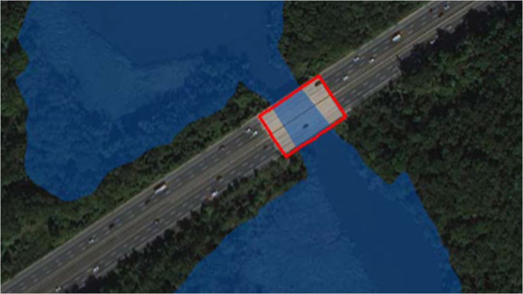
"Hydraulic analysis using data from the CCVV showed that by 2050 the sea level in the locality would rise by two feet, and the bridge would be overtopped. While the 2050 sea level is a projection, the risk to the safety of motorists associated with the potential impacts to the bridge had it not been raised and overtopping had occurred would have been immense."
By using GIS to visualize that risk, the project manager was able to determine how policy could make design decisions justifiable and defensible. Another huge advantage, according to Lassiter, is the reduction in cost. "Cost-benefit analyses have shown how the potential impacts of not making changes can be even more severe downstream, involving a lot more money and time."
"What we've done so far has opened people's eyes, and the new challenge is to do the same for all types of assets," Lassiter said. "Viewed in terms of enterprise risk, however, the analyses that we've already done have proven persuasive."