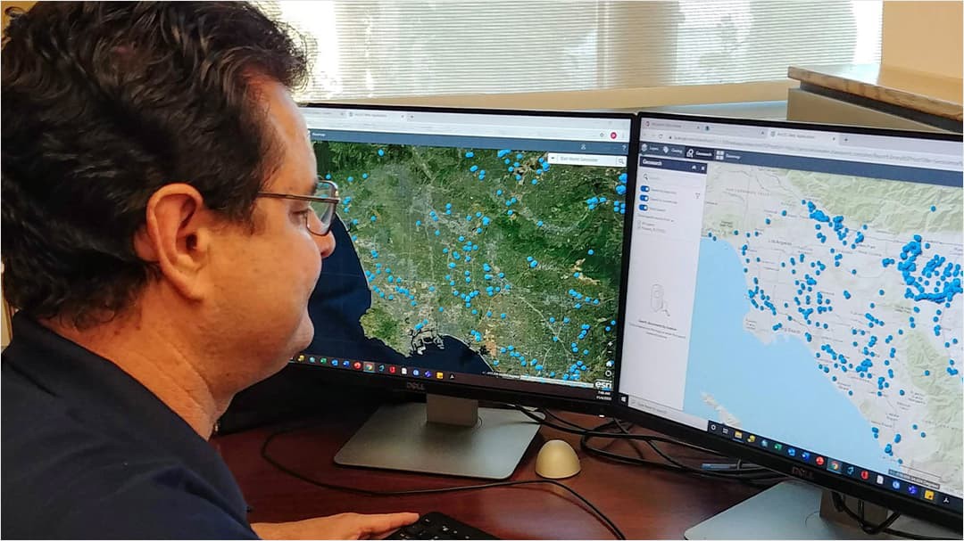
Working in the water industry, there are numerous sources of data which are designed for individual uses. This software allows us to bring these sources into one arena and improves data research. We have reduced the time it takes to conduct research by 50 to 75 percent.
user story
Groundwater Consulting Firm Improves Its Central Repository for Data, Reports with Mapping Technology
Founded in 1978, Geoscience is a California-based groundwater consulting firm that helps water utilities, government agencies, and the private sector worldwide overcome challenges to develop and preserve groundwater resources. The staff of Geoscience—composed of field personnel and teams dedicated to groundwater production, modeling, and legal projects—aims to give water providers the data and advice they need to manage their water resources and defend groundwater rights.
Geoscience has collected a tremendous amount of specialized, regional data during 42 years of being in business, but all of the company's data was stored in different formats and databases. As such, this made it difficult for staff to research and access historical data and reports for clients.
David Bauer, geographic information system (GIS) coordinator and graphics specialist at Geoscience, developed a centralized database that made this vital information available in one location. The new database is yielding positive results for staff both in and outside the office, increasing efficiency in operations and improving access to data and reports across the organization.

Challenge
Geoscience has collected and stored an array of data, including where projects are located, what client covers a particular area, what groundwater basin an area encompasses, and how many wells exist in the area. Bauer explains that the link to their company is groundwater wells, so any well in a specific area has information related to the ground's lithology as well as soil and water level information.
User
Geoscience
Challenge
Performing basic searches for projects and retrieving data took hours because the data was stored in multiple places.
Solution
ArcGIS for SharePoint
Results
The new solution stores large amounts of data in an easy, accessible format. Research that once took hours now only takes a few minutes, saving time and reducing overhead costs.
According to Bauer, performing basic searches for projects and retrieving data took hours and required several steps because the data was stored in multiple places. This made daily operations difficult, but it also made it a challenge for new employees to get a "feel for almost 45 years' worth of information," he says.
Bauer developed an initial solution with a computer program that renders a 3D representation of the earth based primarily on satellite imagery. It brought all Geoscience data together and exposed it to staff in an easier format, but it had limitations. Bauer made a group of KMZ files of the company's project locations and polygons, and users were able to access report details but were unable to do additional work with the information.
"We basically had folders of project reports that were all geographically located in a shapefile that I would make [into] a marketing map for our proposals. The solution wasn't very user-friendly," says Bauer. "The individual would have to click on a shapefile, find its report number, then look for that particular [report in the server]. It took hours upon hours to actually get the information."
Bauer says he wanted to develop a GIS-based tool that would enable Geoscience staff to tap into the company's vast resources, regardless of GIS knowledge or experience. Because the geographic component of the data is vital to the company's work, he also wanted the new tool to link to Geoscience's PDF reports for easier access.
Solution
In search of a new solution, Bauer found a 2016 YouTube video discussing ArcGIS for SharePoint. ArcGIS for SharePoint allows users to map and share content with the ability to visualize, organize, and interact with data. One particular feature stood out to Bauer: the ability to link PDF files to a location. Users can click on a location in an interactive map display to retrieve a report. He believed ArcGIS for SharePoint could be the answer to many of the company's needs.
"We are so niche driven that [I believed] there was not going to be a just off-the-shelf program that's going to just allow me to do A through Z. But [that changed] when I saw that YouTube video," says Bauer.
Bauer ultimately chose ArcGIS for SharePoint to develop a GIS-based tool to help staff research the Geoscience database. He says he set up a "map-based tool for future research and basic analysis for all users in the company, in a secure company-wide environment."
The specific features he liked in ArcGIS for SharePoint include the following:
- Tools to be able to search company databases all in one location
- Graphical ability to display data easily
- Ability to geotag, or link, PDFs to point or polygon location data
- Ability to utilize the vast ArcGIS Living Atlas of the World databases
The connectivity ArcGIS for SharePoint offers was a bonus. Bauer says he began uploading data into the SharePoint environment so that field personnel could access reports from anywhere with an internet connection. Bauer says, "As the COVID-19 pandemic hit, that became critical."
Bauer worked to incorporate all of Geoscience's work databases and reports into ArcGIS for SharePoint. Bauer set up the program as an easy-to-use, map-based, searchable research tool. He produced demonstration videos and instructions within the company's secured online SharePoint environment to help train staff.
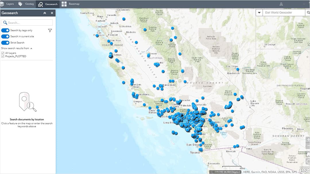
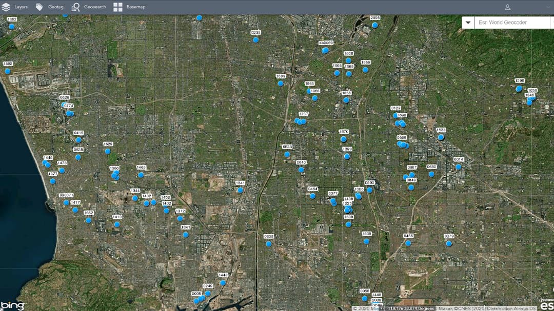
Staff can select a map, zoom in to a specific area, and view the PDF report as a pop-up. Users can also search the different shapefiles and informational databases that are associated with it. The current SharePoint site houses close to tens of thousands of items.
"It's always good to learn and grow, and so this was a wonderful way to kind of readjust and make [our system] more user-friendly for the office," says Bauer.
 Map showing locations of assets
Results
The use of ArcGIS for SharePoint has improved daily operations at Geoscience, including how staff research and access data. Bauer says the new solution stores large amounts of data in an easy, accessible format, which has increased efficiency. He says that research that once took hours now only takes a few minutes because reports and data are just "clicks away," saving time and reducing overhead costs.
"In the consulting industry, time is money. This tool makes the staff more efficient when performing research or processing information in a graphical format," says Bauer. "They can fulfill the client's request literally within minutes."
Bauer says ArcGIS for SharePoint is simple for all staff to use. This is a significant benefit, as only one-third of the staff is familiar with GIS.
"Anyone can use the software . . . either experienced GIS individuals or people with little to no experience using GIS. With a small learning curve for the user, anyone can use the software and . . . it opens an entirely new, map-based perspective to your stored data," says Bauer.
He adds, "Without that GIS knowledge, you don't have an understanding, at least geographically speaking, of how one thing relates to another. [ArcGIS for SharePoint] has allowed everyone to be on the same playing field."
The new solution has also improved Geoscience's field data collection workflows. Bauer says having everything available in SharePoint means that all data is online and accessible in the field via phone, tablet, or laptop. Also, since reports can be linked to a point or polygon, those in the field can get the information they need from anywhere, enabling staff to respond to client needs faster.
Bauer explains that utilizing cloud-based GIS mapping software ArcGIS Online in tandem with Geoscience's SharePoint databases allows the entire team to quickly access internal data. It also serves as an efficient search tool for obtaining information about previous projects and experiences.
"I use [ArcGIS Online] for planning purposes since I can easily identify the number of wells owned and operated by water providers in a given region. It also helps quickly identify where our projects are located in relation to a new client or potential project," says Sean Stewart, Geoscience marketing director. "Whereas before, it would take a few hours . . . to research past projects and create a list or a map, we can now identify projects in minutes with just a few clicks."
"Bringing the library of our prior reports to SharePoint has made assigning work to newer staff much more efficient. Someone who has been with the company for 18 months has access to nearly 45 years of institutional knowledge within a few clicks," says Chris Coppinger, senior geohydrologist at Geoscience.
Coppinger adds, "Quickly locating all work we have performed in a groundwater basin, near a plume, or [in] a specific city means [staff members] don't have to redo background research that's already been done, and provides immediate templates for future work."
Bauer says the partnership with Esri has been wonderful and that ArcGIS for SharePoint has helped Geoscience deliver amazing results for clients. He's excited to see the future enhancements to the software to further improve Geoscience's research capabilities and produce the best and most efficient work for the company's clients.
"As a project manager, I need to gather project information in certain areas quickly for our senior scientist and clients. Given the massive data that the company has collected over the past 40-plus years, it was always a hassle and [a] time-consuming effort," says Tim Chen, Geoscience project manager. "However, [ArcGIS for SharePoint] perfectly solved the issue. It allows us to swiftly and securely search our database and consolidate all the required information."
Stewart adds, "At the end of the day, it's about supporting our clients the best way we can, and ArcGIS for SharePoint enables us to improve the value we provide."
