GeoAI for AEC - Unlocking Smarter Decisions with GIS and AI

June 24, 2025 | 10:00 AM–11:00 AM (PT)

Register now
Aerial view of a residential area where homes and roads are detected with deep learning classification.

Delve into the transformative power of GeoAI in the AEC sector

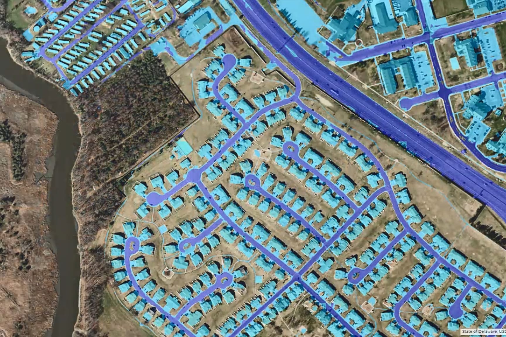
Artificial intelligence is no longer just a buzzword; it’s transforming the way that architects, engineers, and construction professionals analyze, plan, and deliver projects in the built world. In this engaging webinar, we will explore the growing role of GeoAI, where geographic information systems (GIS) and AI converge to enhance decision-making across the AEC project lifecycle.

Presenters

Previous
Next

What you’ll learn in this webinar

  • Understanding GeoAI: Discover what GeoAI means in the context of AEC
  • Integrating AI: Learn how AI integrates into GIS solutions, including machine learning, deep learning, and predictive analytics
  • Applying GeoAI in the real world: Explore real-world examples, from feature extraction in site surveys to risk modeling for infrastructure projects
  • Incorporating GeoAI: Find out when and how to begin incorporating GeoAI into your own workflows

Who Should Attend
This webinar is ideal for anyone interested in the intersection of AI and GIS within the AEC industry, whether you are new to GIS or looking to deepen your understanding of AI's impact on your work.

Don’t miss this opportunity to unlock smarter decisions with GeoAI! Fill out the registration form to secure your spot.

Register for the webinar