Skip to Content

Collaborative Urban Planning

Boost community and stakeholder engagement for a more inclusive planning process

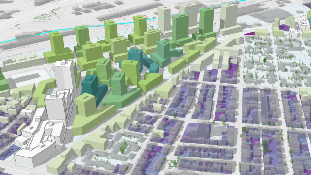
3D buildings in green and purple representing 3D transparent envelopes showing the maximum buildable height in a neighborhood

Strengthen connections through civic engagement

Traditional presentations and 2D plans often fail to effectively communicate scope and impact, resulting in misunderstandings and resistance. Create engaging narratives for shared vision and collective action with 3D visualizations and incorporate a more inclusive approach to your planning processes through participation, feedback, and awareness with ArcGIS Urban. 

What you can do with ArcGIS Urban

Share one digital workspace

For an inclusive and informed end-to-end planning process, give consultants, architects, and policy-makers access to a shared collaborative space. Your team can upload and view models, make real-time edits, and provide feedback through comments and annotations. 
A GIF showing green and blue 3D buildings representing a 3D model of proposed development with a pop-up window of text

Communicate visions to the public

Empower stakeholders and community members to participate in the planning process with accessible, digital content. Export 3D scenarios and citywide models to create approachable guided tours and ArcGIS StoryMaps stories that effectively communicate the impacts of a project or proposal. Present planning scenarios with key metrics that highlight the necessary data to visually convey specific impacts. 

A GIF showing how to create a story with ArcGIS StoryMaps showing 3D urban models and text

Enable public and private discussions

Facilitate meaningful discussions internally or publicly by sharing specific 3D scenario models of plans or projects. Use ArcGIS Hub to distribute your ArcGIS Urban content via websites to provide greater context and support for various forms of feedback such as surveys, polls, and questionnaires. 

A GIF showing how to add comments to a 3D model with a yellow and purple 3D building and popup box with text

WEBINAR

Digital engagement

Digital engagement strategies help remove geographical and physical limitations with stakeholders, opening up participation to a wider range of perspectives. With real-time feedback, 3D visualizations, and easy access to planning information, ArcGIS Urban helps planners foster collaboration and co-creation among stakeholders for more inclusive decision-making throughout the planning process. 

Play the webinar recording
A women using a microphone to give a presentation at a town hall meeting

Who can benefit from ArcGIS Urban

Previous
Next

Contact sales

Please share your information and our sales team will contact you soon. We look forward to communicating with you.