Create, analyze, and report on alternative planning scenarios using the new GeoPlanner for ArcGIS app.
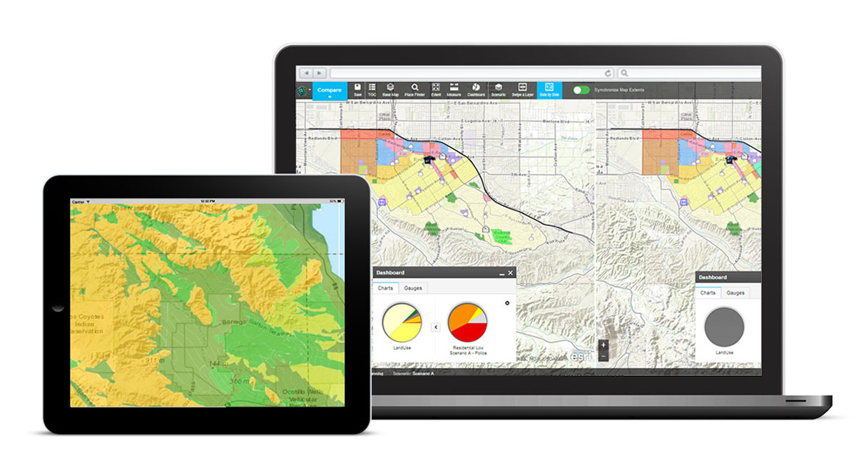
Redlands, California— Esri recently released a web app called GeoPlanner for ArcGIS that brings the power of geodesign to land-based planning. GeoPlanner for ArcGIS is a JavaScript-based application that requires no plug-ins and has been designed to run in web browsers on both desktop and standard-sized tablet devices supporting a minimum 1024 x 768 resolution.
GeoPlanner for ArcGIS incorporates each aspect of a complete planning workflow—project creation, data identification, comparative analysis, and reporting—into a single web-based application. The app helps planners from a wide range of industries create and report on alternative planning scenarios to make geographically informed decisions.
GeoPlanner for ArcGIS comes with several ready-to-use planning templates for land-use planning, special event planning, and more, and it can be easily configured using ArcGIS for Desktop to meet the needs of your specific industry or organization.
You can purchase the GeoPlanner for ArcGIS app from ArcGIS Marketplace. You will need an ArcGIS Online subscription or a trial account to start using the app.
People outside the United States should contact Esri Offices in their area.
