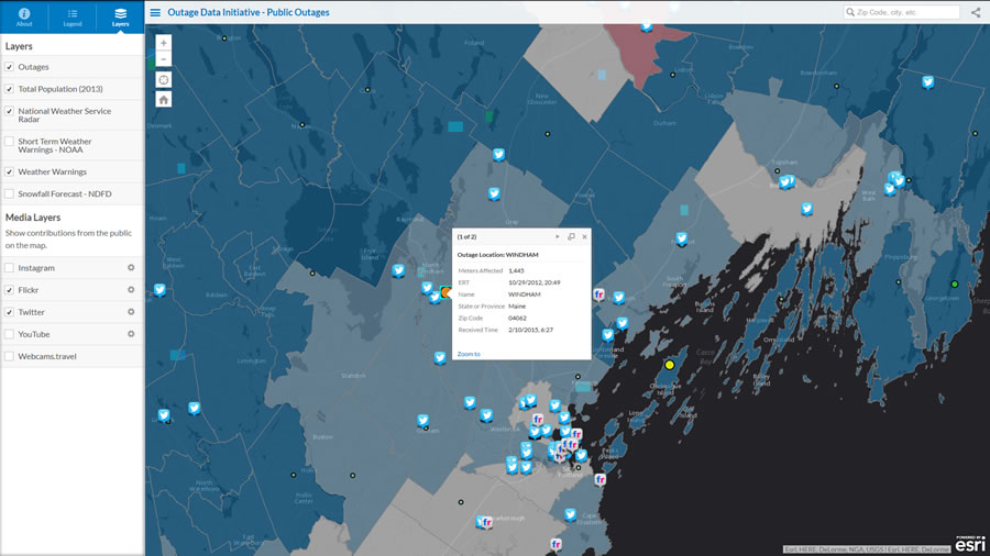
Esri technology-based map application gives first responders and others instant access to weather warnings, utility data, population information, and social media posts to drive faster, more collaborative power resiliency during extreme events.
Redlands, California—Last year the White House Office of Science and Technology Policy (OSTP) challenged software providers and electric utilities to find a common communication platform that fostered power restoration after storms. This year, geographic information system (GIS) technology provider Esri and the Electric Power Research Institute (EPRI) announced they have a solution.
The solution providers built a common information model (CIM). The CIM acts as one source of the truth, ensuring all stakeholders have the same information regarding the location and the number of outages. Esri and EPRI demonstrated their initial results at this month’s DistribuTECH, the world’s largest annual event for electric power transmission and distribution.
“Communicating outage information, especially through the ability to view that data on a map, has traditionally been difficult for power companies due to varying formats of data and, frankly, timeliness of the data,” Esri director of utility solutions Bill Meehan said. “I’m thrilled we could demonstrate that, regardless of how outage data is created, we can consume that data from any number of utilities and display it all together in a simple, easy-to-use Esri map.”
Esri’s mapping application pulls real-time outage information from countless utilities and publishes it as a feature service capable of being consumed at extremely large scales via the web. The map can mash up data layers from live weather, demographics, and social media feeds.
“Emergency personnel, media, and regulators can get accurate, real-time estimates of what’s happening,” Meehan said. “The data is quickly merged from many utilities and then summarized, analyzed, and visualized.”
Utilities currently present outage information in map viewers. However, events like Hurricane Sandy point to the need for overlapping utilities to share this information via a common information model to facilitate collaboration among first responders, utilities, and customers during critical events. EPRI’s work to develop the common information model framework, along with Esri’s mapping application, allows this collaboration to take place.
OSTP announced its Outage Data Initiative (ODI) last year as a voluntary challenge for utilities, co-ops, municipalities, solutions engineers, vendors, and others, to collaborate on a data-driven solution to improve power restoration after storms and natural disasters. The ODI is in phase one, which involves the presentation of generalized outage data in a standard format (e.g., Esri’s map viewer) for public consumption. Phase two involves more detailed outage data to be shared securely with first responders (e.g., police, fire, emergency medical services [EMS], American Red Cross).
Notable participants in the ODI include Duke Energy, BGE, ComEd, Google, iFactor Consulting, National Grid, PECO, SDG&E, and Southern California Edison.
Learn more about EPRI at epri.com.
Learn more about Esri solutions for electric professionals at esri.com/electric.