


|
|
||
|
|
|
|
|
|
Esri Press Titles Hold Esteem in GIS AcademiaThree Esri Press books designed to allow readers to learn about GIS and GIS software at their own pace have become valuable tools in college classrooms. Instructors teaching GIS and geography-related courses at colleges around the country say they are finding that the three publications—GIS for Everyone, Among the most notable of the benefits is flexibility. As the books are self-contained, with concepts, lessons, exercises, software, and data included, instructors can depend on the book to cover the nuts and bolts of GIS. These features free up valuable classroom time that instructors can use as they wish, solving individual students' difficulties and emphasizing the material they feel is important. Eileen Johnson of the Marine Science Department at Southern Maine Technical College finds great utility in Getting to Know ArcView GIS for her Introduction to GIS course. "I like the fact that Getting to Know ArcView GIS allows students to practice certain skills at home, even though they do not have the actual GIS program," she says. "I can assign chapters as homework and then develop a class assignment that uses the skills they have learned. It saves me having to review all of the commands and allows me to cover more material during the course of the semester. Also, by having students work through the tutorials several times before class, they often come in with specific questions about what they have practiced." John Aubert of American River College in Sacramento echoes Johnson's sentiment. "We tend to assign particular chapters followed by assignments that mirror the new skills taught in the chapter," said Aubert, assistant professor of GIS and geography. "These assignments are designed to encourage students to go beyond the cookbook approach and work more independently. They can gain experience applying their skills to new and varied situations." Extending ArcView GIS is finding similarly wide appeal in college classrooms nationally. The book, written by Esri Education Specialists Tim Ormsby "The students will use the tutorials to become familiar with the extensions and then create a project of interest to them, using extensions that might be appropriate to their particular project," says Gail Hobbs, a GIS instructor at Pierce Community College in Southern California. Additionally, GIS for Everyone has found an enthusiastic reception at Southwest Texas State University. There, Associate Professor Ryan Rudnicki has been using GIS for Everyone for, well, everyone. Rudnicki uses the book, authored by Esri Education Specialist David Davis, in his World Regional Geography course, a general-education survey that is composed of students with little background in geography, let alone GIS software. Rudnicki felt he could not let the students out of even a basic geography survey course without exposure to GIS. "I handed the book out to them and told them, 'This is what geography is all about in the 21st century,'" Rudnicki says. "GIS is such a fundamental tool that soon it'll become an innate part of our courses—just like using WordPerfect or Word. We used to teach courses in those software programs, and now you just take it for granted that students know them." The book had an extra benefit that Rudnicki wasn't expecting—helping him overcome the objections of students who didn't own PCs, who knew nothing about them, and who didn't expect that they would need one for an innocent-sounding survey course. Because the book is bundled with Esri's freely distributed ArcExplorer software, Rudnicki was able to install it at the university computer lab, which is open 24 hours a day for student use. Like other instructors, Rudnicki also found the book's self-contained packaging an asset. As the GIS for Everyone CD has about 500 megabytes of data, Rudnicki had plenty of material to work with and did not have to risk overwhelming his young students by also introducing them to the Internet, where an almost infinite amount of data resides. By the end of the course, Rudnicki had used the book to help students create maps that touched on a wide variety of subjects, including archaeology, geology, and demographics, giving them at least a glimpse of geography's usefulness. In that way, Rudnicki's experience with GIS for Everyone mirrored the experience of other instructors using the other Esri Press books: all emphasize the wide diversity of applications of GIS to fields beyond geography—and far beyond the college classroom. For more information, contact Christian Harder, Esri Press manager (tel.: 793-2853, ext. 1-2150; e-mail: charder@esri.com). |
 Getting to Know ArcView GIS, and Extending ArcView GIS—add significant value to their work in the classroom.
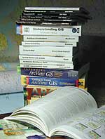 and Jonell Alvi, introduces students to three ArcView GIS extensions: ArcView Spatial Analyst, ArcView Network Analyst, and ArcView 3D Analyst. Like Getting to Know ArcView GIS, the book is designed as a self-contained workbook with lessons, exercises, and software.