
A New Framework for Viewing and Sharing Maps
Esri Announces ArcReader
Sharing maps with both GIS people in your organization and non-GIS professionals is essential. This has prompted Esri to develop a new addition to the ArcGIS desktop family 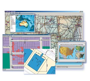 of products called ArcReader. "ArcReader will change the way we share maps," says Rob Elkins, ArcReader project manager.
Right: With ArcGIS Publisher, you can create maps that support text annotation with multiscale labels, layouts with titles, different zoom levels, dimension labeling, and legends.
ArcReader
ArcReader is a free, downloadable, lightweight application that will enable users to access GIS maps and services created with ArcMap. ArcReader provides GIS users with a method to share electronic maps locally and over networks and the Internet. These read-only maps are viewable by ArcReader and all other ArcGIS desktop products.
ArcReader will have the same look and feel as other ArcGIS products as well as the same GUI. Built from the same ArcObjects components as ArcInfo, ArcEditor, and ArcView, ArcReader can easily be embedded into new applications using any COM-compliant programming language such as Visual Basic, Visual C++, or Delphi.
ArcGIS Publisher
ArcGIS Publisher is a new extension to ArcView, ArcEditor, and ArcInfo that will enable users to author or publish GIS maps and services. Any of the ArcGIS desktop products with the new ArcGIS Publisher extension can convert a standard MXD map document to the PMF format used by ArcGIS Publisher. PMF files contain instructions about the location and symbology of data layers (including geodatabase connectivity, Internet connections, and Geography Network layers).
PMF files can only be altered with ArcView, ArcEditor, and ArcInfo using the new ArcGIS Publisher extension, thus making ArcMap an authoring or publishing environment for maps viewed with the new ArcReader technology. Although the free ArcReader software will not be able to author or change PMF files, users will be able to turn layers off and on.
Live Connection
ArcReader preserves a live connection to data, so the user's data view is dynamic. This also makes ArcReader useful for publishing maps based on ArcIMS or Geography Network services.
Using ArcReader
ArcReader can be used in a number of ways. First, as a stand-alone desktop application, ArcReader can access local data via the PMF file. ArcReader can also be used across the Internet. By being connected to the Internet, ArcReader can view the PMF files that point to ArcIMS services. Finally, ArcReader can be placed on a CD with your data. The CD can then be distributed within an organization for desktop and field use or as a publication for external distribution.
The ArcGIS Publisher extension to ArcMap and ArcReader is currently in development.
For more information, visit www.esri.com/arcreader.