
The City of Chicago Implements ArcGIS and the Geodatabase Across the Enterprise
 The City of Chicago, Illinois, has faced many traditional hurdles in its 10-year effort to grow and support GIS within City government. A variety of technologies were used. Moreover, without a common vision for enterprise GIS, departments carried out projects independently of one another. Consequently, datasets and tools were not integrated Citywide.
Enterprise GIS implementation began in 1998, when Chicago adopted Esri software as its GIS standards and a number of departments began implementing large-scale projects on a consistent platform with a common data format. In time, all data created by the City was distributed to departments via SDE.
Now, through a consideration of data and process enhancements offered by ArcGIS and the geodatabase, the City is embarking on a comprehensive enterprise GIS planning effort.
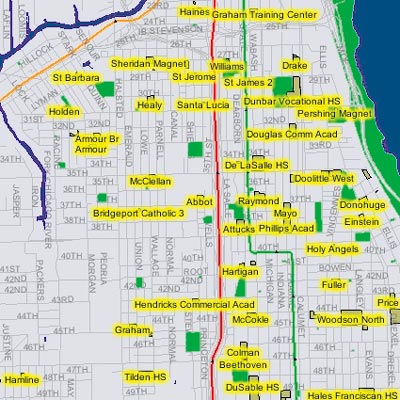
The Chicago Police Department's ArcIMS-based Citizen ICAM will allow
users to map crime incident information in their area of interest.
The GIS Project Unit of Chicago's Business and Information Services Department (BIS/GIS) is responsible for over-sight and implementation of GIS in the City. For the last four years, BIS/GIS has been working very hard to promote enterprise GIS concepts. "We are extremely excited about the implementation of our current environment and training for our users," says Kauser Razvi, project director of GIS for the City, "We're looking forward to continuing our implementation plan as both the technology and our users have matured." By considering the enhancements offered by ArcGIS and the geodatabase in the context of the ways that GIS is developed, used, and supported at the City, BIS/GIS and Esri Professional Services will define an updated enterprise framework to standardize the City's GIS data, applications, system, and staffing environment.
Current Initiatives
A number of active data and application development projects within the City of Chicago are already making use of ArcGIS and the geodatabase. The Chicago Police Department developed the Information Collection for Automated Mapping (ICAM) program in 1993 to give beat officers the ability to analyze crime statistics spatially. The next generation of Citizen ICAM is being built with ArcIMS 3.1, which will be also used to provide additional map services for the department. The Departments of Sewers and Water are updating their custom-built IBM GIS system with standard ArcGIS-based mapping and maintenance tools and new geodatabase utility models. BIS/GIS is developing ageocoding engine to provide geocoding services to clients throughout Chicago from an enterprise ArcSDE 8.1 data server.
Expanding the Effort City-Wide
While individual, departmental ArcGIS and geodatabase initiatives are under way, enterprisewide implementation is by no means straightforward. GIS development initiatives conducted by individual departments can contribute to a fractured data and application environment throughout the enterprise. In the long term, these unique development paths can lead to redundant and unsynchronized data sets and make it difficult to provide comprehensive application support. With ArcGIS, the City of Chicago has found it opportune to reconsider how GIS data is distributed and used, and how to develop applications, systems, and training requirements in the context of the many enhancements offered by this new platform.
Enterprise Implementation Planning Steps
The approach that Esri and BIS/GIS have taken toward planning the implementation of ArcGIS and the geodatabase has both a short- and a long-term focus. Short-term activities will provide a migration path for existing data and applications and describe their corresponding system and training requirements. Long-term activities will involve assessing the enhancements offered by ArcGIS and the geodatabase in the context of the City's Business processes to define new data, applications, and system and organizational models for the enterprise that more fully leverage the capabilities of ArcGIS.
The following activities will establish short- and long-term ArcGIS implementation plans.
- Re-examine the vision for GIS--Examine the existing GIS mission and paradigm and consider how it might be enhanced as the organization matures. Document the vision for enterprise GIS as a foundation for subsequent planning activities. The GIS vision statement will provide a broad definition of the goals and direction for GIS in the City. It will describe enterprise GIS concepts, define their anticipated benefits, identify the issues and opportunities associated with migration to ArcGIS, and indicate GIS implementation priorities in all departments.
- Inventory GIS resources--Define the existing GIS environment including data, applications, hardware, software, network, and staff resources and responsibilities. The resource inventory will establish the volume of information, applications, and processes to be considered for migration and thus provide measures to gauge the migration effort. The inventory will also highlight central migration issues and present a foundation for short- and long-term migration activity recommendations.
- Develop short-term migration recommendations (Action Plan)--Use the GIS resource inventory to address high-priority tasks associated with migrating from the current application and data environment to an ArcGIS and geodatabase environment. The Action Plan should reflect priorities established in the vision statement and the potential benefits relative to costs associated with using ArcGIS.
The Action Plan will describe the tasks and provide a schedule and estimated costs for immediate and quantifiable elements of migration including deployment of ArcGIS-based tools and the production of geodatabases that mirror existing data designs. These activities will allow critical migration activities to begin while long-term planning continues. - Develop enterprise design alternatives--Describe the data, applications, hardware, software, network, and staff components of an enterprise ArcGIS and geodatabase implementation. The design will leverage the enhancements offered by ArcGIS in an enterprise context as enumerated in the GIS vision statement. Each element of the GIS may have many design components. For example, data-related topics might include data model mapping, the integration of nonspatial and external data sources, and such enhancement opportunities afforded by the geodatabase as modeling with subtypes and attribute domains, feature connectivity issues, versioning scenarios, and extended/custom feature behavior. Where appropriate, alternative approaches to creating a particular component or resolving a particular migration issue should be presented.
- Develop long-term recommendations (enterprise ArcGIS implementation plan)--A final enterprise ArcGIS design is developed through an investigation of the design alternatives. Based upon the final design, a long-term implementation plan defines the tasks, relationships among tasks, a potential task schedule, and the relative implementation costs associated with migrating to ArcGIS across the enterprise.
This structured approach toward implementation planning can be adapted to state and local governments of any size that would like to explore the potential of implementing enterprise ArcGIS.
For further information, please contact Paul van Nieuwkuyk, the Esri project manager (tel.: 909-793-2853, ext. 1-2635).