
Hong Kong's Population Census 2001 Challenges GIS and Reaps Rewards
By Jan Selwood, Eric Cheung, and Sam Wong, Esri Hong Kong LimitedHong Kong is famous for its urban landscape and high population density. Outside the urban center, however, Hong Kong includes many large and small towns, villages and rural communities, and extensive areas of natural countryside. It is home to approximately 6.8 million people. Every 10 years the Census and Statistics Department of the Government of the Hong Kong Special Administrative Region conducts a population census. The latest population census took place in March 2001 and was successfully completed. It was the first to make use of digital mapping technology.
In Hong Kong, there are approximately 2.2 million quarters (the smallest unit of enumeration, equating to a household), and during a comprehensive census every single one of them is visited by one of more than 15,000 census enumerators.
Every 10 years the Census and Statistics Department of the Government of the
Hong Kong Special Administrative Region conducts a population census.
Ensuring that enumerators can easily locate households is central to efficient census collection. The Census and Statistics Department (C&SD) maintains a textual database recording the address and characteristics of every quarter in Hong Kong. This was kept in conjunction with the Census Base Map--a set of annotated paper maps showing the location of each quarter. As can be imagined, the production of more than 35,000 operational maps required for the 2001 Population Census using cut-and-paste copying of a paper basemap was a daunting prospect!
Objectives of the DMS
The C&SD therefore decided in January 2000 to establish a Digital Mapping System (DMS) to maintain and store the Census Base Map. The DMS would provide
- Linkage to a textual address database
- Tools to edit and maintain the spatial location of building/quarters and administration boundaries
- Tools for the production of all operational maps required in the 2001 Population Census
The DMS was one of the first applications to be developed under the new ArcGIS object model in Hong Kong. It is based on ArcInfo 8.0.2 and ArcSDE 8.0.2 running on an Oracle 8.1.5 DBMS with a number of ArcView clients. It runs on a Compaq ProLiant Server with four PIII 500 MHz chips, 1 GB RAM, and a 45 GB RAID5 hard disk capacity. Eleven analytical workstations are connected to the server on a 10/100 Base-T network.
DMS Functions
Display--A suite of basic legends, view templates, and tools used for display and navigation of spatial and textual data was established in ArcMap. ArcMap provided the majority of required functionality straight from the box, thus greatly reducing development time. Use was also made of the significant improvement in the way ArcGIS handles Asian character sets. ArcInfo 8 is now capable of importing and exporting a range of different Chinese character sets including EUC, Big5, and UNICODE--functionality that was essential in the integration of data from C&SD's textual database and the creation of Chinese annotation.
Edit--A suite of advanced editing tools permitting subtype and domain editing, multilayer snapping, alignment/offset, attribution, and feature-linked annotation creation was established for quarter map maintenance. The C&SD required that all building structures containing quarters be represented as polygon features and that each polygon was attributed with an identifier that would form the link to the textual address database. No digital spatial data sets of this kind existed, so a major data conversion task was required. The benefits of ArcInfo 8 shown in the preparation of this module as its suite of generic editing tools fully accessible through ArcObjects allowed a truly targeted edit application to be assembled.
Validation--The DMS includes applications for validating converted data and checking synchronization between different spatial layers and between the spatial database and the existing textual address database. Relatively little post-entry validation was required as use was made of feature and attribute domains, feature relationships, and the subtype data models to control data on entry. This was used particularly to control relationships between podium structures and the towers above them, for subdivision of building blocks into multiple quarters units, and to maintain the relationships between coincident boundaries of nested administration areas.
Query/Analysis--As with the Display module, query tools were developed in ArcObjects, which enabled elements of them to be integrated into other modules. A small application was developed using ArcView Network Analyst to calculate straight line and road distances between proposed walk route plans to assist in the definition of enumerator visit trips.
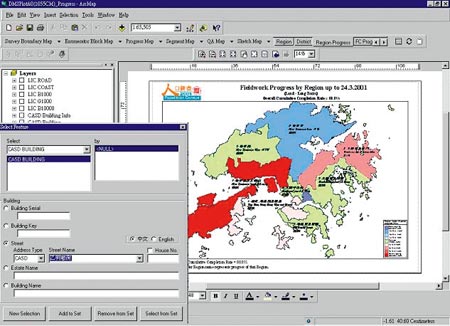
Output--Some 35,000 operational prints at a range of scales were generated for enumerators to take into the field. In addition, 1,500 small-scale plots were produced to coordinate enumerator movement. Additional small-scale plots that were updated on a daily basis were used to track census progress. The production of this volume of output maps in less than two months necessitated highly automated routines. The ability to integrate ArcObjects elements with third party textual reporting tools was critical in providing automatic functionality.
For more information, contact Esri Hong Kong Limited (tel.: 852-2730-6883).