
Three New ArcIMS Enhancements Announced
Esri will be releasing three new services that build on the ArcIMS server technology. They include a street routing service, ArcObjects software-based GIS services, and a metadata service.
ArcIMS 3.1 Route Server
The ArcIMS Route Server extension gives ArcIMS users the option of adding high performance routing capabilities to Web sites. Features include geocoding and reverse geocoding, point-to-point driving directions, calculation of optimal routes based on time and distance, and calculation of multiple stops along a route. The extension is designed for high-volume usage but is also useful in state and regional settings.
The ArcIMS Route Server is packaged with a specially optimized U.S. data set designed for high-speed geocoding and routing. In keeping with the ArcIMS technology, the ArcIMS Route Server can be interfaced to wireless devices.
ArcIMS 4 ArcMap Server
The ArcIMS ArcMap Server Extension can be used to author and publish ArcGIS map documents created using ArcMap. Its services are based on ArcObjects, the underlying framework for ArcGIS. The ArcIMS ArcMap Server gives users the ability to publish MXD files using ArcIMS.
ArcIMS 4 Metadata Server
The ArcIMS Metadata Server allows ArcIMS users to create a central, online metadata repository for organizing and managing their metadata. The ArcIMS Metadata Server allows data producers to easily publish their metadata and, in turn, allows data consumers to 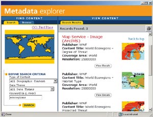 easily search the metadata in the repository. It provides a central place for keeping track of all your data, wherever it may be and whatever format it may be in. It also allows users on any platform to quickly search for data based on keyword, extent, or other criteria using a lightweight Web application.
The ArcIMS Metadata Server is fully integrated with ArcGIS clients, allowing you to publish, manage, and search metadata using familiar tools and interfaces. It is supported, updated, and maintained from the ArcCatalog desktop application in ArcGIS.
"The ArcIMS Metadata Server essentially allows organizations to build their own geography network," states ArcIMS Product Manager Bernie Szukalski. "It is distributed and scalable, allowing networks of servers to be searched with a single request. It has been optimized for search and retrieval, so response times are rapid."
Servers can store metadata on individual documents, on other servers, or both. A request sent to a server is automatically propagated to all servers whose metadata is stored within it. Unlike other ArcIMS services, with the ArcIMS Metadata Server the client initiates the action. Metadata is copied from the client to the server. The metadata is subsequently available to all other clients. Therefore, the administrator maintains the database itself--not the contents of the database.
The ArcIMS Metadata Server runs on all platforms supported by ArcIMS, and it runs on top of any relational database supported by ArcSDE (DB2, Informix, Oracle, SQL Server). ArcSDE is required to run the ArcIMS Metadata Server. This service is fully Z-39.50 compliant. (Z39.50 is a United States national standard defining a protocol for computer-to-computer information retrieval.)