
Undersea with GIS--A New Title from Esri Press
 Few people realize it, but more progress has been made in mapping the topography of Venus and Mars than has been made in mapping a significant portion of our own planet Earth. We probably know more about the dark side of the moon than we do about this usually overlooked--but vital--element of life on our planet, even though it covers 71 percent of the planet's surface.
That frequently overlooked element, of course, is water--the Earth's oceans. Even an agency as big as NASA forgets about the oceans, once announcing, for example, that a recent satellite mission had mapped "80 percent of the Earth's surface." What they meant, of course, was that they had mapped 80 percent of the Earth's visible, terrestrial surface. The surface underneath the waves remained, and remains, largely hidden even from the powerful remote sensing devices of the space agency.
This is changing. The secrets of the planets' oceans are gradually being revealed, and GIS is playing a vital part in these new discoveries as shown in vivid detail in a new book from Esri Press.
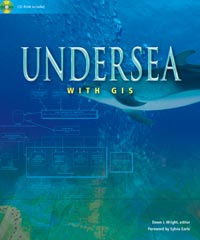
Undersea with GIS, edited by oceanographer Dawn Wright of Oregon State University, is a collection of papers detailing more than a dozen different ways that scientists around the world are using GIS to shed new light on the depths of life beneath the waves. Sophisticated new technologies for ocean data collection and information management are making mapping and interpretation of the ocean environment possible at extraordinary levels of detail and scope.
Among the topics covered are recent technical advances in mapping, charting, and visualizing in three dimensions, from coastal areas to the deepest parts of the ocean. Other studies examine the use of GIS and the Internet to manage submarine cables, to protect environmentally sensitive areas more effectively, and to track the myriad travels of right whales and bluefin tuna. Also examined are ways in which GIS can help integrate diverse fields of marine science--even the ways that GIS can be used by the Mediterranean cruise ship industry.
Undersea with GIS includes a foreword by Sylvia Earle, a world-renowned oceanographer, author, and authority on GIS and marine issues and the keynote speaker at the 2000 Esri International User Conference.
The book comes with a CD-ROM laden with marine-oriented GIS tools: ArcView GIS extensions and ARC Macro Language (AML) scripts, ocean data, three-dimensional marine multimedia underwater flythroughs, and a sample educational module for K-12 teachers. Many of these tools are direct demonstrations of the concepts and applications described in the chapters of the book, provided by ocean GIS specialists from all over the United States, men and women in the vanguard of this last, great exploration of the Earth.
This title and others from Esri Press are available at better bookstores, online (www.esri.com/esripress), or by calling 1-800-447-9778. Outside the United States, please contact your local Esri distributor.