Citizens Help Validate Authoritative Environmental Monitoring
Jacqueline McGlade—Esri UC Keynote Speaker—Shows a New Side of Crowdsourcing
European Environment Agency (EEA) executive director Jacqueline McGlade, PhD, gave a keynote presentation at the 2011 Esri International User Conference (Esri UC) in San Diego, California. She described different ways that EEA works to collect data, ensure its quality, and engage citizens in becoming part of the solution.
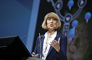
Jacqueline McGlade, executive director, European Environment Agency (EEA).
EEA assures the quality of information that 38 countries send regarding the environment in European Union states. Participants send information about soils, air quality, and so forth, and consequently have become more interested in geospatial science. These countries are reaching out for the spatial tools provided by Esri and others in an effort to situate themselves in the minds of their citizens. This has led to an environmental legislation transformation within those countries.
Europe has to take account of resource usage inside and outside its borders. It is tremendously dependent on those countries for rare earth timber and food. EEA seeks to be part of the global nexus that flows around the world,
"The world is changing quickly," said McGlade, "so we are introducing overnight the way we view our environment for early warning systems."
How quickly are the ice caps melting? Platform vessels in the arctic gather data about the ice cap thickness, link it to an environmental security system, and connect space observations with what is happening on the skin of the earth. EEA is promoting other types of sensors that are much less expensive than an arctic vessel. These enable anyone to monitor the environment with very little cost.
"By bringing this information onto platforms, we will see terabytes of data available to locate changes and translate them into policy from decision makers," McGlade said.
The role of EEA is to connect the institute monitoring data with space station observations and past reporting and then tell people why this matters. It is not only official data that holds sway when it comes to changing people's minds; it is their own engagement.
McGlade showed platforms of innovation. EEA provides map and data services for 500 application areas, such as biodiversity, water quality, and ozone pollution. For instance, the ozone pollution map is derived from sensor stations and includes a model that shows how the ozone changes over 24 hours. This is authoritative data, and data tagging and sources are important.
EEA has developed applications for iPad and Android. The Life app shows where government investment has been spent, its impact, and the future benefit of additional funding. The user can overlay biodiversity data to see its relationships with legislative protection for habitats and endangered species. Europe has experienced enormous urbanization. An urban atlas app shows where and how urban areas are affecting the environment.
The data service provided by EEA includes online content from ArcGIS and provides more than 80 maps and apps. People can also access the data via a GIS-powered atlas, which is an online book that allows users to flip through digital pages and click data and tools for their own use.
"EEA wants to get people engaged in the environment," explained McGlade. "By considering citizen and cultural knowledge, along with Western science, people can contribute in professional, semiprofessional, and amateur ways. Citizen reporting brings people into the mainstream of the environment. Europe's Shared Environment Information System forces countries to see that they need a system of care. EEA supports via IT, applications, technology, and software, as well as training the population [to become] a large group of people who know what is going on around them. Programs like Earthwatch can take ordinary people into the field and train them to gather data and bring it back in a structured way."
To democratize information, EEA has worked with Microsoft and Esri to create the Eye on Earth platform. This is cloud technology that facilitates interaction. It includes the official data mandated by countries and allows citizens to say what they think. Crowdsourcing is an effective way of validating authoritative data from countries. With enough observations, it is easy to see when stations are not monitoring correctly.
McGlade concluded, "We should all take time to be in nature and realize the changes that are going on around us."
About Jaqueline McGlade
Previously serving as director of the UK's Centre for Coastal & Marine Sciences and director of theoretical ecology at Forschungszentrum J�lich, Germany, McGlade is now executive director of the European Environment Agency, having worked there since 2003. McGlade has also worked as a senior scientist in the federal governments of Canada and the USA and held professorships at Warwick University and Aachen colleges. Her research areas include spatial data analysis and informatics, expert systems, environmental technologies, and the international politics of the environment and natural resources.
McGlade has worked extensively in North America, southeast Asia, and west Africa. She has published more than 100 research papers; written popular articles; and presented and appeared in many radio and television programs, including her own BBC series The Ocean Planet, Learning from Nature, and—most recently—Our Arctic Challenge.
More information, datasets, data viewers, interactive maps, and ArcGIS Server Technology APIs are available on the European Environment Agency website at eea.europa.eu.