|
Company's Success Reflects Users' Success
A Robust Esri Turns the Corner on the Century
| Esri ushered in a new millennium with continued steady growth, a trend the company has enjoyed for the past 30 years. 1999 was an exciting year of evolution that included the launch of new GIS software, improved support to our clients, and significant achievement and success within our user community. |

Esri employees number more than 1,400 from 44 countries around the world. Pictured are a few Redlands, California, employees who gathered to celebrate the release of ArcInfo 8 on December 27, 1999. |
At the heart of our success is the continued evolution of GIS software technology. Our new products will make GIS easier, more productive, and compliant with IT standards. They will also extend spatial data and geoprocessing tools into the new frontier. Spatially enabling IT database systems will facilitate embedding of mapping and geoprocessing functionality into a whole new world of applications. Finally, our new products will facilitate widespread access to GIS via the Internet and continue realizing the vision of societal GIS with geographic knowledge being used by everyone.
Specific product milestones of 1999 included
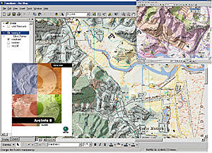
- ArcInfo 8: A New Architecture for GIS—On December 27, 1999, Esri began shipping ArcInfo 8. This product is the first release of the largest research and development effort ever undertaken in the GIS industry. ArcInfo 8 will help our GIS users deploy many of the advanced concepts of information systems management. This required the engineering of a whole new architecture for creating, managing, and applying geographic knowledge.
 ArcInfo 8 is an "information system"
that integrates into standard IT infrastructure.
ArcInfo 8 is the first GIS technology to fully embrace all of the new open GIS standards as well as the commonly accepted IT standards.
While the scope of ArcInfo software's functionality is enormous, the new user interface makes it easy to learn and use. The software is presented in three applications that represent the fundamental ways that people interact with a GIS (e.g., with maps, data, and tools). The data is stored in a "geodatabase" (an object relational environment for managing geographic objects/features and images).
www.esri.com/arcinfo
- ArcView GIS 3.2—In 1999, the number of ArcView GIS users passed 500,000 and is growing . . . . Last fall, Esri shipped a significant new update to ArcView GIS, Esri's popular desktop GIS software. Some of the enhancements in this release included a projection utility, an improved Database Access extension, a revised Report Writer, new data integration utilities, and five CDs with updated Esri Data & Maps.
www.esri.com/arcviewgis
- ArcView Spatial Analyst 2—1999 also saw a prerelease version of the ArcView Spatial Analyst 2 extension, which includes the newModelBuilder that enables users to quickly build and interact with spatial models. Models can be constructed using process wizards or by dragging icons representing data (grid themes) and functions, such as slope, buffer, and overlay, into the model document and connecting them with lines to show how the data is processed.
www.esri.com/spatialanalyst
- MapObjects 2—Esri released a new version of MapObjects. Version 2 provides a powerful tool set for developers to create applications that include dynamic live maps and GIS capabilities. MapObjects is an ActiveX control (OCX) that now has more than 45 programmable ActiveX automation objects. MapObjects 2 offers many new features such as on-the-fly projection, unparalleled data support, a state-of-the-art geocoding engine, improved data handling, and a rich set of powerful mapping and GIS component tools. Enhanced global positioning system (GPS) management, robust geometric functions, ArcExplorer source components, feature rendering and attribution, and a comprehensive collection of geographic data are added enhancements.
www.esri.com/mapobjects
- ArcIMS 3—ArcIMS is creating the first fully Java-based GIS for the World Wide Web. This solution is designed to be a scalable solution for creating, designing, and managing Web sites with mapping and GIS capabilities. ArcIMS provides access to geographic data via a simple Web browser. Users can easily access information that previously was only available by using advanced and more expensive GIS software such as ArcView GIS. ArcIMS features direct and open "data streaming" between the server and a Web browser or other client. This enables users to integrate local data from remote Internet sites. The new application contains many out-of-the-box solutions such as mapping, querying, and geo-coding, and users can plug in their own custom GIS service using local or distributed data sets.
www.esri.com/arcims
- NetEngine—The programmer's library designed for geographic network analysis, NetEngine 1.1 began shipping, and Esri announced NetEngine 1.2 (which began shipping in February 2000). NetEngine 1.2 includes new solvers, improved performance, and options that add flexibility for programmers. The new hierarchical shortest path and origin-destination solvers enhance the performance of NetEngine and make creating custom network solutions easier, with support for additional data structures and externally developed solvers. NetEngine 1.2 also includes samples that show how to construct networks with turn information and how to use the allocate view and the new hierarchical solvers.
www.esri.com/netengine
Industry-Specific Solutions
Esri also introduced new software applications designed for specific industries such as banking, commercial Business, health care, insurance, real estate, and utilities.
- ArcFM—Esri launched the GIS extension designed for utilities, ArcFM, in 1999. ArcFM extends the power of ArcInfo into the utility domain and combines standard off-the-shelf software with a rule-based customization environment. Its open programming and database environment enables it to integrate easily with existing and future mapping and Business processes. ArcFM meets the data management needs of electric, gas, water, and wastewater utilities and other organizations working with network and land base data.
www.esri.com/arcfm
- ArcView Business Analyst 1.1—The 1999 release of this integrated Business application includes data sets from leading industry information providers and a set of Esri's world-leading GIS tools designed specifically for Business applications. Users can easily create and analyze market areas, do site prospecting, perform customer profiling, conduct drive-time analysis, and run detailed reports.
www.esri.com/Businessanalyst
- BusinessMAP PRO Corporate Edition—The newest version of this award-winning, easy-to-use consumer mapping software package includes enhanced site analysis and demographic data, a Business locator for the entire United States, and a built-in report writer. One of BusinessMAP PRO Corporate Edition's strongest features is Market Analyzer, which has extensive demographic information down to the neighborhood (census tract) level. Market Analyzer contains more than 400 data variables such as population, income, education, households, race, age, and occupation. Esri has been shipping this affordably priced suite of tools and data since early last year.
www.esri.com/Businessmappro
- ArcLogistics—Organizations efficiently route vehicles in the most optimum ways and at the same time consider critical time constraints. Fully interactive and easy to use, this updated routing and scheduling package includes Esri's application software and real street data by GDT Dynamap/2000. Companies can generate dispatcher summary reports, street-level directions, driver manifests, and color maps. ArcLogistics software's enhancements include improved geocoding, better support for one-way and turn restrictions, and increased overall reliability and route quality.
www.esri.com/arclogistics
- RouteMAP—Esri introduced a high-tech travel planner last year. RouteMAP is a CD travel planner with street-level nationwide routing that companies can customize to display their Business locations, making it the ultimate promotional tool. With RouteMAP, Businesses can increase traffic to their locations and advertise and route customers to locations and service centers virtually anywhere in the continental United States. RouteMAP is custom software, which includes a company's logo and artwork on a CD-ROM sleeve and start-up screens.
www.esri.com/routemap
- RouteMAP Internet Map Server (IMS)—RouteMAP IMS is the newest member of Esri's comprehensive family of Internet mapping solution software. Out of the box, RouteMAP IMS offers mapping, site locating, and routing capabilities to an organization's Web site with driving directions to any location within the continental United States. RouteMAP IMS is easy to use yet powerful and affordable. It is a stand-alone Internet Map Server application that does not require programming to create custom maps.
www.esri.com/routemapims
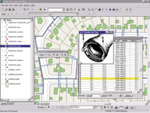
- Parcel Editor from NovaLIS—Esri made available this land records application at no cost to ArcInfo for Windows NT users. The Parcel Editor was developed by NovaLIS in Halifax, Nova Scotia, Canada, and is software for creating and maintaining land parcel databases. Developed specifically for the cadastral mapping and land records market, Parcel Editor users maintain ownership and assessment parcel boundaries, land use boundaries, and street networks for civic addressing data.
www.esri.com/arcinfo
The Future Is Bright for GIS
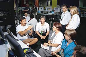 User Conference—Breaking attendance records is an Esri User Conference tradition. Last summer, more than 9,000 attendees flooded the San Diego Convention Center to share their work and learn about advances in GIS. Representing 91 countries and more than 20 industry sectors, Esri users attended workshops and seminars, viewed GIS exhibits and demonstrations, and shared new ideas. User Conference—Breaking attendance records is an Esri User Conference tradition. Last summer, more than 9,000 attendees flooded the San Diego Convention Center to share their work and learn about advances in GIS. Representing 91 countries and more than 20 industry sectors, Esri users attended workshops and seminars, viewed GIS exhibits and demonstrations, and shared new ideas.
www.esri.com/events/uc- GIS Day—November 19, 1999, marked the first annual GIS Day, which was sponsored by Esri, the National Geographic Society, and the Association of American Geographers. The goal to educate one million people about GIS was surpassed as more than two million participated in events held worldwide. Events included open houses, facility tours, all types of GIS presentations, and GIS Day proclamations by state and local jurisdictions. GIS Day 2000 will be November 15, 2000. For information on GIS Day 2000, please visit www.gisday.com.

- Business Partner Program—Esri's Business Partner Program grew to more than 1,000 domestic and international partners, 163 of whom were added in 1999. They include a wide array of organizations that deliver specialized GIS products and services in association with Esri technology.
www.esri.com/partners
- Corporate Partner Highlights—The SAP/Esri Development Partnership completed a successful first year with the integration of specialized GIS solutions into SAP applications. Esri components will enable users to use GIS analysis and visualization tools on information in SAP applications. Additionally, Esri's ArcView GIS, ArcLogistics Route, and ArcView Business Analyst software have direct interfaces to SAP applications.
Esri and Leica GeoSystems, the leader in surveying and land records, signed a cooperative development agreement in 1999 relative to software development initiatives and cross-licensing of technology. Leica has used Esri's core software components for its survey field collection devices and its new Survey Office product suite. In addition, Leica is working with Esri to build Esri's new ArcSurvey product, an extension to the ArcInfo software line.
Esri and Telcordia Technologies of Morristown, New Jersey, have continued to pursue the alliance they formed in 1998. Last year, Telcordia codeveloped with Mesa Solutions, an Esri telecom developer in Huntsville, Alabama, the Network Engineer, a GIS-based network engineering design and documentation tool that runs on the ArcInfo 7.2 platform. Telcordia is currently working on the ArcInfo 8 version of Network Engineer, which is scheduled to ship in June.
Esri, Microsoft, and Compaq joined forces last year and sponsored Digital City, seminars offered in 61 U.S. cities that showed state and local governments how to take advantage of knowledge and data that already exist in their organizations. The hands-on sessions explained how municipalities can benefit from integrating information from individual departments into an enterprisewide GIS.
In addition, Esri continued to have strong relationships with several premier development partners such as ABB Automation, AG-CHEM Equipment Co., BAE Systems, CH2M HILL, Copperkey Technologies, ERDAS, Evans & Sutherland, FileNET, Galaxy PrecisionAg Services, Geographic Data Technology, GIS Solutions, IBM, Informix, Landmark Graphics, Linnet, LizardTech, Lockheed Martin, Miner and Miner, NovaLIS Technologies, Sagent, SAIC, Seagate, Signalsoft Corporation, Space Imaging, SPOT Image, SST Development Group, TASC, Telemate, Trimble Navigation, VantagePoint Network, VESTRA Resources, and Wavecall.
www.esri.com/corporatepartners
- Professional Services—Esri's Applications Group enjoyed phenomenal success in 1999, contracting for more work than ever before. Project highlights from the year include a highway monitoring application for the Maryland Department of Transportation, coastal study applications developed with the National Oceanographic and Atmospheric Administration (NOAA), a facility analysis system for the Pennsylvania Department of Environmental Protection, a data access and dissemination system for the U.S. Bureau of Census, and a Web-based zoning information and map access system for the City of Los Angeles Department of City Planning.
- Agreements—In November, Esri and the National Imagery and Mapping Agency (NIMA), the largest mapping and geospatial information organization in the world, entered into a software agreement valued at more than $20 million.
Forging new relationships and continuing growth in existing Business partnerships marked Esri's successful year. Among them, BellSouth Telecommunications, Inc., a $23 billion communications services company serving nine southeastern states, awarded a multiyear contract to Esri for an enterprise GIS. The contract includes software for data warehousing, land base data maintenance, specialty map production, and complete, open access to GIS data and applications via a corporate Intranet.
- National Geographic Society's Map Machine—In November 1999, the National Geographic Society launched its Interactive Atlas powered by Esri's software. The popular Web site enables anyone with Internet access to view maps and geographic data online. Features of the interactive atlas, known as Map Machine, include dynamic maps of geographic data organized by themes such as political, cultural, physical, and weather. Plans are for Map Machine to be a continuously updated source of map information including names of places as they occur, daily updates to weather maps, and satellite images of the earth.
www.nationalgeographic.com/mapmachine
- Year 2000—Esri helped its users make a smooth transition into 2000. Launched in 1998, Esri's year 2000 Web site provided users with a list of software compliance levels and relevant Year 2000 support information including useful facts about date support and the handling of software.
www.esri.com/y2000
Recognitions All Around
Esri and our users received many honors in 1999.
- Leading GIS Software Provider—Software Magazine listed Esri as the world's leading GIS software provider and the 49th largest software company in its annual Software 500 report.
According to International Data Corporation (IDC) of Framingham, Massachusetts, Esri has "a firm grasp on the GIS market's top position." In 1999, its revenue share accounted for a substantial percentage of the market's worldwide revenues.
- Awards—The United Kingdom Design Council awarded Esri (UK)'s Maplex automated text placement and cartographic design software Millennium Products status, recognizing the innovative work done by the University of Glamorgan and the continuing effort by the Maplex team at Esri.
EDUCAUSE, a nonprofit consortium, and the Association of American Geographers (AAG) named Jack Dangermond, president of Esri, a winner of the 1999 EDUCAUSE Medal Awards Program in August 1999. They recognized his efforts to improve teaching and learning through the effective application of information and communications technologies. Dangermond also received the Cullum Geographical Medal from the American Geographical Society citing his contributions to the advent of GIS and related information technologies. The medal was established at the bequest of General George Washington Cullum in 1893. Among other recipients of the award are Admiral Robert Peary, Rachel Carson, and Neil Armstrong.
- FEMA's Project Impact—Esri was honored at the Federal Emergency Management Agency (FEMA) Project Impact Summit in Washington, D.C., December 15, 1999. FEMA Director James Lee Witt recognized Esri as a Project Impact Model Corporate Partner and noted its outstanding efforts and contributions to Project Impact: Building Disaster-Resistant Communities. One of more than 1,100 corporate partners, Esri's contributions to the initiative are numerous. They include the development of a natural hazards Web site, grants of software and training to Project Impact communities, and the donation of hazard identification and risk assessment materials to primary and secondary schools as well as colleges and universities.
 Local Government—Building on the foundation of its Local Government Start-up Grant Program launched in 1998, Esri established its Solutions Grant Series for Livable Communities the following year. These grants provided applications, software solutions, data, and training to local governments intent on implementing programs for livable communities while championing increased public access to information and decision making analytical tools. Esri distributed the awards within nine different community sectors and bundled the grants with software solutions specific to each area. The two grant programs disbursed awards valued at approximately $16 million to more than 1,000 local governments and agencies. Local Government—Building on the foundation of its Local Government Start-up Grant Program launched in 1998, Esri established its Solutions Grant Series for Livable Communities the following year. These grants provided applications, software solutions, data, and training to local governments intent on implementing programs for livable communities while championing increased public access to information and decision making analytical tools. Esri distributed the awards within nine different community sectors and bundled the grants with software solutions specific to each area. The two grant programs disbursed awards valued at approximately $16 million to more than 1,000 local governments and agencies.
In February 1999, the National Association of Counties (NACo) awarded Esri the Information Technology Premier Membership status. Esri will endeavor to assist NACo in providing a number of technology, data, and educational opportunities to NACo members including several new GIS software applications that focus on the needs of county governments. The NACo membership will also have many opportunities to learn about GIS.
In 1999, Esri joined the International City/County Management Association's (ICMA) Corporate Partnership Program, which seeks to foster effective public–private partnerships especially in the local government arena. As part of its membership, Esri cosponsored "Brownfields '99: Alliances for 21st-Century Livability/Environmental Challenges and Solutions." This conference was held in December in Dallas and brought together a range of participants involved in revitalizing contaminated properties.
www.esri.com/localgov
Spreading the Word
- Training—More than 50,000 students worldwide enrolled in Esri's instructor-led software classes in 1999. Esri software training is more accessible than ever, with training facilities available at regional offices and international distributors around the world. In the United States and more than 50 other countries, Esri third party instructors now number more than 900 globally. New instructor-led courses, developed in 1999 and now being offered, include Programming ArcInfo with Visual Basic for Applications; Introduction to ArcSDE; and Advanced ArcView GIS. Ten new courses in development for introduction in 2000 include sessions on ArcIMS, ArcSDE Administration, ArcInfo 8 Geodatabase, ArcFM, and Maplex.
www.esri.com/training
- Esri Virtual Campus—The Esri Virtual Campus continues to be the focal point for GIS professionals and students—1999 enrollment exploded to 25,000 students representing 140 countries. Forty-eight new learning modules in various disciplines, including new courses on ArcInfo 8, were introduced. Esri now offers organizationwide Virtual Campus subscriptions. This product provides unlimited Web-based GIS education to everyone in an organization for a single and highly affordable annual fee.
There are plans for online education seminars and instructor-mentored courses as well as courses authored by academic and industry experts in GIScience and GIS applications. These include GIS planning and implementation; spatial data; Census 2000; Internet GIS; and GIS in forestry, marine science, marketing, public health, planning, and tax assessment. Learn more about Esri Training and Education.
- Esri Press—Esri Press expanded its publishing efforts significantly in 1999 with these new titles: Extending ArcView GIS, GIS for Everyone, Enterprise GIS for Energy Companies, Transportation GIS, GIS for Landscape Architects, Modeling Our World, and The Esri Guide to GIS Analysis. Plans for 2000 include new books on public policy and GIS, GIS and the global positioning system, geospatial imaging, health care, a comprehensive GIS dictionary, cartographic design with ArcInfo, and a number of books supporting the release of ArcInfo 8.
www.esri.com/esripress
Our Vision
We believe GIS will continue to expand in many segments of society. Esri's success is due in part to the growing awareness of the value of digital geographic integration. We also believe that our key technology initiatives to make GIS technology more standard and competitive will pay many dividends. GIS component technology (COM and Java) will be used for GIS embedding. Management of spatial data within a DBMS environment will mean better integration and data management and the new Web platforms will mean that all GIS users will be able to leverage this information and knowledge in ways that greatly affect society.
We at Esri appreciate the opportunity to participate and support our users in their evolution. We don't take this opportunity lightly. We know our success is linked to our ability to continue to serve our users effectively. For this we need good relationships and continuous feedback and communication. In 2000 and beyond, we are planning many events that will support this, and we invite your participation.
Thank you.
The Esri Staff
ArcNews home page
|
|