


|
|
||
|
|
|
|
|
|
Utility Market Embraces ArcFM GIS Solution
Today's utilities are now facing direct competition for customers. It is this competition that has caused many to reevaluate current approaches to customer service, service delivery, and service reliability. In addition, competition is changing the utility Business paradigm, with utilities diversifying their product offering. Utilities are now entering other markets in order to provide value-added service that propels them ahead of the competition. Telecommunications, security systems, Internet service, and other new services now provided by utilities are changing the way these Businesses manage information.
Enter ArcFM. Developed in conjunction with utility Business partner Miner and Miner, ArcFM is the open solution based on industry standards. The following are just a few of the successful utility Business sites succeeding with ArcFM. Sam Houston ElectricThe Sam Houston Electric Company (SHECO) GIS solution will provide advanced tools across the enterprise with its core Business processes including engineering, customer service, and operations. Using a custom interface and application tools, applications such as distribution and line analysis, work order processing, automated mapping, and facility planning will all be managed using one solution. "We needed better information on our customers and our facilities, and we needed to more accurately manage and update that information in a digital environment," says Robin Holm, SHECO. "GIS gives us the ability to integrate our customer information with our facility information, work management system, and other separate database systems." "ArcFM will give SHECO a customized solution designed specifically to meet today's utility needs," says Linda Hecht, director of marketing, Esri. "SHECO will be able to get up and running quickly using this solution, and they will be able to integrate Business functions that in the past were managed separately. By automating and integrating these processes, SHECO will stay ahead of future growth and other industry changes." SHECO, headquartered in Livingston, Texas, serves 45,490 members in parts of 10 Texas counties: Angelina, Hardin, Jasper, Liberty, Montgomery, Polk, San Jacinto, Trinity, Tyler, and Walker, and maintains more than 5,700 miles of line. The GIS software will consist of ArcFM for core editing, modeling, and data management functionality for facility, network, and land base data, as well as related attribute data. ArcFM Viewer will serve as the desktop solution for high-speed query, display, and plotting of spatial data. SHECO will use Microsoft SQL Server as its relational database management system. New York State Electric and GasNew York State Electric and Gas (NYSEG) launched its advanced Trouble Call Management System (TCMS), based on Responder, the commercial outage management system built from components of ArcFM software. The TCMS recently went live in the pilot area of Brewster, New York, which is one of NYSEG's 13 service divisions. Full use of the TCMS in Brewster will begin in July 1999 with corporatewide use in all 13 divisions to take place this fall. NYSEG serves more than one million electric and natural gas customers. The utility operates a natural gas service area that covers 6,400 square miles spread across 31 counties, 85 cities, and 143 towns. NYSEG maintains an electric service area of more than 18,000 square miles and a service population of 2,223,000 in 42 counties, 149 cities, and 373 towns. Utility assets include 40,000 miles of transmission and distribution line and 434 substations. With TCMS, the speed and efficiency with which the utility restores power are dramatically increased. In addition, new information, such as the number of customers affected by an outage and the estimated restoration time, is automatically generated and updated in TCMS. Today's outage management system allows customer service representatives to enter information directly into the system as soon as they receive a call. This information can then be accessed by all of NYSEG's customer service representatives. Alexandria Light and PowerAlexandria Light and Power (ALP), Alexandria, Minnesota, will take advantage of ArcFM, ArcFM Viewer, and more. "Rapid growth over the last seven years played a key role in our acquisition of GIS because we needed a better way to keep up with our ever-expanding utility infrastructure," says Scot Deitz, operations manager, Alexandria Light and Power. "In the last four years, we have had average growth of 7.2 percent, which is phenomenal. GIS will help us manage both our spatial data and our attribute data to help us keep up with this growth using current staffing levels. It's an exceptionally powerful tool." With more than a century of service, ALP serves approximately 7,500 electric and 2,500 water customers. Its electric service territory is approximately 30 square miles and spans inside and outside the City limits, with the water service territory covering the City of Alexandria. Information on utility assets, including utility poles, transformers, secondary lines, conduit, and other data, will be managed using the GIS. Virtually all ALP departments will have GIS access including ALP's Line Department, Engineering Department, Customer Service Department, Water Department, and others. Reliant EnergyReliant Energy (formerly Houston Industries, Inc.) selected Esri as its GIS standard for consolidating its electric and gas subsidiaries to one GIS platform for enterprise, client/server computing. Subsidiaries involved in the GIS consolidation are electric utility Reliant Energy--HL&P, Texas, and gas utilities Reliant Energy--Arkla, Louisiana; Reliant Energy--Entex, Texas; and Reliant Energy--Minnegasco, Minnesota. Reliant Energy will consolidate to one common GIS using the full suite of Esri software. Spatial Database Engine (SDE) will serve as the universal spatial data server for integrating very large spatial databases with relational database management systems. Esri's scalable client software solutions include ArcFM and ArcFM Viewer software, an easy-to-use mapping and analysis solution for the desktop. The client/server architecture will use open development and database environments, with local area networks, wide area networks, and the Internet linking the separate subsidiaries. The GIS will serve hundreds of users in approximately 50 remote locations. Greenville UtilitiesGreenville Utilities has selected Esri for a major GIS implementation for its electric, water, sewer, and gas services. Greenville Utilities will implement ArcFM GIS, Esri's utility solution software for creating, managing, editing, and modeling facilities data in a completely all-relational, rule-based environment. "This will be a system used by all of our utility services, and that will be of tremendous value to how we do Business and how we serve customers," says Howard Corey, engineering support manager, Greenville Utilities. Greenville Utilities was chartered by the North Carolina Assembly in 1905. It is organized as an independent agency of the City of Greenville and operates electric, water, sewer, and gas utilities for the City of Greenville and a portion of Pitt County. Greenville Utilities electric operations service about 47,000 customers with 1,400 miles of primary wires/cables, gas operations serve 14,000 customers with 400 miles of medium pressure main, water operations service 25,000 customers with 475 miles of main, and sewer operations serve 20,000 customers with 333 miles of main. Greenville Utilities will acquire ArcFM, including Esri's Spatial Database Engine (SDE) for their SQL server, and ArcInfo software. The company will also acquire ArcFM Viewer, which allows casual users, customer service representatives, field crews, and others to easily query, plot, and analyze spatial and related attribute data. Greenville Utilities will use ArcFM as an engineering tool. For more information about ArcFM, to download the brochure or white paper, or to contact Esri about ArcFM, please visit www.esri.com/arcfm. |
 Whether it's an electric, gas, water, or wastewater utility, Arc Facilities Manager (ArcFM) is sweeping across the industry and providing a complete, state-of-the-art solution for managing utility information in an all-relational environment.
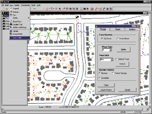 When you add the fact that utilities now need to think and perform more like a Business competing in a free market than an organization operating in a regulated environment, the need for advanced information technology becomes greater than ever. Applications such as competitive analysis, customer analysis, and site location--which were abstract terms in the utility language just a short while ago--are now becoming commonplace.