|
Web Sites Using Esri Software
Internet Mapping Sites Expanding over the Spectrum
This regular ARC News column features the growing number of World Wide Web sites using Esri software. If you have or know of such a site and would like it considered for this column, please E-mail a description and the URL to arcnews-editor@esri.com. Links to Web sites powered by Esri technology are at this address:
www.esri.comhttp://www.esri.com/apps/showcase.
Center for Agricultural, Resource, and Environmental Systems (CARES)
www.cares.missouri.edu
CARES is an intercollegiate research and education center at the University of Missouri's College of Agriculture, Food, and Natural Resources. Its primary mission is to improve the understanding and management of agricultural and natural resource systems and environmental quality through the integration of biological, physical, and social sciences. CARES serves several interactive mapping sites using ArcView Internet Map Server. They are designed as decision support systems for the integrated management of agricultural and environmental resources. CARES Watershed Information Clearinghouse provides users with analytical tools and data for several Missouri watersheds and water resources. Other mapping sites by CARES include a livestock decision support system, Missouri drinking water assessments, and an environmental data list. Users can generate custom maps by selecting criteria from each of the data sets.
Lancaster Township, Pennsylvania
www.twp.lancaster.pa.us
The Web site of Lancaster Township, Pennsylvania, details every aspect of the local government. Users can find information about parks and recreation, planning and zoning, public works, schools, and township history. They can also contact township officials. The GIS component of the site uses MapObjects Internet Map Server. Site visitors can locate properties in the township and retrieve parcel information including location, owner, acreage, land use designation, assessment value, last sale date, last sale price, and current zoning. The interactive map is closely tied to a hypertext version of the township zoning ordinance, so residents can quickly determine what regulations apply to their properties. This GIS applet enables residents to easily obtain answers to common questions online. Developed by RETTEW Associates Inc. of Lancaster, Pennsylvania, an Esri authorized Business partner, the map site is derived from the Lancaster County, Pennsylvania, GIS database.
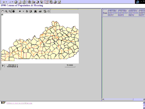 The Social, Natural, and Agricultural Resources Information Laboratory (SNARIL)
snril.ca.uky.edu
The Social, Natural, and Agricultural Resources Information Laboratory evaluates and distributes descriptive and spatial data that is relevant to community and economic development issues in Kentucky. Supported by the extension sociology faculty and staff in the College of Agriculture at the University of Kentucky, SNARIL's Web-based mapping resources use ArcView Internet Map Server and MapObjects Internet Map Server. The easy-to-use Web site provides some of the resources needed for local community empowerment. Users can generate custom maps (including legend colors) with the Thematic Mapper, which uses census data and information from the Regional Economic Information System. The Kentucky Demographics feature is a Java applet that displays data at county, tract, and block group levels for 220 variables from the 1990 Census of Population and Housing. The WWW Community GIS area uses Esri's free ArcExplorer GIS data viewer to access a variety of databases located on the SNARIL Web site.
Switzerland Regional Coordinator for CORVETTE
www.bs-ing.ch
The Coordination and Validation of the Deployment of Advanced Transport Telematic Systems in the Alpine Area (CORVETTE) research project has developed a traffic information site with a dynamic map of real-time traffic. Heavy traffic flows at cross-border connections with Switzerland and Austria, Germany and Italy make the alpine area sensitive to traffic-related incidents and extreme weather conditions. CORVETTE enables users to access traffic data throughout the Alps and peripheral areas. Three message groups, including traffic conditions, road construction, and viability of alpine roads, are available in four languages (German, English, French, and Italian). The application uses MapObjects Internet Map Server.
ArcNews home page
|
|


