


|
|
||
|
|
|
|
|
|
Esri Lends a Helping Hand to Gore's Livable Communities AgendaGIS Takes Center Stage in Community/Federal Information PartnershipAs the 21st century approaches, the GIS movement is gaining momentum. Increasingly, top-level Clinton Administration officials--from President Clinton to Vice President Gore to Attorney General Reno--feature GIS in their speeches. They all point to GIS for solutions in crime prevention, resource management, and the problems associated with rapid growth. Building Livable CommunitiesIn keeping with his "smart growth" theme, Vice President Gore has launched the comprehensive Livability Agenda intended to help communities thrive in a sustainable manner. On January 11, 1999, in a major speech at the American Institute of Architects (AIA) headquarters in Washington, D.C., the Vice President announced the Clinton-Gore Livability Agenda. "By helping communities pursue smarter growth, we can build an America for our children that is not just better off--but better," he said. 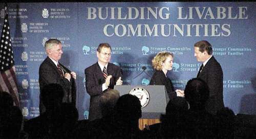 Left to right: Parris Glendening, governor of Maryland; H. Brent Coles, mayor of Boise, Idaho; Tracy Seder-Hines, a regional land protection specialist; Vice President Gore. (Photo courtesy: AIA. Photo by James B. Gardner.) The initiative's key goals direct various federal agencies to provide communities with new tools and resources to implement regional "smart growth" strategies. Vice President Gore also announced the Community/Federal Information Partnership (C/FIP) as part of the Livability Agenda. He said, "We are proposing nearly $40 million to provide communities with easy-to-use information and technical assistance to develop strategies for smarter growth." The partnership, which consists of the 15 agencies that make up the Federal Geographic Data Committee (FGDC), will help local and regional agencies build GIS capacities and fund improvements to public access to spatial data residing in federal agencies. Demonstrations Show ProofKey to the success of the partnership are the six National Spatial Data Infrastructure (NSDI) Community Demonstration projects the Vice President launched last year. Each of the projects, located throughout the country, has an ongoing GIS program with specific cross-regional challenges. The sites will focus on different issues from water quality management to crime analysis to land use planning. Each will serve as an example of the benefits that can be realized through expanded sharing of geographic information between federal and local agencies. "These demonstration projects are proof of concept for the C/FIP," said Mark DeMulder, the federal coordinator for all six sites. DeMulder said that the six projects would receive grants from the federal government's Innovation Technology Fund totaling approximately $644,000. An NSDI Demonstration Facility showcasing GIS applications from each of the sites is scheduled to open this spring in Washington, D.C., and will remain open through the end of the projects in May 2000. Esri Steps Up to the PlateIn March, Jack Dangermond, president of Esri, announced grants in software, education, and technical support to all of the demonstration projects. Additionally, Esri is providing ongoing technical support at the Demonstration Facility. "We felt these donations would help foster the spirit of cooperation among the various agencies," Dangermond said. "The demonstration projects will now be able to appropriate the federal grant money toward expansion of their spatial databases rather than for software purchases." For information about the demonstration projects or the NSDI Demonstration Facility, contact Mark DeMulder (tel.: 703-648-4514). |