


|
|
||
|
|
|
|
|
|
Esri Virtual Campus at the Cutting Edge for 1999Explore and Learn GIS at Esri Training and Education.It's a safe bet the course descriptions at your school didn't look much like these.
Later this year, Web site visitors and students will open the campus "doors" to find a significant expansion of course offerings, as well as a revamped and expanded Web site that will bring GIS instruction to a new and unparalleled level. "Our vision is a Virtual Campus that supports students, academics, and professionals in GIS throughout their careers by offering comprehensive, high-quality, on-demand training and education, and access to the GIS community worldwide," says Esri President Jack Dangermond. Virtual Campus graduates come to class from places as far away as Turkey and China, and they work in a broad range of GIS fields, from natural resources management to logistics planning to environmental quality regulation. Many Virtual Campus graduates are also students at real-world colleges in the United States and across the globe. As diverse as the alumni list is, one common element among students is enthusiasm for the freedom the Virtual Campus allows them while learning on their own. "I found I could learn at my own pace through the use of the campus, as opposed to a conventional classroom setting," says Tom DeAngelis, an agent with the U.S. Border Patrol, which is in the process of setting up a national GIS system. "The actual course has helped me to become a more informed user and has allowed my agency to benefit from what I have learned through the campus," he says. Graduate Jim Gram of the Aircraft Owners and Pilots Association says Esri's courses are as professionally done as any real-world class. "Compared to other online courses I've participated in, Esri has really hit the mark," says Gram. "Not only were the modules well prepared, but they presented the material in a way that proved at once informative, interesting, and entertaining. As a newcomer to GIS, the introduction Esri provided helped spark a new phase in my career and allowed me to add a new dimension to my customers' network analysis efforts." The modules Gram refers to are the basic building blocks of the Virtual Campus courses--six of them comprise a course. The courses themselves train users in a broad range of GIS technology--in ArcInfo, ArcView GIS, ArcView GIS extensions, and the Avenue programming language. Application courses include such titles as Conservation GIS Using ArcView GIS and Spatial Hydrology Using ArcView GIS. A learning module consists of three lessons, each made up of a lecture, exercises, and a quiz. To pass a module and move on to the next one, a student must pass a 20-question, multiple-choice exam. Quiz and exam questions are graded by Esri's Web server so students know almost immediately whether they've passed or not. If they don't pass, students can study some more and then take it again with different questions chosen at random. If they do pass, the Web server generates a personalized certificate of the student's achievement--and the student's PC will generate a round of applause, something else missing from real-world school. Each module is designed to take three or four hours to complete. But that is not a requirement; students are allowed access to the course for as long as they need. "I was able to do it when I had time and didn't have to leave the house," says Marianne Van Kerckhove, a recent geography graduate at Michigan State University. "Also, the exercises and the format of the course I took (Introduction to ArcView GIS) made it easy to go through the lessons all at once or slowly. I just did it when I had time." The cost of each module is a standard $19.95, but many modules are free including the first one in every course. Numerous discounts are also offered to qualifying groups. Investment in online education efforts in both the public and private sectors has exploded in recent years as access to the Internet has become widespread. To stay on the cutting edge of that phenomenon, Esri's Virtual Campus at Esri Training and Education will undergo a significant transformation in 1999, says Esri's Ron Gullon, who oversees the Virtual Campus. Come explore and learn at Esri Training and Education. |
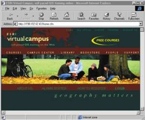 No, this is not the college of your dreams. It is the Esri Virtual Campus at