|
|
||
|
|
|
|
|
|
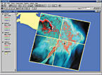
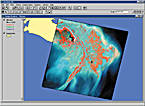
ArcView Image Analysis 1.1 Upgrade Now AvailableArcView Image Analysis 1.1, an optional extension to ArcView GIS, is now available. ArcView Image Analysis 1.1 significantly expands the geographic imaging capabilities for ArcView GIS users by giving them access to a broader range of data types, and particularly emphasizes the growing uses and applications of aerial photography and other remotely sensed data. The ArcView Image Analysis 1.1 upgrade includes new capabilities for mosaicking imagery, image stacking, setting and managing user preferences, additional data enhancement options, and access to new data types.
The addition of a mosaicking function is a significant enhancement to ArcView Image Analysis. This is an easy-to-use capability that allows you to automatically combine multiple images into a single file. For example, several digital orthophotos can be mosaicked into a single image file, conforming to the extent of an ArcView GIS project. Image stacking is another important new capability that allows you to combine, visualize, and interpret a wide range of data types and resolutions in a single ArcView Image Analysis theme. For example, you can combine image data of a single geographic area from two different dates for visualization and analysis of temporal change. ArcView Image Analysis 1.1 provides enhanced flexibility for setting and managing user preferences. You can now select and edit preferences through an intuitive dialog. The dialog allows you to control default band selection, to display multiband imagery, and to resample options for image alignment and image statistics used in histogram functions. The ability to enhance data for visualization has been expanded in two ways. First, several one-button operations have been added to the legend editor in order to simplify standard histogram stretching and band selection processes. Second, the edge detection filter has been incorporated to the ArcView Image Analysis menu for easy access and operation. ArcView Image Analysis also includes support for new data types, therefore providing access to almost any format that is not accommodated by either an importer or direct-read capability. ArcView Image Analysis is intended primarily for ArcView GIS users who want to generate more information from imagery without having extensive knowledge of remote sensing and image processing. One of the most practical uses of the ArcView Image Analysis extension is for GIS basemap updating and temporal analysis. The extension provides an efficient means of displaying and enhancing imagery and performing simple analyses, heads-up digitizing, automated change analysis, and map editing in a productive manner. ArcView Image Analysis 1.1 is now available for Windows 95/98, NT, and 2000. ArcView Image Analysis is an ERDAS software program and the result of a collaborative effort between ERDAS and Esri. For more information on ArcView Image Analysis, please visit www.erdas.com or www.esri.com/imageanalysis, or call your local Esri reseller, Esri at 1-800-447-9778, or your Esri regional office. Outside the United States, please contact ERDAS at 404-248-9000 or visit www.erdas.com/contact/sales/sales_contact_intl.html. |