
Teaching GIS Theory and Practical Applications
University of Redlands Offers International Practitioner's Master's Degree in GIS
Professionalism in GIS involves more than just knowing how to use the technology. Geographic information forms the basis of a large percentage of operational and strategic decisions made today. Understanding the fundamentals of collecting, storing, 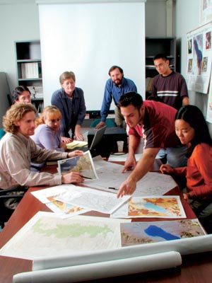 analyzing, and managing such information is critical. As well, knowledge of how management and decision making processes operate is needed to ensure that geographic information and related technologies are used appropriately. The ability to articulate a spatial problem, develop a project plan to resolve it, and implement those steps is also necessary.
Efforts to define the profession of GIS are progressing on a number of fronts. The Urban and Regional Information System Association (URISA) in the United States, the Association of Geographic Information (AGI) in the United Kingdom, and the International Standards Organization (ISO), for example, all have committees considering aspects of professional certification in GIS. All of these activities are dependent on the recognition that GIS is a profession and that a certain body of knowledge beyond the technology is required. While certification programs are one part of the solution, intensive professional education programs for GIS practitioners are needed.
At the University of Redlands, Redlands, California, a program to provide one such practitioner's master's degree in GIS is being developed. This new international program is a concentrated 11-month curriculum where people will come from around the world to Redlands as full-time students of the university to learn the fundamentals of GIS  theory, computer science, and project management, as well as to undertake practical applications using Esri's technologies. This program will involve case studies; lectures; practical experience; training by Esri staff; and lectures by Esri staff, university faculty, and visiting faculty.
One of the goals at the university is to train people to really "know" how to make GIS systems work and be professional practitioners. In other words, it's a kind of professional degree underpinned by theory, science, and technology as well as plenty of practical experience.
This M.S. degree will cost approximately $20,000 plus housing and related expenses. The focus is on GIS and international professionals who want to go back to school and achieve an advanced degree in GIS in order to start or advance a GIS-related career.
Program Specifics
The objectives of this degree program are to provide an intensive educational environment in which students of varied academic and national backgrounds enhance their existing professional and educational experience with comprehensive knowledge about the fundamentals of GIScience and the use and application of GIS technologies. Students graduating from this program will be equipped to take up positions as GIS practitioners including project managers, analysts, and software development team members.
Graduates will be able to
- Demonstrate comprehensive knowledge of the functionality and applications of GIS technology and a thorough understanding of the fundamental theory and concepts on which the technology is built.
- Explain the principles underlying spatial analysis in all its variations.
- Demonstrate high-level skills in spatial problem solving and spatial analysis.
- Effectively communicate and present project deliverables.
- Describe how geographic information is used, managed, and marketed in the global context.
- Demonstrate competence in the use of various Esri products including ArcGIS, ArcSDE, and ArcIMS, as well as a functional grasp of Visual Basic programming.
- Design and complete small GIS projects in specific application areas.
- Undertake needs analysis, system design, and implementation of GIS within organizations—with the managing GIS option.
- Design and create software programs in one or more object-oriented languages—with the programming GIS option.
Through elective courses and optional seminars, students may choose to focus their GIS education toward specialized areas such as technical writing, spatial data librarianship, technology training, quality assurance, software development, or specific application areas. Focus areas will be determined individually in consultation with program advisors.
Instruction will be provided through a mixture of lectures, written exercises, seminars, practical work in computer labs, and individual and group projects. A final major project will integrate and demonstrate students' newly attained knowledge and skills.
The Student
This course is intended for
- Professionals who are currently employed in any field using spatial information and who would like to deepen their knowledge of the theoretical underpinnings and use of GIS technology
- Professionals in any field who would like to begin a career in a GIS-related position
- Recent university graduates who wish to build a strong basis for career advancement through a solid foundation in geographic information science and technology
Program Structure
Pending approval from the university board of trustees, the program will consist of nine months of course work plus the undertaking of a major project. The normal course schedule will begin in September with two fall terms of seven weeks, each offering one theory and one technology-oriented course, plus GIScience and project planning seminars and one elective. A special four-week interim term in January allows for intensive instruction in one of two program specialties. This will be followed by two spring seven-week terms of course work and a summer term for concentrated project work. The program will usually culminate in a public presentation of project results at the Esri User Conference followed by a week of internal review and examination.
The program will start in September 2001 or February 2002. Find out more about it by looking at the University of Redlands Web site (institute.redlands.edu/giscenter). For more information, contact the program director, Dr. Karen Kemp (kemp@uor.edu).