


|
|
||
|
|
|
|
|
|
Now Includes ArcExplorer ComponentsMapObjects 2 Now Shipping
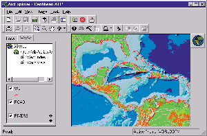
ArcExplorer is Esri's freely distributable GIS data browser that was built using MapObjects software and is available at www.esri.com/arcexplorer. Over a third of a million sites use ArcExplorer as an easy-to-use and cost-effective way to provide simple GIS capabilities to users free of charge. Since it can be bundled with data on CDs and distributed as a free data viewer, ArcExplorer has been popular with data publishers. ArcExplorer is unique in that it can also be used to connect to MapObjects Internet Map Server (IMS) sites for viewing data and maps on the Web. "ArcExplorer is a great example of an application created using MapObjects," says Bernie Szukalski, MapObjects product manager. "A lot of users like what they see in ArcExplorer, and we've had quite a few requests to release the source code to kickstart development. What we've done for MapObjects 2 is package some of the major pieces of ArcExplorer as components so that they can be reused easily." MapObjects 2 will include the OCXs and Visual Basic source code for the ArcExplorer legend, toolbar, and scale bar. A collection of common utilities used in ArcExplorer is also included. Sample applications using these components demonstrate their use and provide a framework for further development. "ArcExplorer is frequently referred to as the most popular GIS application in the world because it is freely available and anyone can learn to use it," says Szukalski. "Many users have taken advantage of ArcExplorer, and now developers can build highly custom applications for end users based on the same components." MapObjects 2 will now include more than 45 mapping components. Other new features include
MapObjects 2 components can be used in any standard Windows development environment such as Visual Basic, Visual C++, Delphi, PowerBuilder, and others. And with the optional extension you can use all these capabilities on the Web. MapObjects users who acquired a license for version 1.2 after January 15, 1999, will receive a free upgrade to version 2. For more information on MapObjects 2, visit www.esri.com/mapobjects, or call your local reseller, Esri at 1-800-447-9778, or your regional office. Outside the United States, please contact your local Esri distributor. |
 MapObjects, Esri's powerful collection of embeddable mapping and GIS components for application developers, is now shipping. A key feature to MapObjects 2 is that it includes the source components for key parts of ArcExplorer.