|
|
||
|
|
|
|
|
|
| Special Insert | ||
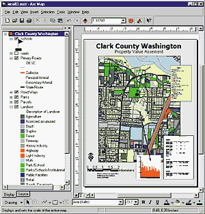
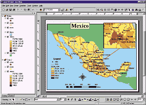
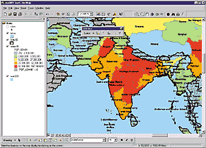
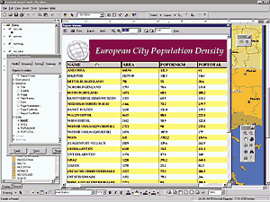
ArcMap: Mapping and Editing Made EasyIn ArcInfo 8, display, query, and analysis of your map data are supported by the new, map-centric ArcMap application. ArcMap expands on concepts and interfaces first introduced in Esri's popular ArcView GIS software. ArcMap provides the ease of use of ArcView GIS with the full functionality of ArcInfo. ArcMap extends even further Esri's popular direct data read capability, which allows data sets to be used on the fly without translation or use of an intermediate format. ArcMap supports ArcInfo coverages, Esri shapefiles, SDE layers, map libraries, ArcStorm layers, DXF and DWG, DGN, many image types, GRIDs, and much more. In addition, ArcMap supports on-the-fly projection and the individual layer level.
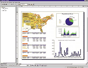
Many users will see ArcMap as the central application where they will spend most of their time. It is an easy-to-use, fully menu-driven application for working with any type of map data. Existing ArcInfo users will think of it as the power and flexibility of ARCEDIT and ARCPLOT in one modern application and more. It is a completely integrated application for creating and editing spatial databases, displaying and querying geographic data, performing complex analysis, generating quality reports and charts, and making high-quality maps. Common tasks, such as geocoding and map navigation, are intuitive and accessible to licensed users throughout an organization. Easy applications include thematic and topographic mapping, map-based query and analysis, charting and reporting, and map-centric geoprocessing. ArcMap introduces high-quality maps and reports in the desktop environment. Plus ArcMap contains graphics layout systems fully integrated with standard Windows-based applications like those found in Microsoft Office, giving you the freedom to include your maps in other documents.
|
|||||||||||||||||||||