


|
|
||
|
|
|
|
|
|
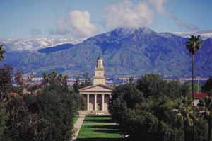
GIS Education Center and International Master's Degree Program at the University of RedlandsBy Karen K. Kemp, Associate Professor of Geographic Information Science, and Director, International Master's Degree Program, University of Redlands, Redlands, CaliforniaWhile distance and asynchronous learning now are becoming quite common for the professional market, the University of Redlands' new International Master's Right and below left: images of the University of Redlands campus. The International Master's Degree Program in Geographic Information Analysis and Management is designed for an international audience of professionals seeking to develop or improve their knowledge of the use and management of geographic information as it relates to their professional activities. The program will consist of one year of coursework at the University of Redlands followed by approximately six months of project work either at the university or at other approved sites. The GIS Education Center associated with the program will be an open, on-site education environment for professionals and academics seeking intensive academic learning opportunities but for whom the extended master's degree program is inappropriate. It is intended that the center become a world renowned GIS education think tank where scholars, professionals, and developers will interact through extended discussion and shared study. All courses will be offered in modules of one month or less. This will allow study programs to be tailored specifically to the needs and expertise of individual learners, accommodate the busy schedules of international visiting faculty who will present key advanced courses, allow university courses to incorporate and expand upon instructor-led technical courses at the Esri campus in Redlands, and permit short-term students to participate in center activities for one or more months at any time during the year.
The close physical proximity to Esri provides many opportunities for interaction including
What will make the program international? While it is likely to attract U.S.-based professionals and academics, it also will appeal to students from around the world interested in studying in the United States and extended exposure to Esri staff and facilities. To ensure that course content is truly international, faculty also will come from around the world to participate annually in the learning experience. Their international perspectives on how GIS is done differently in various countries and international agencies are key to the program's learning objectives. While all instruction will be in English, when possible and appropriate, language support for students for whom English is a second language may be provided. This may include native language-speaking mentors or non-English seminars. The program is on a fast track to development. Up-to-date information on content, application procedures, and fees will be posted on the program Web site at cem.uor.edu/giscenter. It is anticipated that the first students will be accepted in fall 2001, though entrance into the full master's degree program may be delayed until 2002. For more information, contact Karen Kemp (e-mail: kemp@uor.edu). |
 Degree Program in Geographic Information Analysis and Management will take advantage of the fact that the university campus is within easy bicycling distance of Esri's Redlands, California, headquarters—the American heartland of GIS.
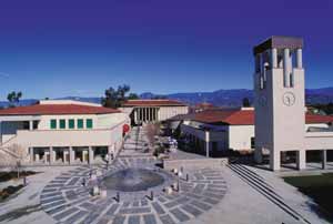 The program will be directed toward increasing students' depth of knowledge in the field of GIScience while at the same time providing them with fundamental technical and project management skills. Given the open structure of the program, students with interests in nontechnical aspects of the GIS profession, such as technical writing or training, will be able to enrich their study program through additional courses offered at the University of Redlands but outside the GIS Center.