


|
|
||
|
|
|
|
|
|
NIMA Enters into $22 Million GIS Software Agreement
In addition to GIS software, NIMA has the option to also purchase software training and professional GIS services from Esri. This agreement was organized under Esri's General Services Administration (GSA) Contract and will allow NIMA to procure Esri technology in a more cost-effective and efficient manner.
This contract also includes Esri application software known as the Production Line Tool Sets (PLTS), which are specifically designed to support the generation and maintenance of standard soft-copy and hard-copy products by NIMA, NIMA contractors, and NIMA coproduction organizations. The PLTS products currently support soft-copy production of Digital Nautical Charts, Vector Maps, Urban Vector Maps, and Foundation Feature Data as well as digital production of the following hard-copy products: Harbor and Approach Charts, Topographic Line Maps, and Joint Operations Graphics. The agreement will save NIMA time and money by eliminating the need for repetitive, individual purchases from separately negotiated contracts for the same requirements within different NIMA organizations. Since the contract is open to all NIMA customers and government contractors working with NIMA, it will also operate as a vehicle to consolidate purchases and GIS services work among these organizations. This contract will enable all NIMA organizations to easily acquire Esri's GIS software suite, which complies with federal data standards for open geospatial software. All licensing and contract obligations are already prenegotiated via the GSA Schedule in place with Esri. Therefore, NIMA organizations, customers, and government contractors can choose a variety of configurations all the way from desktop to enterprisewide GIS solutions. The National Imagery and Mapping Agency was established in 1996 as a member of the intelligence community and a Department of Defense combat support agency. NIMA was created to accelerate the fusion of geospatial information and imagery intelligence and to meet growing customer needs for a common, digital view of the mission space. NIMA is committed to delivering the imagery and geospatial information that gives national policymakers and military users the information edge.
Esri has had a decade-long relationship with NIMA, helping NIMA to implement and use GIS tools for mission-critical applications. Esri's first major NIMA program was the Digital Chart of the World (DCW). That was followed by data production contracts for Digital Nautical Charts and Vector Map data. Esri served as a subcontractor on the Hydrographic Source Assessment System (HYSAS) and Navigation Safety System (NSS) programs. Esri staff has supported NIMA and its customers at various military commands. Both the NIMA prototyping facility and several NIMA production cells develop NIMA products using Esri technology. Esri is also supporting NIMA to implement GIS within defense organizations through many other programs. For more information on the NIMA BPA, contact Tara Helfeldt, Esri-Washington, D.C. (tel.: 703-506-9515, ext. 8044). Digital Chart of the World (DCW) is a registered trademark of NIMA. |
 Esri and the U.S. National Imagery and Mapping Agency (NIMA) have entered into a blanket purchase agreement for approximately $22 million of GIS software and related technology support. This is the largest "commercial off-the-shelf (COTS)-based" GIS software agreement ever for Esri and will help make Esri's software solutions a standard in the military establishment and the world.
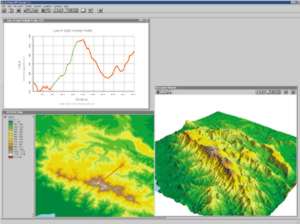 The agreement covers the entire Esri GIS software family including ArcInfo, ArcView GIS, and ArcSDE (Esri's technology for managing spatial data in leading commercial database management systems). Esri's popular Internet mapping solutions (ArcIMS) are also included.
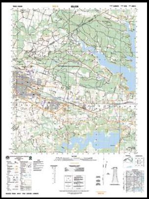 "This is exciting because this relationship with NIMA means we have the opportunity to serve the nation's premier mapping organization," says Jack Dangermond, president, Esri. "Involvement in NIMA's mission through this BPA is something that Esri is extremely proud of. The contact will help NIMA more quickly and effectively procure and standardize on COTS GIS technology that will enable NIMA to fulfill its critical mission of providing timely, accurate maps and information."