ArcUser Online
 |
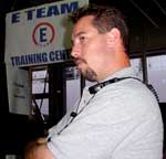
Responding to this disaster was made more challenging because New York City's Emergency Operation Center (EOC), which had been located in Building Seven of the WTC, was also destroyed in the collapse of the towers. The City ultimately relocated the EOC to a shipping pier. Emergency personnel from more than 200 city, state, and federal agencies and private companies, such as Consolidated Edison, Verizon, Esri, and AMTRAK, responded to the September 11 disaster. Coordinating immediate rescue efforts and long-term recovery plans required sharing information among responding personnel. Prior to the incident, New York City had selected emergency and event management system software from E Team, an Esri business partner. This system uses ArcIMS as its mapping component and takes advantage of the cross-platform capabilities of the Internet to deliver vitally needed information to virtually anyone connected to the Internet. Users log on to the E Team secure Web site and access constantly updated information on an incident. Although E Team had been chosen, this decision was made only one week before the disaster--insufficient time to install, set up, or train the intended users. The author, Eric Kant, a technology specialist from Osceola County, Florida, traveled to New York City and assisted in setting up a field GIS implementation for coordinating rescue efforts.
I arrived in New York City on September 15, the Saturday after the disaster. By that time, the New York City Mayor's Office of Emergency Management (OEM) had set up an impromptu EOC at Pier 92 on the west side of Manhattan. The Emergency Mapping Center at the EOC, consisting of 20 workstations running ArcGIS, five plotters, and a data server running ArcSDE, was impressive. An online map request system allowed quick entry of map requests into a database and provided a prioritized queue to the Emergency Mapping Center staff. The center supplied maps that showed destroyed, damaged, and unstable buildings; helped route debris removal; described the path of asbestos plumes; illustrated power outages; showed the location of emergency centers; and provided other information that assisted rescuers and decision makers. I met with two senior staff members from E Team-Troy Armstrong, vice president of solutions development, and John Hughes, director of East Coast operations-to work out a game plan for setting up E Team as the framework for emergency operations communications among the more than 200 computers at the EOC. Osceola County's Office of Emergency Management was the first local agency on the East Coast to use the E Team system. While responding to several presidentially declared disasters, I and other Osceola County personnel had become familiar with the software. Instead of removing or replacing operational procedures or verbal communications, the E Team system provides tracking, documentation, and accountability. In the past, information conveyed by conversations between emergency personnel would be limited to a few people and perhaps be documented by some notes. This static information could be accessed by only a few people. Entering information into the E Team system provides not only content but also metadata concerning communications (e.g., persons spoken to, information sources, GIS mapping links, contact information). E Team moves incident information from a static data model to a dynamic routable information workflow that is available to every participant on the system with explanations, GIS mapping layers, attachments, and contact information. On September 11, E Team had full operational capacity for New York City on the E Team application service provider (ASP) and contacted OEM with information on how to access the application over the Web within a matter of hours of the collapse of the towers. In just a few days, OEM staff could access maps that provided an overview of the operation as well as the detailed underlying information. Detailed maps of ground zero were distributed using ArcIMS, which provided the foundation for disseminating geographic information and mapping services via E Team. Because most people have used browsers to access the Internet, training on the E Team system is relatively easy and takes just a few minutes. Creating the link between operations and the system takes a little longer and is a common problem in implementing technology solutions. Osceola County, which has been managing disasters using the E Team system for more than three years and has activated the County EOC more than a dozen times, has been able to integrate operations with E Team by thoroughly understanding both the Incident Command system and the technology being applied. Continued on page 2 |