ArcUser Online
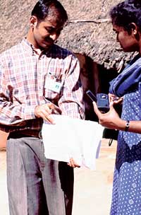
Armed with a handheld PC running ArcPad, a couple of GPS receivers, and a handful of volunteers, Dr. Jay Devasundaram developed a methodology for quickly generating a spatial framework for an Indian village that has also made decades of census data accessible. He hopes this process will jumpstart GIS use for addressing socioeconomic, environmental, and public health issues. This work also enabled GIS-based analysis of data gathered on a dengue fever outbreak. Devasundaram, who holds a master's degree in public health in addition to a medical degree, works as a consultant for Esri Professional Services. Trained as a physician at the Christian Medical College and Hospital (CMC) in Vellore, India, he has been involved in many aspects of epidemiology—in field-based leprosy control programs, in the physiology research lab at the National Institute for Mental Health and Neurological Sciences in Bangalore, and as a research fellow at the Center for Biomedical Engineering, Indian Institute of Technology in New Delhi. He has also worked for disease control programs for the State of Maryland and St. Mary's and Charles counties in Maryland. Devasundaram has long been interested in the use of GIS for global disease surveillance programs and the development of GIS tools for health data collection and sharing. In fall 2001, a trip home to India to attend to family matters provided an opportunity to test a down-to-earth approach to GIS that he had been contemplating for several years. He felt that staff at CMC just needed a little assistance to implement a GIS that would benefit the institution's many holistic health programs so he paid for the needed GPS units out of his own pocket. CMC is a prominent teaching and medical institution in India with a world-class reputation. Founded in 1900 by a young American missionary, Dr. Ida Sophia Scudder, CMC is a nonprofit organization located on a 2,000-bed multicampus complex. This institution pioneered many medical treatments-the first open heart surgery in India as well as India's first kidney transplant were performed there. The Community Health and Development (CHAD) program at CMC serves as the first referral unit for the inhabitants of Kaniyambadi block in the Vellore District and was recognized by the World Health Organization as a Center of Excellence for Community Health. Dengue OutbreakOn September 1, 2001, a young man from Pennathur Village visited a CHAD outpatient facility complaining of a fever and nose bleeds and reporting that many people in his village were suffering from high fever. The next day, a team from CHAD visited Pennathur Village, a community of agricultural workers in the Kaniyambadi block, to assess the problem and institute appropriate control and preventive measures. Anyone in the community who had developed a fever of any duration from August 1, 2001, onward was identified as a case. In this situation, in which more precise case definition involving labratory tests would have been prohibitively expensive, a house-to-house survey collected symptom information. An extensive questionnaire on each individual was filled out and demographic information including age, sex, and date of birth was obtained from an existing database at CHAD. Based on this information, the results of laboratory tests run on a small sample population, and entomological evidence, a dengue fever outbreak was declared. Of the 989 people living in Pennathur Village, 301 eventually contracted the disease.
Each year, tens of millions of cases of dengue fever (DF) occur worldwide as well as several hundred thousand cases of the more deadly dengue hemorrhagic fever (DHF). Of the five percent of cases that end in death, most are children and young adults. An occurrence of either DF or DHF is caused by one of four closely related but distinct serotypes of the genus Flavivirus (i.e., DEN-1, DEN-2, DEN-3, and DEN-4). Immunity acquired for one serotype does not protect an individual from other types. Consequently, a person living in a dengue-endemic area can potentially suffer four episodes of the disease during a lifetime. The disease is transmitted to humans via a day-biting mosquito, Aedes aegypti, and the rate of infection typically increases with the beginning of the rainy season. Mapping the Spread of DiseaseAlthough mapping in public health is more than 150 years old, public health GIS applications are relatively recent. More than just the display of data, these applications include the storage, integration, and analysis of spatially enabled health data. Of all the areas of public health, GIS use for epidemiology is most widespread. Because no vaccine is currently available for DF or DHF, mosquito control that reduces larval breeding sources represents the most effective available long-term prevention measure. However, in the short term Devasundaram believes the development of improved, proactive, laboratory-based surveillance systems that provide early warning of impending dengue epidemics will allow the public to be alerted and aid physicians in correctly diagnosing and treating dengue/DHF cases. Devasundaram spatially enabled the data collected on dengue fever outbreak by generating a basemap for the village in a period of about five days. Simply walking through the streets of the village, he used ArcPad with a GPS receiver to generate a street centerline file. Next, a small team of CMC students and staff captured GPS points for each house in the village. This five-day period also included much time spent standardizing the data collection process and teaching it to volunteers. In a part of the world where street addresses suitable for geocoding are virtually nonexistent, unique house numbers assigned as part of the National Malaria Control Program (NMCP) provided a built-in key to unlocking census data and organizing new attribute data. Later renamed the National Malaria Eradication Program (NMEP), it was instituted in 1953 in response to a severe outbreak of the disease. Using house numbers, Devasundaram could not only explore data on the dengue outbreak but could also integrate the detailed census data that has been collected by the Government of India since 1872. Continued on page 2 |