ArcUser Online
Data Maintenance Is the KeyPlanning for ongoing maintenance of vital data sources is a critical component of overall GIS system design. Initially, this means locating sources of information, deciding how to use them, and where they will be stored. But, don't stop there! Consider how data will change over time. Few GIS datasets are built once and left alone. They usually represent real, living, changing, evolving spatial information. End users depend on current, accurate data to make correct decisions. Developing strategies for maintaining data currency helps ensure that people can and will rely on data to produce meaningful results over the long term. Consider the following examples of data, likely to be represented in a GIS system that are subject to change over time:
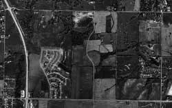
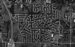
In some of these examples, data changes relatively slowly. Branch office locations for a business could remain static for years. Other examples, such as the current locations of delivery trucks in transit, could change in real time. Maintaining sales territories for a small company with a two-person sales force entails minimal work. However, managing this information for a nationwide company with multiple vertical markets and hundreds of salespeople is a substantial task. Furthermore, when handling infrastructure changes, a single modification may impact many different areas. For example, the development of a new subdivision is likely to cause changes to utility databases (water, gas, electric, telephone, cable, sewer, etc.); tax and parcel maps; E-911 dispatch for emergency services; mail and package delivery; school bus routes; and pizza delivery zones. Data Update TechniquesThe ArcGIS environment includes ArcSDE and the geodatabase at its core. Built on relational database technology, this architecture is particularly well-suited for data update tasks. Because the primary source of new information for some GIS data layers is local data entry, the multiuser editing tools and versioned geodatabase provided by ArcGIS are particularly helpful. Planning for data updates involves devising a methodology and publishing rules for accomplishing the necessary editing tasks. As the number of concurrent editors increases, the need for solid software tools and established conventions for their use becomes more critical. Editing sessions must be controlled and coordinated and any conflicting changes reconciled. An established protocol will become more important with the implementation of disconnected editing at ArcGIS 8.3, which allows remote editors to check out and check in data to a central versioned geodatabase. Data layers obtained from external sources may be read-only copies of data purchased from a vendor that are shared over the Web or replicated internally. In considering data maintenance scheduling for information that must be available 24/7, a parallel loading scheme might be appropriate. Using this procedure, new data is installed on separate disk partitions or even on a different server as the old data continues to be accessed live. Once the new data is available, the application software, switched on the fly, can begin using it. The old information can be removed or left as a backup for the newer version. A spatial database used for wireless E-911 call routing and dispatch purposes is an example of this type of critical 24/7 application. Because a wireless 911 call can arrive at any time and must be promptly routed to an appropriate Public Safety Answering Point (PSAP), a GIS dataset of active PSAP boundaries must remain online at all times, even as the database is being updated. Transactions can be an excellent solution for near real-time revisions of large datasets for situations in which only a portion of the information changes. Rather than removing an entire layer and completely reloading it, selected records can be updated by applying appropriate add, change, or delete transactions. The rows-and-columns nature of the relational databases used by ArcSDE make a transactional approach useful for updating selected data. In many situations, update transactions can be applied to a live system without causing significant disruption. The amount of data, frequency of update, and the complexity of the data model all influence the development of the methodology used for maintaining data. Refreshing a year's worth of changes to a fairly static database, or a minute's worth of modified records for a rapidly changing real-time dataset present different challenges. A model of the data flow from each information source to the GIS system that includes intermediate format translations will assist in designing an effective update technique. The rate at which changes can be applied to the database and system up-time requirements also help in determining an appropriate method. Continued on page 2 |