ArcUser Online
| Border "Traffic" Meets Technology |  |
|
The United States Border Patrol maintains the security and integrity of U.S. borders. As the mobile uniformed law enforcement arm of the Immigration and Naturalization Service, it controls the entry of persons or contraband, known within the agency as "traffic." GIS is now being utilized to analyze traffic and more efficiently use resources. 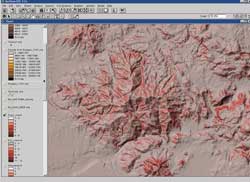
The Border Patrol's jurisdiction is divided into Regions and further subdivided into Sectors. In the Western Region, the San Diego and El Centro Sectors are responsible for patrolling approximately 130 miles of border between the State of California and Mexico. As part of the Border Safety Initiative, a program designed to increase migrant safety, GIS is used by the Border Patrol to concentrate resources at dangerous areas to deter crossing in these areas as well as a tool for improving response to border emergencies. Because most apprehensions are made on trail networks far from named or maintained roads, these and other incidents are tracked by latitude/longitude. GIS is also used for case support to increase communication and understanding between investigating agencies and enhance visual aids in court proceedings. Registered aerial imagery is added in ArcView GIS to show location, direction of travel, contact points, and other field information. The San Diego Sector, headquartered in Chula Vista, California, has used ArcView
GIS for several years. The El Centro Sector, east of San Diego, is implementing
GIS and works closely with the San Diego Sector. Both Sectors are committed to standardizing GIS collection, symbology, and analysis. Through data sharing exercises, Border Patrol staff noticed that two standard street centerline data sets that should have aligned, didn't. A call from the El Centro Sector to the author about this problem led to the accompanying article, "The Dilemma at the Border: Registering Vector Data Across Datums." |