Agriculture is an information intensive industry that is profoundly spatial in nature. To be successful, farmers must be generalists who are not only well versed in the latest farming techniques but also astute businessmen who are technologically savvy. Similarly, government agencies that serve this sector of the economy have a wide range of responsibilities associated with regulating, assisting, and monitoring the activities of farmers and agribusinesses.
The scope of government agriculture activities is so broad that local, state, and federal agencies--perhaps more than any other sector of government--must share information and coordinate activities. No information technology "brings it all together" more effectively than GIS. Not only does GIS integrate data from many sources but it also provides a common framework for sharing data and developing information.
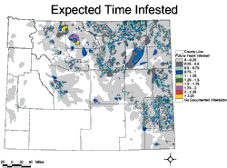 Government agricultural agencies on the federal, state, and local levels use GIS for protection, information, and oversight activities. Protection activities include safeguarding the food supply, monitoring agricultural practices and environmental factors to balance the needs of agriculture with the well-being of the surrounding area, and disease and pest control programs that mitigate these age-old adversaries of the farmer. In agricultural research programs, GIS is a valuable tool for developing information that improves protection activities.
GIS is also effective in disseminating information that helps farmers become more productive. In addition, government agricultural agencies use GIS to monitor the quality of rural life, allowing for the development of programs that safeguard rural populations. The ability of GIS to integrate, display, and query many types of information at the same time makes it an important tool for decision support and policy making. Departments and agencies across all levels of government maintain data in GIS, use information derived from GIS analyses, and manage programs with the help of GIS.
The United States Department of Agriculture (USDA) has made tremendous use of GIS in many aspects of its operations and that trend will only increase. The Department is using GIS to map the nation's farmland (see "USDA Establishes a Common Land Unit" in this issue). The USDA also recently entered into an agreement with Esri that will expand the use of GIS technology by providing a complete suite of Esri's GIS software to all USDA agencies. See the accompanying article, "Agreement Expands Use of GIS Throughout the USDA."
USDA National Resources Conservation Service is one of more than 16 USDA agencies that use GIS. The Soil Survey Geographic Database (SSURGO) produced by the USDA National Resources Conservation Service is supplied in ArcInfo exchange format (i.e., .e00 files). SSURGO data is the basis for state-level soil surveys and ongoing research in soil conservation.
Many other governments have recognized the benefits of using GIS to support agriculture. The Government of South Africa is using GIS to support the increased food production needed for a growing population. The Agricultural Geographic Information System (AGIS), a joint venture of the National Department of Agriculture (NDA), the Agricultural Research Council (ARC), and the Provincial Departments of Agriculture (PDA), manages agriculturally related data for the nation in a GIS. The program has the twin goals of improving decision making for the government and sharing information with farmers. Web applications developed for AGIS use maps to share information. See the article "Web Application Monitors Crop Conditions" in this issue to learn more about one of the applications developed by AGIS.
