Web Site Coordinates Undercover Activities
Editor's note: A Web mapping site developed by the Oregon Department of Justice (ODOJ) coordinates multiagency undercover operations, avoiding costly and possibly deadly miscommunication, without compromising the confidentiality of these operations.
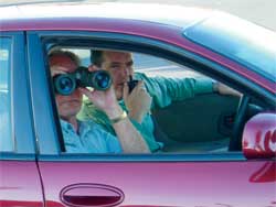 |
| A Web mapping site developed by the Oregon Department of Justice (ODOJ) coordinates multiagency undercover operations. |
Before leaving to serve an arrest warrant on a suspected drug dealer in Marion County, Oregon, a Regional Organized Crime Task Force police officer entered the suspect's address into the ODOJ Oregon State Intelligence Network's Web mapping site. The Web site geocoded the address, searched the database for other police activities in the vicinity, and immediately notified the officers that serving the search warrant might interfere, or "conflict," with a Marion County Gang and Narcotics Enforcement Team (MAGNET) case. The application also e-mailed and paged the MAGNET officer in charge of the case.
In the ODOJ Watch Center, an alarm sounded and staff responded by using a Web browser to click on the mapped event location and display detailed officer contact information. Officers were notified that they were conducting activities in close proximity to each other and were given each other's contact information. No other information was provided to the officers and they discussed their cases on the phone, thereby avoiding a potentially dangerous situation. By informing the officers that they were working in proximity to each other, the situation was "deconflicted."
Need for Deconfliction
ODOJ's federally funded High Intensity Drug Trafficking Area (HIDTA) program provides an Intelligence and Investigative Support Center that serves, in part, as a "one-stop shop" for criminal research, analytical case support, information exchange, and case coordination services often referred to as deconfliction. One of the goals of the Federal Office of National Drug Control Policy HIDTA program is to facilitate multiagency communication. Officers from federal, state, and local law enforcement agencies operate throughout Oregon.
Several geographic and operational issues make narcotics interdiction problematic: undercover operations are common; agencies have overlapping jurisdictions; in metropolitan areas, operations are often in close proximity to each other; investigations may take officers hundreds of miles from their offices; multiple agencies may be investigating the same suspect; and suspects may be under investigation for nondrug related crimes, such as burglary, by other departments in the same law enforcement agency. All of these factors combine to create situations in which officers may interfere with each others' cases. Occasionally, undercover operations have deteriorated to the point that weapons are drawn and one officer harms, or even kills, another. True identities are often hard to ascertain in high-pressure undercover situations.
ODOJ managers knew that other law enforcement agencies had used desktop GIS to enter and search for potentially dangerous conflicts. These systems required officers to provide event addresses to a GIS analyst who geocoded and searched the vicinity for other officers operating in the area. If a potential conflict existed, officers were instructed to call one another and discuss their planned activities. This system achieved the goal of fostering interagency communication, but it was labor intensive and required officers to wait while event addresses were manually processed.
A Web Mapping Solution
ODOJ felt that the GIS used by other law enforcement agencies worked well; however, it was interested in developing a secure, automated, and Web-based method for deconflicting events. Esri Business Partner Alsea Geospatial, Inc. (AGI), was contacted and a meeting was held to discuss the problem. Working with AGI, a list of system requirements was identified.
- Ability for officers to share the geography of their activities without compromising other case details
- 24/7 availability and direct officer entry of event information
- Automatic geocoding and search for other proximate events
- Automated event processing and the ability to preview and confirm events and the locations on a map
- Easy-to-use interface that required no understanding of databases or GIS
- Database security
- Secure availability through a browser interface
The system requirements were documented and reviewed with federal, state, and local law enforcement officers and managers, as were the layout of the Web page, mapping interface, Web forms, and data to be collected. The system architecture was identified and the hardware and software purchased. Because of the mission critical nature of the application, an enterprise solution using a Microsoft SQL Server database, ArcIMS, and ArcSDE in a redundant, clustered six-server Windows 2000 environment was selected. To ensure that the site would continue to function during periods of electric power failure, a gas backup generator was installed.
The Web site has three frames that contain event registration, a map for confirming event locations, and conflict notification. After login, officers register their event and staging location by entering the address, type of operation (e.g., search warrant, buy, surveillance), search radius, event start and stop time and date, and contact information. This information is stored in the geodatabase, the address is geocoded, and the radius is searched for other events. If none is found, the event is simply stored for future potential deconfliction.
However, if one or more conflicts are detected, a screen pops up containing a contact list that shows the names, phone numbers, and e-mail addresses for the other officers. No geographic information regarding the other event is provided to the officer-its mapped location and address are not displayed. The instant the conflict is detected, an e-mail and page are sent to the officer owning the previously submitted event, and an alarm sounds in the Watch Center. This is the only point in the entire process that requires human action. Watch Center analysts click on the conflict to select and display it on the map and are provided detailed information about both events.
Watch Center staff make calls to ensure that both officers involved and any others on the contact list are aware of the conflict. To avoid disclosing sensitive case information, no information regarding either officer's case is provided by the Web site or the Watch Center. The officers decide what case information will be disclosed. However, the goal of facilitating interagency communication has been achieved.
Program Status
Subscribing to the notion that even the most useful Web site will go unused if it isn't advertised, more than 700 officers from federal, state, and local law enforcement agencies have been trained to use the Web site. At any given time, approximately 80 active events are registered and numerous potentially dangerous situations have been avoided. Conflicts between agencies and even between departments within the same agency have been detected and deconflicted. Many agencies now require officers to use the system.
A number of enhancements have also been identified; some have been implemented and others are being developed. New tools will select locations or enter GPS coordinates for events that do not have an address, such as parks and national forests; move incorrectly located event addresses; and help Watch Center analysts perform investigations and queries. Other enhancements include tactical planning pages and GIS layers from neighboring states because drug dealers do not respect political boundaries.
The automated nature of the Web site allows officers to self-register events, which limits ODOJ's staff responsibility for conflicted events and results in substantial time and labor savings. Officers are also able to enter events and search for conflicts at any time-they are not limited to Watch Center business hours.
Lessons Learned
It is essential to catch errors in data that is submitted to the database. Geocoding errors can be detected by verifying that an event address is within the state boundary. Data entry errors can be limited through the use of pull-down selection menus. During training, interaction with a live site is necessary. Skeptical officers are quickly won over when their pagers go off in response to conflicts detected from sample events registered during training. The Web site has been well-received, and ODOJ has had numerous requests for additional training and access to the site.
For more information, contact
Ken Rueben
Assistant Chief Investigator
Criminal Intelligence Unit Supervisor
Criminal Justice Division
Oregon Department of Justice
Tel.: 503-378-6347
E-mail: Ken.Rueben@state.or.us
Charles Karl
Oregon HIDTA Director
Tel.: 503-378-5123
E-mail: Charles.Karl@state.or.us
John Gabriel
Principal, Alsea Geospatial, Inc.
E-mail: john@alseageo.com
|