ArcUser Online
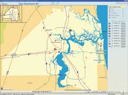
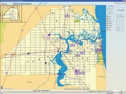
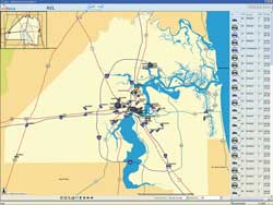
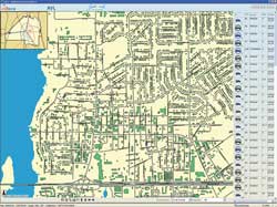
The JAXGIS executive Map Board system is a rapidly growing program of online mapping applications. In addition to the CARE Solid Waste Complaints Status Dashboard, the program includes the Debris Dashboard. This application tracks the full life cycle of debris collection and post-hurricane cleanup. As part of Jacksonville's overall hurricane preparedness and recovery efforts, it helps the city comply with Federal Emergency Management Agency (FEMA) regulations by ensuring the appropriate tracking of debris collection. The program maximizes the city's opportunities and eligibility for FEMA reimbursement funds. The Auto Vehicle Locator (AVL) Dashboard lets fleet managers track mobile assets throughout the county and monitor vehicles' locations, speed, and routes. By looking at the map, managers can tell when the vehicle is off or on, which street sweepers' brooms are up or down, which trash truck compactors are activated, or when fuel trucks' pumps are engaged. Program administrators report that the AVL Dash Board is improving the efficiency of vehicle resource allocation, helping with vehicle maintenance scheduling, and giving them the information necessary for optimizing service routes. JAXGIS provides the City of Jacksonville and Duval County with additional ArcIMS-powered dashboards for monitoring mosquito control, animal management, incident reporting, and tracking the loss of library books caused by storm damage. Making a Connection with ResidentsOver the last two years, JAXGIS has developed a series of public-facing ArcIMS Web sites that connect Duval County residents to their local government. My Neighborhood, one of the most popular sites, allows visitors to find a parcel by searching on a house number or property owner's last name and generates a detailed map and a comprehensive list of neighborhood amenities such as solid waste pickup schedules, contact information for the nearest schools, libraries and parks, and links to local representatives from the city council to Congress. Dozens of GIS layers, ranging from hospitals to voting precincts to two-foot aerial imagery, can be added to the map.
The public response has been overwhelmingly positive. "When we have people telling us, the mayor, and other government administrators that My Neighborhood is a good site, it makes a difference that cannot always be measured in dollars and cents," said Chakhtoura. "Add to that the fact that the tourist industry in town relies heavily on our Web site, and tax preparers, real estate agents, and other professionals are making use of it, too. The return on investment translates into improved service to the community we serve." JAXGIS maintains additional public-facing sites that work similarly. Each has a specific focus. The Duval Maps site provides public information about properties and streets in Duval County. Visitors can find and view parcels in relation to land use, zoning, council districts, airport noise zones, and evacuation routes. All administered permits based on street, parcel, permit number, or area of interest can be found using the Permits and Inspection site. The Crime Statistics site supplies a breakdown of crimes by time period within a half mile of a selected address or location chosen interactively from a map. People can find out about street closures and alternative routes at the Event Traffic site. The Downtown Jacksonville site identifies buildings and landmarks in the downtown area. Information on Duval County schools and services is available at the Asset Mapping site. New JAXGIS users can watch an online orientation video that describes the site's tools and how to use them. Customer SatisfactionBecause all JAXGIS applications were developed in-house, the cost has been minimized. In 2006, the local government invested in high-resolution digital aerial photography of the city and surrounding areas with the express purpose of extracting numerous GIS data layers such as edge of pavement, building footprints, driveways, parking lots, sidewalks, pools, management ponds, and fences. When department managers saw the quality and quantity of vector data being produced and realized it could be queried and manipulated using GIS, they began asking how they could take advantage of the GIS database and how they could use it to automate processes. As a result, more dashboard-like applications are being developed. JAXGIS has responded to this increased demand for online mapping applications with a traditional application development process. When developing a new application, the team uses comparisons, metrics, and benchmarks. These findings are presented to the management team. An initial needs assessment ensures that customer requirements for the application are understood. The assessment determines if the project will repackage existing information and/or blend capabilities from existing applications in a different way or if it will require creating something completely new. The JAXGIS team takes the project through a development period, meeting regularly with the requesting department to discuss and demonstrate the prototype. After implementation on a testing server, the new application is vigorously tested using real data and scenarios. When it can perform to specifications, it is deployed on the production server. This comprehensive approach has received a very positive response. For more information about JAXGIS, go to maps.coj.net. |


