ArcUser Online
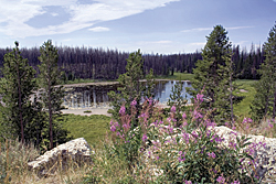
This article as a PDF . A program developed by an Idaho school district encourages students to use GIS skills to solve real-world problems. Teachers in the Shelley School District have been using GIS technology for a decade. The Solutions program developed by the district exposes students to new technologies and skills that are valuable in the problem-solving process. Shelley School District is located about 20 miles from the Idaho National Laboratory (INL), a national science laboratory. The district's teachers were first introduced to GIS technology at INL, and GIS was a natural fit for the Solutions program. Some of the GIS projects students have worked on over the years include using current census data to redistrict the school board zones, creating maps for the City of Shelley showing fire hydrant locations, and mapping noxious weeds for county and state weed agencies. Teachers like to involve students in both short-term projects and longer-term projects. Short-term projects help students gain an initial sense of accomplishment, which instills the confidence that will be required for longer-term projects. Long-term projects generally require higher skill levels but can be rewarding for students who persevere. As successful as these GIS projects have been, teachers were concerned that too many students were passing up opportunities to work with GIS projects, and many students involved in GIS projects were learning advanced computer skills but lacked basic map-reading skills. As a result, the program was restructured. Students are now introduced to mapmaking/map-reading skills at a younger age. For example, students learn how to make simple compasses, how to make maps, how to read topographic maps, and how to use GPS technology in geocaching activities. This introduction exposes more students to GIS and helps them pick up basic skills. One project, Holding the Line, is a capstone effort that exemplifies the aspirations teachers have for effectively incorporating GIS in the classroom. This project addressed the slow spread of noxious weeds toward Yellowstone National Park. Current weed control measures had not been effective in preventing the spread of one weed in particular: leafy spurge (Euphorbia esula). A consortium of government agencies, weed control entities, watershed organizations, and interested citizens banded together to stop the spread of leafy spurge to Yellowstone Park.
Rebecca Schneiderhan, who has since graduated and has her own GIS consulting business, was contracted to oversee the distribution of four million beetles as part of a biological control effort started more than 10 years ago. The beetles are effective in controlling leafy spurge but harmless to native flora and fauna. They are released at marked sites that have been studied for years to determine how effective the beetles are in controlling spurge. Schneiderhan was tasked with collecting two million beetles from previous release sites, purchasing two million additional beetles, then releasing all four million beetles in areas adjacent to the Yellowstone Park boundaries. The beetles were successfully collected, and released at target sites, and those sites were mapped. Much of the beetle collecting and mapping was done using the services of Paul Muirbrook, an individual who established a business that hires high school students and high school graduates to perform various GIS/GPS tasks for local government agencies. Schneiderhan was also assisted by a second grade student who helped collect beetles and map the sites. These sites will be monitored for the next five years to determine the effectiveness of the effort in preventing the spread of leafy spurge. This project is considered a capstone project for Shelley District's GIS efforts because it provides opportunities to help solve real-world problems and helps students of all ages develop multiple skills. For example, students involved in this project learned about plants (weeds), insects, Yellowstone Park, government agency interactions, and how GPS and GIS technologies can be used. It also provided employment opportunities for both entrepreneurs and summer hires and helped build partnerships between government agencies and schools. In summary, Shelley School District's efforts to expose students to GIS/GPS technologies have evolved over the years. The district's teachers now attempt to introduce students to mapmaking fundamentals at an early age and seek projects that involve solving real-world problems, encouraging students to use their skills in the solutions of those problems. |