April - June 2006
April - June 2006 |
||||||||
|
|
||||||||
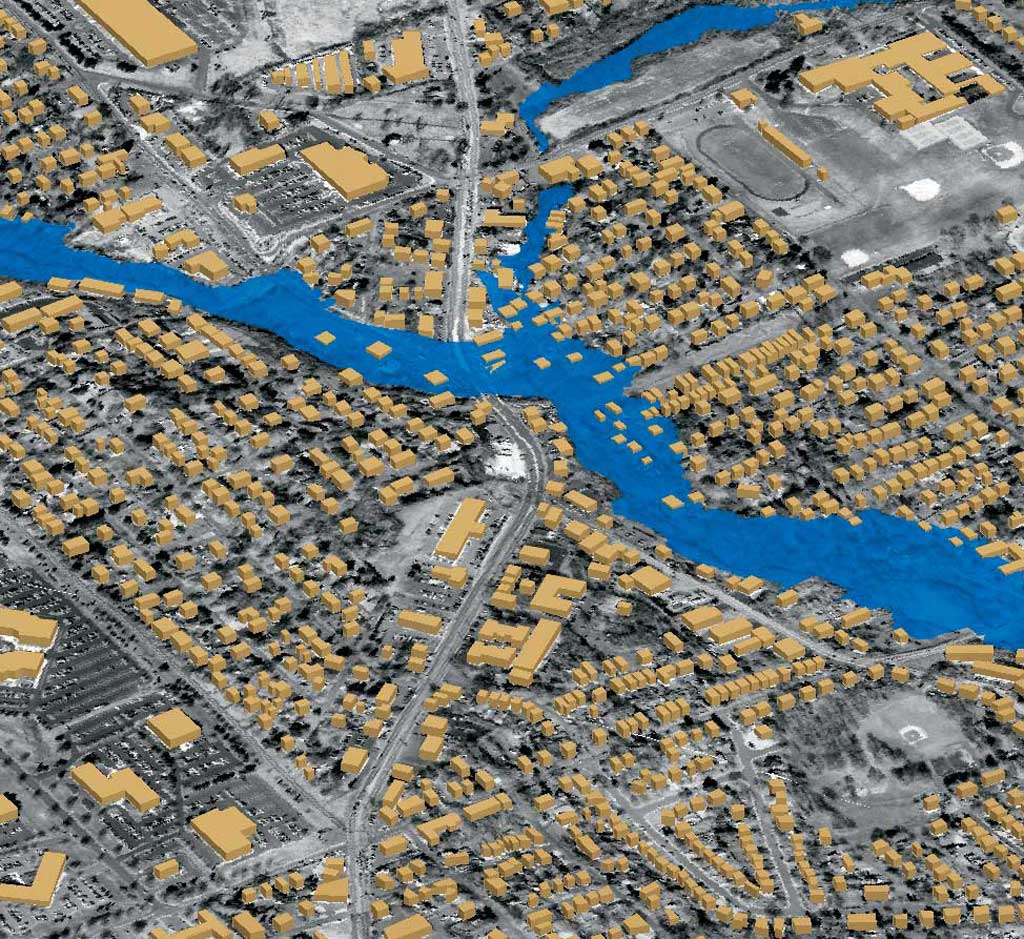
Map visualization is often considered as important as the map content. In community planning, a GIS map is typically used to model reality. While good analysis is important and data quality is a key factor, the most critical matter is the method of communication. When GIS information is presented using appropriate visualization techniques, it can stimulate public participation. A three-dimensional GIS simulation always communicates more effectively than two-dimensional. Imagine being able to experience a proposed development project by walking, driving, or even flying over it, regardless of time and season, while the project is still in its conceptual stage. With the GIS visualization tools in ArcGIS 9, local and regional planning agencies and development organizations can create simulations that foster public participation. GIS Visualization in Three DimensionsThe three-dimensional GIS has some key visualization components: three-dimensional maps, three-dimensional digital models, three-dimensional physical models, virtual reality, and simulation. The topics of three-dimensional visualization with digital photogrammetry or Lidar will not be included in this discussion.
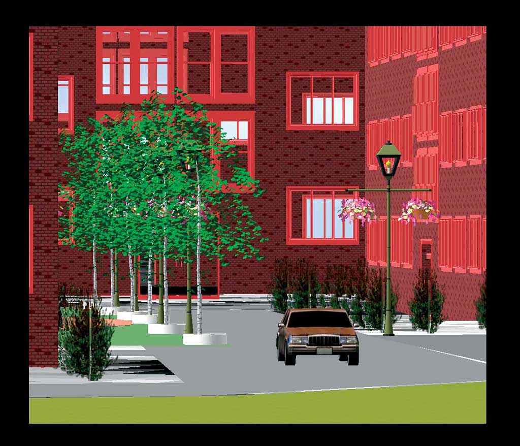
For planning sessions that include public participation, three-dimensional GIS maps are generated in ArcScene or ArcGlobe. These two applications translate complex three-dimensional spatial data into a visual, nontechnical language. Such maps may use orthophotographs and terrain data (i.e., digital elevation models, triangulated irregular networks, or contours) for modeling the base. Parcel and zoning data and data on man-made or natural features are used for modeling existing scenarios. CAD and other drawings of proposed construction are used for modeling future scenarios. With a three-dimensional digital model, the viewer can almost experience a proposed structure or site plan before it is built. GIS is an excellent application for three-dimensional color printing using a three-dimensional printer with rapid prototyping technology. This technology constructs a physical model from the base up, layer by layer. These physical models, created from three-dimensional GIS or CAD data, can display more information than a flat screen image or paper printout and allow people to communicate clearly and reach consensus on an idea more efficiently. With virtual reality, the viewer is projected into a computer-generated three-dimensional space that creates the illusion of reality. Virtual reality can be applied to two types of simulations—real environments, such as the interior of a building or a streetscape, and imagined environments that can incorporate proposed development changes. Representing GIS data in three-dimensional virtual reality helps the public, local planners, and elected officials understand the existing situation and the impact of any proposed projects. Three-Dimensional Digital Models
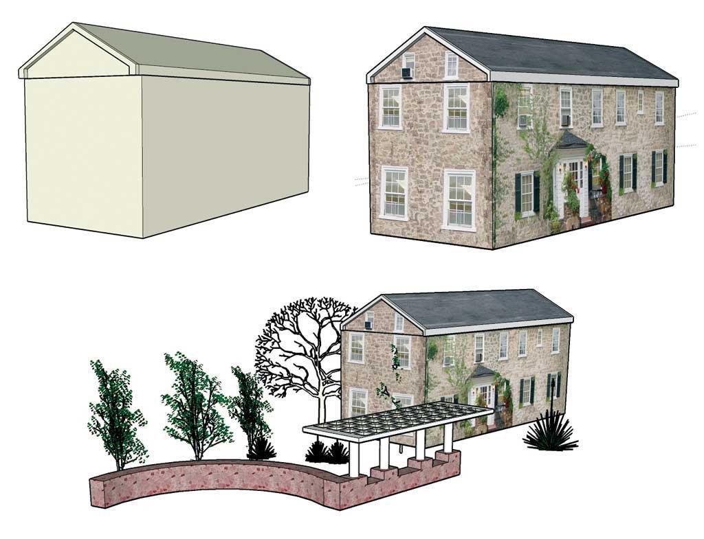
The ArcGIS 9 3D Analyst extension lets the user quickly and schematically visualize a three-dimensional scene by extruding the point, line, and polygon features from the base terrain. Three-dimensional digital models are the best option for visualizing a three-dimensional scene more realistically. Three-dimensional digital models represent real-world objects using z-values stored in the model's geometry. Buildings, people, trees, street furniture, and paved and natural surfaces are some of the three-dimensional digital models commonly used in urban development projects. The ArcGIS 9 3D Analyst extension comes with a free three-dimensional digital model library with more than 500 real-world symbols that can be easily used to simulate a three-dimensional digital model scene. These models might not represent the actual buildings or other objects of a real neighborhood, but they definitely help in simulating a conceptual three-dimensional digital model-built environment. Similar ready-made models are also available from some third-party software libraries or a number of online resources such as www.amazing3d.com, www.3dcafe.com, www.3dlinks.com, and www.multigen.com. However, if the user wants to simulate an exact representation of the reality or visualize a proposed development using actual drawings, it is better to create the custom three-dimensional models in a non-GIS platform and then bring them back in an ArcGIS environment. Creating Custom 3D ModelsSome software for building three-dimensional digital models are Google's SketchUp; Graphisoft's ArchiCAD; Artifice's DesignWorkshop; AutoCAD; Autodesk's 3ds Max, Map 3D, and Maya; Softimage; Visual Nature Studio; and Esri business partner MultiGen-Paradigm's ModelBuilder 3D. With so many options for creating three-dimensional digital models, the ArcGIS user needs to carefully choose a compatible product. ArcGIS can work with three-dimensional digital models that have been created in MultiGen-Paradigm's OpenFight (.flt), SketchUp (.skp), 3D Studio (.3ds), or Morfit's 3D WorldBuilder (.wrl) format. Continued on page 2 |