Building the Next Generation of Internet GIS
by John Auble, Geographic Data Technology, Inc.

| Building the Next Generation of Internet GIS by John Auble, Geographic Data Technology, Inc. | |
|
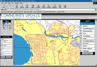
Editor's Note: The Community Update program is a public/private partnership for maintaining and distributing street centerline data. Local and regional governments use an Internet-based system to send information to a central server where it is validated, cross-referenced, and integrated with other data, then returned to the server for downloading. When it was launched by Geographic Data Technology, Inc. (GDT), and Esri, the Internet-based Community Update program faced two exciting challenges. The first was integrating GDT's own tools with those from Esri and Safe Software, Inc., to construct a comprehensive system for data management. The second was working with a growing community of local governments across the nation to cooperatively develop and distribute street data.
Because communication with the Community Update application is bidirectional, it differs from the growing list of Internet map servers. Although GDT started with a strong Esri-based solution, it was necessary to integrate a suite of additional tools to deal with the complexity of this type of information management. Partnering with GovernmentAs a nationwide program, Community Update must be prepared to partner with any local government, regardless of its geography. The core of the Community Update server is an ArcSDE database that continuously serves the 13 GIS data layers that make up a nationwide tile of approximately 20 gigabytes. An additional benefit of ArcSDE has been the ability to develop a transactional update model, allowing GDT to refresh street centerline data each month by processing only changes rather than the entire data set. While ArcSDE provided an excellent solution for the Community Update server, GDT still needed to address the end user requirements of government partners. Having access to GIS data doesn't necessarily mean the data is immediately usable. To overcome this hurdle, GDT used Safe Software's SpatialDirect solution that lets Community Update partners specify four parameters--geographic extent, data layers, GIS format, and map projection--to produce plug-and-play data. The final off-the-shelf component, ArcIMS, provided additional flexibility by allowing Community Update to deploy three types of mapping sessions. These sessions differ in the data served and the choices that the user has in interacting with that data. This flexibility has been especially important given the large size of the Community Update database and the need to serve the data efficiently. The system described so far resembles a relatively standard Internet map server. The real test has been the integration of this standard functionality with custom tools developed for more comprehensive data management. These tools were needed to track and report Community Update server activity and capture data flow from partners to GDT. Monitoring Community Update server activity was accomplished through a back-office solution that uses Structured Query Language (SQL) databases and management tools that interface with the off-the-shelf components. GDT has successfully developed an Internet map server that is able to differentiate between users so that an essentially unique application is delivered to each government partner. As part of the program, partners have dedicated sections of the server that can be used to build and manage their own user group and assign different downloading and editing privileges to many users. Three Data Editing ChoicesTo capture data flow from government partners, GDT integrated solutions from several sources and offered governmental partners three methods for submitting data. Each method requires that the user access information managed in the back-office system. The simplest method of data submission is direct transfer. In the second method, users edit data previously downloaded from the Community Update server, upload it back to the Community Update server, and GDT uses Safe Software's SpatialDirect utility to directly compare the pre- and post-edited versions. The third method is through a "live" editing session using ArcIMS. Live editing is truly at the cutting edge of Internet-based GIS. And while many communities may not be ready for wholesale adoption of live, Internet-based editing, the same could have been said about central data storage and spatial analysis just a few years ago. As with any evolutionary technology, tools for migrating traditional desktop activities to the Internet must improve. This means that a core group of innovators must work with and improve first generation tools. The Community Update program is using ArcIMS as the foundation for developing a suite of Internet editing tools. GDT and Esri will continue to work together to develop Internet-based GIS. GDT's experience in developing the Community Update server makes it clear that the GIS industry is committed to improving the tools that enable Internet GIS. The data development part of this equation has benefited both from off-the-shelf solutions currently available through companies such as Esri and Safe Software as well as the commitment to interoperability by the entire industry. It is this latter characteristic that has allowed GDT to move beyond traditional Internet map servers and produce working prototypes of what the future may hold for Internet GIS and cooperative data development. John Auble |