ArcUser Online
 

July - September 2003
Search ArcUser:
 
ArcUser Main Current Issue Previous Issues Subscribe Advertise Submit An Article
 

Persistence and Technology Save Hiker
Continued...

More than half the teams had GPS receivers. Garmin was the most common brand so Elenburg and Murphy converted the data to a polyline or polygon using the DNR Garmin extension. Screen digitizing was employed to input the areas covered by the teams without GPS receivers who documented their progress on paper maps. ArcPad, which produces an instant shapefile literally on the fly, was used on handheld PDAs to map some of the reconnaissance flights and ground search assignments.

Each day, Tom Patterson, the park's fire management officer, inputted data into ArcView from the teams as they completed their assignments. Data entry was performed in the front seat of Patterson's four-wheel- drive command vehicle, which is equipped with a small inkjet printer for mapping wildland fires and can print letter-sized color maps. As a result of these efforts, shortly after dark each day, a permanent record of the areas that had been covered during that operational period was available. Incident managers could instantly tell which segments were searched adequately and which needed to be revisited the next day.

On the fifth day of the search, the Riverside Mountain Rescue Unit (RMRU) team made up of Kirk Cloyd, Jeri Sanchez, and Will Carlson found Matsumoto alive. The RMRU team discovered after they had been dropped off by helicopter that the wrong GPS coordinates had been entered for their intended destination and they were in the wrong search sector. Rather than recall the helicopter, they set out cross-country to their assigned area.

the Wonderland of Rocks
Marvin Matsumoto was lost in an area of Joshua Tree National Park called the Wonderland of Rocks. The 20-square-mile maze of boulders can confuse even an experienced hiker.

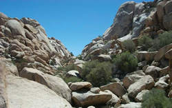
While traveling to the correct search sector, the team encountered extremely difficult terrain. Sanchez, doubting whether "any 60-year-old man in his right mind would be here," shouted out Marvin's name just to prove it. When Matsumoto feebly responded, all three team members stood with bulging eyes in silent disbelief.

Matsumoto was found at 2:20 p.m. in a location approximately 2.5 miles north of where he was last seen. He had fallen into a space between boulders and was not visible from the air. His recollections of how he got there were limited but, after hearing the helicopters searching overhead, he believed that he would eventually be found.

The GPS coordinates for the location were relayed by searchers, and a hoist-equipped helicopter was sent to airlift Matsumoto to the Desert Regional Medical Center where he was treated for a brain concussion, fractures to his back and lower right leg, hypothermia, severe dehydration, and numerous cuts and contusions. He was released from the hospital after a week of corrective surgery, and he is expected to fully recover.

There are many lessons to be learned from the Matsumoto search. One of them might be, "If you enter the wrong coordinates, you will go to the wrong location and just might find the right subject!"

photo of rescuers
Jeri Sanchez, Will Carlson, and Kirk Cloyd of the Riverside Mountain Rescue Unit found Matsumoto on the fifth day of the search in a remote and rugged area of the park.

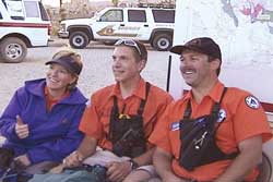
GIS was instrumental in coordinating the efforts of the more than 80 people from the National Park Service, the San Bernardino County Sheriff's Office, the Riverside County Sheriff's Office, the Bureau of Land Management, Joshua Tree Search and Rescue, Morongo Basin Search and Rescue, Sierra Madre Search and Rescue, and the Riverside Mountain Rescue Unit who participated in the search as well as the logistical support that was provided by the local Citizens Patrol, the Marine Air Ground Task Force Training Command, park rangers from Death Valley National Park, and numerous other volunteers.

For more information on GIS use by fire and search and rescue personnel, contact

Russ Johnson
Esri Public Safety Solutions Manager
E-mail: russ_johnson@esri.com
Tel.: 909-793-2853, ext. 1-1836

Contact Us | Privacy | Legal | Site Map