From Deficient to Efficient
Many benefits flow from water district's GIS
By Trey Lyon, Spatial Data Integrations, Inc., and Daniel Clifford, Hardin County Water District No. 1
Summary
Current, accurate maps are critical to water district operations not only for maintaining infrastructure and providing decision support but also ensuring compliance with government regulations. GIS provides a comprehensive asset inventory and accurate mapping for utilities that can increase operational efficiency and enhance customer service.
A water district in rural Kentucky began implementing GIS eight years ago. After success with its initial system, the district expanded and upgraded its GIS to better serve the organization's more extensive infrastructure and complex operations.
Now and Then
Hardin County Water District No. 1 (HCWD 1 1) was formed on July 15, 1952, to serve the needs of northern Hardin County, Kentucky. Over its 50-year history, HCWD 1 has grown from serving 125  water taps to more than 10,000 in Northwest Hardin County including the city of Radcliff. On July 1, 2005, HCWD 1 took over operation of the Fort Knox Sewer and Stormwater Systems. Today, HCWD 1 maintains 33 employees, 268 miles of water main, approximately 90 miles of wastewater mains, and 39 miles of stormwater mains. HCWD 1 also supplies wholesale water to the City of Vine Grove, Meade County Water District, City of Hardinsburg, and Hardin County Water District No. 2. water taps to more than 10,000 in Northwest Hardin County including the city of Radcliff. On July 1, 2005, HCWD 1 took over operation of the Fort Knox Sewer and Stormwater Systems. Today, HCWD 1 maintains 33 employees, 268 miles of water main, approximately 90 miles of wastewater mains, and 39 miles of stormwater mains. HCWD 1 also supplies wholesale water to the City of Vine Grove, Meade County Water District, City of Hardinsburg, and Hardin County Water District No. 2.
Before GIS Implementation
Six years ago, HCWD 1 was just like many other small-to-medium-sized water utilities across the United States. It did not have current, accurate maps of its system. For three consecutive years, the Kentucky Public Service Commission (PSC) issued deficiency notices to HCWD 1 because it did not comply with mapping requirements of Title 807 of the Kentucky Administrative Regulations (KAR), specifically PSC 807 KAR 5:006. It was also out of compliance with requirements established by the Kentucky Division of Water, but it was not cited since annual inspections were not completed.
HCWD 1's as-built drawings were severely inadequate. The district had only two paper blueprint copies of the overall system. The as-built drawings that did exist were old, tattered, and illegible. Many of them were preliminary drawings because HCWD 1, at that time, did not require developers to provide final or completed drawings. The original Mylar drawings were missing or kept by the previous engineering firms and were not available for reproduction. As with many systems its size, HCWD 1 relied heavily on its employees' memories for infrastructure locations and information. Inevitably, these employees began to leave the utility and took their knowledge with them.
Phase 1: Initial Data Collection and Processing
In June 2000, HCWD 1 presented these problems to its Board of Commissioners and recommended acquiring the services of Spatial Data Integrations, Inc. (SDI), a geospatial firm and Esri business partner based in Louisville, Kentucky, to assist in the development and implementation of a GIS that could be used by all utility personnel. This would provide HCWD 1 with a comprehensive inventory and accurate map of its system for the first time.
SDI provided HCWD 1 with a variety of services including hardware and software. Initially, HCWD 1 purchased
- Two Corvallis MicroTechnology (CMT) Alto-G12 submeter GPS units
- One editor's license of WaterWorks/FM, SDI's ArcView 3.2 water utility extension
- Basemaps that included 1-meter digital orthophoto quarter quadrangles (DOQQs) that were seamlessly integrated with 1-foot aerial photography from the City of Radcliff, digital raster graphics (DRGs), digital elevation models (DEMs), and hillshading
- GPS and GIS training
To minimize costs, it was agreed that HCWD 1 personnel would complete some tasks such as GPS data collection. To facilitate this work, SDI created a map grid of the district service area that helped organize the GPS collection process. HCWD 1 personnel collected actual field locations and attributes for each feature in the service area. The raw data was forwarded to SDI for postprocessing and integration with the master shapefiles. The processed data was imported into WaterWorks/FM.
HCWD 1 personnel digitized water mains for the available features and passed this information back to SDI. With this data, SDI developed a series of tools that automatically created service lines and taps for each water meter and ensured that each feature was appropriately snapped to the nearest water main. HCWD 1 personnel performed a final quality control (QC) on the data and verified that all the service lines generated were connected to appropriate water mains where multiple mains were present. This process was repeated several times during the year until the collection process was complete.
Phase 2: Upgrading the System and Its GIS
Since the initial phase, HCWD 1 has upgraded and expanded not only the physical infrastructure but also the hardware and software used in the original GIS implementation. SDI migrated HCWD 1 from ArcView 3.2 and its WaterWorks/FM extension to ArcGIS 9.2 and SDImaps, the SDI utility extension, and a 9.2-compliant geodatabase. The original Alto-G12 GPS units were replaced with smaller, more accurate Trimble GeoXH subfoot GPS units running ArcPad software. This migration included updating the positional information of historic data collected during the original GIS implementation.
At about the same time, HCWD 1 selected SDI to assist with the development and implementation of a wastewater and stormwater GIS for the Fort Knox Sewer and Stormwater System. The district acquired the system and HCWD 1 was contractually responsible for initial capital improvement projects, asset management and replacement tasks, and daily operations. A portion of the asset management and replacement tasks required the creation of a GIS map for the entire sanitary and storm system. The district had six months to accomplish this task to meet the federal Spatial Data Standard for Facilities, Infrastructure, and Environment (SDSFIE) standards. [SDSFIE implements Federal Geographic Data Committee (FGDC) standards and adheres to Executive Order 12906, which requires federal agencies to collect "geospatial data�in a manner that meets all relevant standards."]
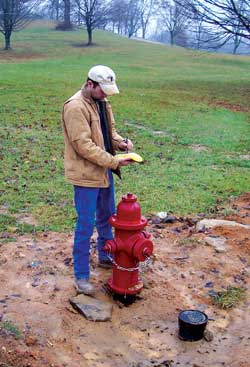 |
| HCWD 1 personnel collected actual field locations and attributes for each feature in the service area. |
The first task SDI and HCWD 1 personnel undertook was a complete inventory of existing geospatial information including paper maps and digital data supplied by HCWD 1 to the Department of Defense (DoD) that had not been sourced or verified. Several GIS/CAD files were located that included sewer/stormwater manholes, lift stations, sewer/stormwater mains, and 1.5-foot elevation contours. This investigation quickly revealed that the origin and quality of this data was unknown and existing paper maps were incomplete and outdated.
Based on these findings, SDI recommended a GPS sampling of the wastewater and stormwater features that were shown in the existing documentation. A sampling of 300 features was taken to determine the accuracy of the existing geospatial data. This sampling showed an average error of 30 to 150 feet between the submeter GPS data collected and the original geospatial data. In response to this information, HCWD 1 authorized SDI to re-collect the entire wastewater and stormwater system. SDI collected a total of 2,249 wastewater and 4,937 stormwater features, exceeding the original estimates of 200 wastewater and 1,000 stormwater features. The main reason for this discrepancy was the amount and quality of data initially supplied to HCWD 1 by the DoD.
SDI collected, differentially corrected, and incorporated the GPS data into the utility geodatabase. Heads-up digitizing (HUD) was then performed on all the wastewater and stormwater mains. HCWD 1 had contracted MetroplexCore, a Houston-based engineering firm, to complete manhole and sanitary sewer main inspections. Consequently, SDI collected only the manhole identification numbers while in the field, and MetroplexCore supplied SDI with all attribute information in Microsoft Excel spreadsheets along with still and video photography of each location. SDI developed a process that automatically performed quality control on the data received from MetroplexCore, copied it into the geodatabase, and created associated hyperlinks.
In addition to the GPS collection and data attribution, SDI accomplished several data projects and developed tools to streamline HCWD 1's operations. SDI converted the original 1.5-foot elevation contour line drawing to a high-resolution DEM to facilitate future modeling activities and integrated the HCWD 1 asset management system (OPS Job Plus) with its GIS. SDI developed tools that
- Automatically calculate the amount of average drop per 100 feet of wastewater and stormwater mains
- Automatically delineate the wastewater flow areas
- Automatically give each main segment a unique identifier based on upstream and downstream manhole IDs
- Export utility data to an SDSFIE-compliant database
After GIS Implementation
These solutions have allowed HCWD 1 to effectively utilize an accurate and complete system map of all its critical infrastructure locations. The functionality in SDImaps and ArcView 9.2 has helped HCWD 1 remain in compliance with state regulations. HCWD 1's system exemplifies how GIS can help rural utilities run daily operations more effectively. HCWD 1 now routinely uses GIS to increase operations and maintenance efficiency, prioritize rehabilitation efforts, plan for future capital projects, and increase customer satisfaction.
The following projects illustrate how effectively GIS has aided HCWD 1:
- The Insurance Services Office (ISO) was able to change the rating for the City of Radcliff using information supplied by HCWD 1. By buffering all fire hydrants, HCWD 1 demonstrated complete coverage for all structures within city limits.
- HCWD 1 is currently migrating to an automatic meter reading (AMR) system for mobile radio meter reading. Existing GPS data that had been collected for each water meter location was inputted into the AMR software.
- The site for the first elevated glass-lined water storage tank in Kentucky was selected by HCWD 1 personnel. Using GIS to perform analysis, HCWD 1 selected a site with the elevation needed to maintain required pressures, that was located in proximity to areas needing service, and was assessable to the utility.
- By migrating its customer consumption information from the customer information system to the district's GIS, HCWD 1 created an updated hydrological model using real-world data and used this information to complete its Stage 2 Disinfectants and Disinfection Byproducts Rule (DBPR) Initial Distribution System Evaluation (IDSE), a survey required by the United States Environmental Protection Agency (EPA). HCWD 1 became the first utility in Kentucky to complete IDSE using only GIS data.
In 2002, the Kentucky/Tennessee Chapter of the American Water Works Association presented HCWD 1 with the 2002 Public Information Award in Division B for Internal Relations using GIS Mapping.
For more information on HCWD 1 GIS implementation, contact
Trey Lyon
Business Development Manager
Spatial Data Integrations, Inc.
Tel.: 502-213-0981
E-mail: tlyon@sdimaps.com
or
Daniel Clifford
GIS/Planning Specialist
Hardin County Water District No. 1
Tel.: 270-352-4280
E-mail: dclifford@HCWD 1.com
About the Authors
Trey Lyon is the business development manager for the full-service GIS firm Spatial Data Integrations, Inc. Prior to his employment at SDI, Lyon worked at the Center for Water Resource Studies while obtaining a bachelor's degree in computer information systems from Western Kentucky University. The center helps small rural utilities meet Safe Drinking Water Act and Clean Water Act requirements. While at the center, he was involved in numerous projects helping rural utilities benefit from GIS solutions.
Daniel Clifford, the GIS/planning specialist at Hardin County Water District No. 1, has been employed with the utility for 16 years. He currently creates and maintains GIS data for water, wastewater, and stormwater for a service area covering 145 square miles. Clifford actively works with other local utilities and agencies to create, update, and share GIS data and initiate new GIS projects with rural water utilities. His other duties include the design and review of system improvements and modifications. He holds an IVD Certification for water treatment plant operators with the Division of Water in the state of Kentucky.
|