Telecommunications
Data Model Available

| Telecommunications | |
|
The geodatabase, the foundation of ArcGIS, lets users create common data models for specific industries. These data models provide a nonproprietary framework for modeling and capturing the behavior of real-world objects. Once established, data models give users quick-start solutions that optimize performance and establish industry standards thus improve data sharing. Data models can also help make information about successful GIS implementations more accessible to average organizations with limited budgets. By creating consistency, these models can improve communication and generate synergy between similar systems. In the long term, data models can encourage better decision-making based on available geographic information. Instead of establishing formal standards, the goal in defining data models is to benefit people working on real GIS projects while supporting existing standards. Esri is working to establish data models for more than a dozen industries. A consortium made up of users and business partners in each industry, interacting with developers at Esri, define the scope and content of each model. This interaction results in a draft data model. This draft model is a first pass at the problem intended as an implementation starting point for people working on projects.
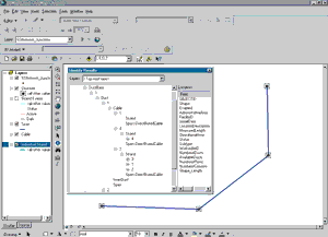
Just prior to the 2001 Esri International User Conference, the telecommunications data model was released. This first iteration of the model includes both fiber and copper networks. The model describes relationships between the most dominant network components. The telecommunications data model will be expanded to depict point-to-multipoint networks as well as continuous wireless networks using Code-Division Multiple Access (CDMA), Global System for Mobile communications (GSM), and Time Division Multiple Access (TDMA) technologies. The complexity of telecommunications networks prevents Esri from providing a complete, ready-to-use model. The draft model allows users to create an overview of a network for a given area that provides high-level connectivity information and is a starting point for further development. A complete set of telecommunications objects would only be implemented for a specialized GIS application such as Network Engineer, a product developed by Telcordia, an Esri business partner. To download the analysis model, data model diagram, sample data, and UML model for the telecommunications data model, visit support.esri.com/datamodels. |