Largest Conference Builds GIS Community

| Largest Conference Builds GIS Community | |
|
THE 21st ANNUAL Esri INTERNATIONAL USER CONFERENCE, with 11,000 attendees from 110 countries, was not only the largest meeting of the GIS community but also the most international and interdisciplinary. With the expansion of the San Diego Convention Center, this year's conference could accommodate more paper presentations, more technical workshops, and more trade show exhibitors than ever before. Users from 13 regional groups, as well as numerous special interest groups, met during the conference. Familiar and popular conference events—the Map Gallery, GIS Education Fair, Esri Showcase, user demo area, and Software Applications Fair-were well attended. There were also special exhibits on the Hindu–Kush Himalayan Region, the Thailand Recompilation Program, The District television show, GIS in the Defense Industry, and GIS in Public Safety and Law Enforcement. Many fun activities-tennis and ping-pong tournaments, a 5K Run/Walk, GIS Kids Camp, Family Night, and a Chinese New Year's celebration-were also part of the program.
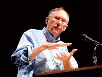
During the plenary session Jack Dangermond, Esri's founder and president, welcomed conference goers to a week crammed full of experiences and work. "You are special people—not just the normal set. Some of you are the people who invented it [GIS]," he said. In keeping with the conference theme, "Geography—Creating Communities," Dangermond urged the attendees to get away from their virtual lives and grow as a face-to-face community at the conference. His address focused on the importance of geography in creating communities and how GIS is the framework for those communities. "Bringing things together—this is the essence of the tool," he said. He recited a long list of organizations that are using GIS to address the world's problems. He predicted that, as GIS becomes more standards-based and integrated with the IT infrastructure, it will become even more pervasive.
This trend will be enhanced by a new vision of GIS on the Internet called g.net. This new multi-participant, scalable, and collaborative architecture was debuted by Dangermond. Organizations can share and directly use GIS information from many distributed sources at the same time. Using Internet protocols, g.net makes use of a metadata portal and a network that serves information about the types of data and resources available. The technologies that make up g.net can be used by local, state, or regional governments to create custom g.nets that support unique and identifiable communities. After Dangermond addressed the conference, David Maguire, Esri's director of software products, and other senior Esri staff members demonstrated the functionality in new releases of existing products as well as introduced new products. They provided insight into emerging trends in GIS technology. Esri has been very active in building open and interoperable technology that can support the creation and development of communities. ArcReader and ArcReader Publisher, introduced during the plenary session, will do just that by helping communities share geographic information. ArcReader Publisher, an extension to ArcGIS, will let GIS users author or publish GIS maps and services. A lightweight, free reader, ArcReader will let users view and interact with maps locally or over a network. ArcReader can also be packaged with data on a CD–ROM. These products complement the ArcGIS family. With the arrival of version 8.1, ArcGIS is a complete system with automation, data management, and spatial analysis that is integrated with the Internet and mobile devices and is a robust technology for creating communities. Next at the podium was keynote speaker J. Michael Fay who described his 15-month trek to document "the last wild place on earth." The Wildlife Conservation Society biologist is using GIS in his quest to preserve part of the natural community in central Africa. (See "Real Hero Gives Keynote Address" and "Visualizing Megatransect Data" in this issue.)
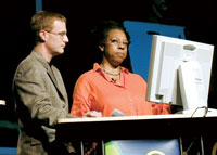
In addition to sharing information and creating community, the User Conference is an occasion for recognizing excellence in GIS. Several award presentations were made during the plenary session. Dr. Michael F. Goodchild, a leading GIS scholar, received the Lifetime Achievement in GIS award (see the accompanying article, "Dark, Wet, Muddy Places Led to GIS," in this issue). The International Centre for Integrated Mountain Development (ICIMOD) received the President's Award for promoting sustainable development in the Hindu Kush–Himalayan region through a GIS network. (See the accompanying article, "Sustainable Growth for Mountain Region," in this issue.) Lynne Thigpen accepted the Making a Difference award for The District , a dramatic television series. Craig T. Nelson, a lead actor in the series, and CBS Television were also included in the award. In the series, Thipgen portrays Ella Farmer, director of crime analysis in the Washington, D.C., Metropolitan Police Department. In every episode Farmer uses ArcView 3.x and ArcGIS to map the locations of criminal activities such as murders, armed robberies, and drug arrests. From Tuesday through Thursday, attendees could choose among presentations organized into 40 different industry and interest categories; technical workshops on all types of Esri software for every level of user; panel discussions; special sessions; and regional and special interest user group meetings. At a ceremony held on Thursday, Special Achievement in GIS awards were given to 125 organizations from around the world for their outstanding use of GIS. At the same ceremony, the Distinguished Service in GIS award was given to Miklos Pinther and Jack Estes. Pinther, who served as a cartographer for the United Nations and the American Cartographic Society, was honored for his contributions to GIS and cartography. Dr. Jack Estes, who died on March 9, 2001, was a professor of geography at the University of California, Santa Barbara, and the director of the university's Geography Remote Sensing Research Unit. He made many contributions to fundamental and applied research especially in the area of integrating remote sensing and GIS. The conference festivities culminated with a Chinese New Year's celebration hosted by Esri and held along the harbor waterfront on Thursday evening. GRIDLOCK, a band composed of Esri staff, and Geno DeLaFose and the French Rockin Boogie helped party goers usher in the "Year of the Snake." On Friday the closing session was followed by the Esri Golf Tournament, which was held at the Torrey Pines Golf Course in La Jolla. Next year's conference will be held July 8-12 at the San Diego Convention Center. |