Learning, Sharing, and Relaxing at EdUC
In its fifth year, the Esri Education User Conference (EdUC) attracted more than 500 educators, administrators, librarians, and other education professionals to San Diego, California, to gain information and inspiration.
The conference, held July 23-26, 2005, began with a keynote address by David Rumsey, founder of the David Rumsey Map Collection and coauthor of Cartographica Extraordinaire: The 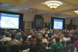 Historical Map Transformed. Rumsey acquired his extensive collection (more than 150,000 maps, atlases, and globes from the 18th and 19th century) over 20 years of collecting. Rumsey has created a Web site for his collection and developed innovative GIS tools that give site visitors new ways to interact with old maps. During his keynote presentation, he demonstrated new ways of seeing the maps in a dynamic, contextualized ArcGlobe display. Historical Map Transformed. Rumsey acquired his extensive collection (more than 150,000 maps, atlases, and globes from the 18th and 19th century) over 20 years of collecting. Rumsey has created a Web site for his collection and developed innovative GIS tools that give site visitors new ways to interact with old maps. During his keynote presentation, he demonstrated new ways of seeing the maps in a dynamic, contextualized ArcGlobe display.
The plenary session also gave attendees an overview of the new functionality available in ArcGIS 9.1 and introduced resources such as the 2005 Community Information for Education and the 2005 Sourcebook·America books that provide real-world data for classroom exercise.
The conference was a great venue for networking beginning with the EdUC EXPO and Welcome Reception held on the first day. At the EdUC Lounge, attendees could relax with refreshments or lunch and network with peers. The first Museum/Zoo/Botanic Garden Special Interest Group (SIG) meeting was held at the conference as was the inaugural meeting of the Community College User Group and meetings of the Library and Museums SIGs.
In addition to connecting with others involved in GIS education, attendees could learn about the latest developments in the field. Conference presentations demonstrated the use of GIS across school campuses from administration and planning to teaching. More than 100 presentations on topics that ranged from urban planning to coastal erosion to AIDS were organized into seven tracks. Sessions were designed to address the specific interests of teachers, administrators, researchers, librarians, and other education professionals.
For example, sessions in the GIS for Administration and Planning track showed how some schools and districts are using GIS to help understand demographic shifts and make better 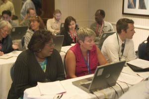 decisions regarding building allocation, facilities management, and bus routing. Presentations in the Community Projects and Partnerships track shared information on environmental and government-workforce partnerships and GIS projects conducted in cooperation with community groups or organizations such as 4-H clubs. From cataloging trees to mapping trails to analyzing local water use, students working with local GIS professionals can learn a tremendous amount while benefiting communities. decisions regarding building allocation, facilities management, and bus routing. Presentations in the Community Projects and Partnerships track shared information on environmental and government-workforce partnerships and GIS projects conducted in cooperation with community groups or organizations such as 4-H clubs. From cataloging trees to mapping trails to analyzing local water use, students working with local GIS professionals can learn a tremendous amount while benefiting communities.
A panel discussion was presented on the upcoming release of Learning to Think Spatially: GIS as a Support System in the K-12 Curriculum, a report on the importance of spatial thinking as a cognitive skill. Project coordinators and principal authors Dr. Roger M. Downs, head of the geography department at Pennsylvania State University and Anthony R. deSouza, director of the Board on Earth Sciences and Resources at the National Research Council, presented a synopsis of the multiyear project that recommends a dramatic increase in the attention to spatial thinking in K-12 education in the United States.
Computer lab sessions let attendees test drive the latest releases of many software products or learn more about GIS topics firsthand. As in previous years, these sessions were jammed.
The conference had a lighter side, too. The GeoTreasure Hunt, held on the first day of the conference, combined learning and fun. Participants received instruction on using GPS units and, with the help of 4-H student mentors, used the units to visit a succession of locations around the convention center and hotel and answer questions about those locations. Winners, selected on the basis of speed and accuracy, were eligible for prizes. Participants in another contest on the final day could vie for prizes such as poster-sized prints from the David Rumsey Collection and GIS books in a contest sponsored by the Friends of GIS Education (FOGE). Part scavenger hunt, part raffle, participants in the GeoAdventure Map Contest were issued a map of EXPO hall, collected stickers from FOGE vendors, and submitted the completed map for a chance in the drawing that evening.
In addition to the events specific to EdUC, conference attendees were admitted to the plenary session of the Esri International User Conference and could attend the Map Gallery reception, both held on July 25. That evening, representatives of college and university academic GIS programs participated in the Academic GIS Program Fair.
The conference ended on a high note with a report from Dr. Michael Fay, biologist and explorer, on his most recent project. Previously, Fay had described his 2,000-mile trek through the Congo and Gabon in his keynote address to the 2002 Esri International User Conference. At EdUC, he described a project that looked at the relationship between people and African ecosystems. Fay spent eight months crisscrossing Africa in an airplane, documenting the condition of ecosystems and capturing the conditions he observed in 100,000 photographs.
|