Learning and Sharing
At the Esri International User Conference
This article as a PDF .
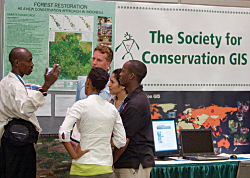
 For the 29th consecutive year, thousands gathered for the Annual Esri International User Conference (Esri UC), a weeklong event that supplied information, recognition, and inspiration for GIS professionals from more than 100 countries. For the 29th consecutive year, thousands gathered for the Annual Esri International User Conference (Esri UC), a weeklong event that supplied information, recognition, and inspiration for GIS professionals from more than 100 countries.
Held July 13�17, in San Diego, California, the Esri UC was the centerpoint of a constellation of industry-specific conferences: the Esri Education User Conference, 2009 Esri Survey & Engineering GIS Summit, Esri Remote Sensing and GIS 2009 conference, Homeland Security Summit, and 2009 Esri Business GIS Summit.

Information
During the Plenary Session on July 13 and throughout the week, attendees learned about current trends in GIS technology, plans for Esri software, best practices, and innovative applications of the technology.
The Next Big Thing: ArcGIS 9.4
The Plenary Session highlighted not only what GIS users have been doing in the last year but also previewed GIS technology and Esri software developments. This year, the dramatic improvements in usability, performance, and functionality that will be available with the upcoming release of ArcGIS 9.4 were in the spotlight. Improvements in editing, the integration of the Python scripting language, the availability of additional analysis tools, and the substantial 3D enhancements are just a few of the ways ArcGIS 9.4 will make GIS a lot easier.
ArcGIS 9.4 will make editing easier, not only for traditional GIS users who do compilation and editing but also for a whole new class of Web editors—users who collect data and share a common map.
Python, the open source scripting language that is evolving into a scientific programming language, will be integrated inside ArcGIS.
 ArcGIS 9.4 will extend the quantitative methods available with new spatial analysis tools such as fuzzy overlay modeling and an ecological sampling tool. Math/algebra integration and raster performance for analytic operations will greatly improve. Time will be integrated throughout ArcGIS with the ability to manage time-based data, animate temporal datasets, and publish and query temporal map services. ArcGIS 9.4 will extend the quantitative methods available with new spatial analysis tools such as fuzzy overlay modeling and an ecological sampling tool. Math/algebra integration and raster performance for analytic operations will greatly improve. Time will be integrated throughout ArcGIS with the ability to manage time-based data, animate temporal datasets, and publish and query temporal map services.
With this release, ArcGIS is a complete 3D GIS with a more powerful visualization environment for things like virtual cities and support for a complete 3D vector data model. It will support 3D editing, terrain editing, and the integration of real-time video.
GIS Day Every Day
During the plenary, Esri announced a new program to improve geographic knowledge at the grassroots level. The GeoMentoring program teams GIS professionals with educators at all levels in an ongoing, supportive relationship. What an individual GeoMentor does will depend on an educator's needs. (For more information on this program, see "Can You Do It?—The challenge to improve geographic awareness" on page 62 of this issue.)
Brevity Is a Virtue
Be brief and brilliant (and gone)—these were the instructions given to the participants of a new event at the User Conference—Lightning Talks. These five-minute informal talks demonstrated compelling Web or mobile applications that were delivered in the Map Gallery during the first evening of the conference. Topics ranged from an agricultural monitoring project in Iraq to a public safety application for first responders.
Recognition
The User Conference has always been an opportunity to highlight exceptional work and honor organizations and individuals for their contributions to the GIS industry.
 MapAction, a nonprofit, charitable organization based in the United Kingdom, and its founder, Andrew Douglas-Bate, received the first GIS Humanitarian Award. This award recognizes the role GIS is beginning to play in humanitarian relief activity. MapAction's volunteers remove land mines in areas of civil conflict such as Afghanistan, Pakistan, and Sri Lanka. MapAction, a nonprofit, charitable organization based in the United Kingdom, and its founder, Andrew Douglas-Bate, received the first GIS Humanitarian Award. This award recognizes the role GIS is beginning to play in humanitarian relief activity. MapAction's volunteers remove land mines in areas of civil conflict such as Afghanistan, Pakistan, and Sri Lanka.
Dr. Krishnaswamy Kasturirangan received the Making a Difference Award because "He makes an enormous difference because of the integration of remote sensing into GIS and also the tremendous focus he has created on applications," said Esri president Jack Dangermond when presenting the award. Kasturirangan, an esteemed space scientist, spearheaded the development and use of Indian Remote Sensing (IRS) satellites. He is also a member of the Indian Parliament and former chairman of the Indian Space Research Organization (ISRO).
For his more than 25 years of involvement in GIS education and project implementation, Dr. Henk J. Scholten received the Lifetime Achievement Award. He was one of the first adopters of GIS technology in the world and is a prolific author of books on spatial analysis.
The extraordinary enterprise system built by CenterPoint Energy was recognized with the Enterprise Application Award. GIS manager Cindi Salas accepted the award. CenterPoint, the third largest public utility in the United States, has built approximately 80 applications that support many different aspects of the company's operations.
The State of Maryland has also adopted GIS as the foundation for its operations, and it received the President's Award for its use of GIS to make government work more effectively. Maryland Governor Martin O'Malley accepted the award on behalf of the state. In his address, O'Malley noted, "Those of us who believe in the progressive power of GIS believe that in using the map, in using smart maps to strengthen our connections to one another, we have the potential to change the course of a city's history, to change the course of a state's history, to change the course of our country's history, and maybe even the course of the planet's history."
Inspiration
This year's conference had two fascinating but very different keynote speakers: Hernando de Soto and Willie Smits.
Called the world's greatest living economist by former U.S. President Bill Clinton, de Soto explained the importance of cadastral systems in the developing world and his belief that land information records are the foundation for a civil society.
The second keynote speaker was Willie Smits, a biologist who chairs the Masarang Foundation, a nonprofit organization that works to restore the forests and empower the local people in eastern Borneo. In 2007, the organization opened a palm-sugar factory that uses thermal energy to turn sugar palms into sugar and ethanol and returns cash and power to the community.
The good works of 150 of the approximately 300,000 organizations that use Esri software were recognized with Special Achievement in GIS awards presented in a ceremony held on July 16.
These users are improving processes and adding to capabilities in many areas. As Dangermond noted during his address to the Plenary Session, "You're building at the same time a kind of information infrastructure, which is a new chapter I think in the history of the world. It's creating a new kind of information which is powerful that I think will lay down the fabric for creating a more sustainable future."
|