Fall 2009
Fall 2009 |
||||||||
|
|
||||||||
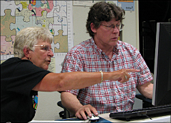
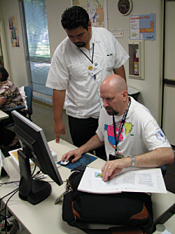
Thirty educators who participated in a unique training event held at Esri this year were challenged to become tireless role models, mentors, spokespersons, and advocates for the infusion of geospatial technologies in educational systems. In June 2009, educators from across the United States gathered at Esri headquarters in Redlands, California, for a week of training called the Teachers Teaching Teachers GIS Institute (or T3G Institute). The participants—teachers from middle schools, high schools, community colleges, and universities and those involved in informal education settings—shared a common desire to enhance their ability to use GIS and GPS technologies in their own educational programs as well as learn better methods for teaching and encouraging other educators to do the same. T3G Institute instructors were Anita and Roger Palmer from Esri business partner GISetc, GIS education consultants Lyn Malone and Kathryn Keranen, and Esri instructors Charlie Fitzpatrick and Joseph Kerski from the Esri Schools and Libraries program and Laura Bowden from Esri Educational Services.
Success as a GIS educator role model requires skills in three different areas: GIS knowledge and skills, teaching and professional development skills, and supporting technical skills. The institute provided training in all three areas. "It's great that educators who are passionate about teaching with GIS are equally passionate about sharing their expertise with others," said Malone. "It takes more than good software skills to train teachers to incorporate this powerful tool into educational programs. Educational trainers need to be able to support teachers in the development of projects and data that address both curriculum content and rigorous curriculum standards. They also need to be able to address technical issues such as software installation in a range of computer lab configurations." T3G Institute participants were selected from a pool of applicants several months before the event. An application process ensured all participants possessed fundamental skills using ArcGIS software and had experience teaching GIS to other teachers. On Sunday evening, T3G Institute began with an event that allowed participants to meet in a casual setting and let instructors set expectations for the week. Two paper map games, "Topo Match" and "Topo Bingo," got everyone interacting and having fun. (Instructions for these games can be found at edcommunity.esri.com/arclessons.) These games were the first of a variety of instructional strategies for teaching GIS and spatial thinking that would be modeled by institute leaders in days ahead. Monday morning was the beginning of an intensive week. In general, hands-on GIS lessons began with structured, step-by-step examples from the Our World GIS Education books from Esri Press and moved to less-structured explorations and investigations as the week progressed.
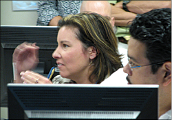
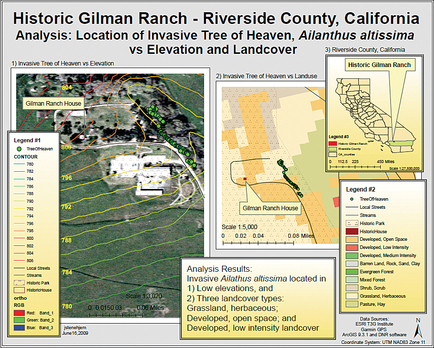
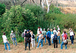
Participants were encouraged to think about multiple levels of their experience simultaneously. Throughout the week, while enhancing their own GIS software skills, participants also reflected on how they might incorporate different approaches into their workshops or classes. What approach is being modeled? Is this an effective way to learn? How might this strategy strengthen the outcomes of my own workshops? These questions and others were topics of discussion in both small and large groups. The notion of transfer was also emphasized. For instance, participants were asked, "How can the GIS skills presented in this lesson about earthquakes be transferred to another subject? To another set of data?" Because pre-built lessons can never fit every teaching need, these teacher-trainers must help other teachers see that out-of-the-box GIS lessons are a starting point. They can modify, expand, and adapt materials to meet their own objectives. ArcGIS Desktop 9.3.1 software was used for most of the activities. In addition to covering topics, such as creating and populating a file geodatabase, handling map projections and coordinate systems, performing GIS analysis using the ArcGIS Spatial Analyst extension, and exporting maps as PDF documents, participants created mashups in ArcMap using imagery, topographic maps, and layers from ArcGIS Online. Participants also tried out the new release of ArcGIS Explorer using an early-adopter beta version. They practiced using ArcMap as an authoring tool for symbolizing data and creating layer packages for display in ArcGIS Explorer. They created presentations and views, toggled between 3D and 2D map displays, and experimented with other new ArcGIS Explorer functions. A project incorporating several skill-building activities was centered around a midweek field trip to Gilman Historic Ranch and Wagon Museum, a local park in nearby Riverside County, California. In the classroom, the historic and geographic context of the park was presented using ArcGIS Explorer. Then participants created basemaps of the park using ArcGIS and readily available data. On the field trip, they collected GPS waypoints and tracks and at each point collected data on a variety of phenomena such as roads, trails, extent of invasive species, fruit tree inventory, bird sightings, and temperature measurements.
Back in the classroom the next day, participants downloaded the GPS data into ArcView for display on their basemaps. Using the topic of the data collected as a starting point, each person created map documents, ArcGIS Explorer presentations, or maps exported as PDFs. The resultant maps could become the basis for a class or workshop lesson. Afterward, an impromptu "gallery walk" through the classroom left everyone amazed and inspired. At the end of each day, participants completed a daily questionnaire that enabled the instructor team to adjust the schedule or fine-tune its approach for the next day to meet the needs of the participants. An evaluation for the full week was given on the last day of the event, followed with a short online survey a month later. T3G Institute participants are also required to make a presentation, conduct a hands-on GIS workshop for educators, and develop a lesson and post it to the ArcLessons Web site within six months of the class. Toward that end, each participant was required to develop a personal action plan with goals and supporting tasks. They presented these action plans to the group on the final afternoon of the institute. This was seen as a valuable exercise—several participants had revised existing plans or had been inspired to take a new approach to a previous goal.
Fitzpatrick said, "We do not expect attendees to become full-time trainers. We do want them to have new skills, a more vigorous vision for how GIS can be used in instruction, a set of best practices, and support to enhance and expand what they are already doing." By the end of the week, everyone involved had built a network of enthusiastic peers whom they can call upon for assistance, moral support, and collaboration. An online group for all T3G Institute participants and instructors was established for ongoing communication and exchange of information and ideas. Follow-up Web meetings to cover additional topics and discuss participant progress and challenges are planned monthly through the end of the year. Second T3G InstituteThe 2010 T3G Institute sponsored by Esri will be held June 13�19, 2010. Apply before Nov. 30, 2009. Forms and information are available at the Esri Education Community Web site (edcommunity.esri.com/t3g). |