How ArcGIS Indoors works
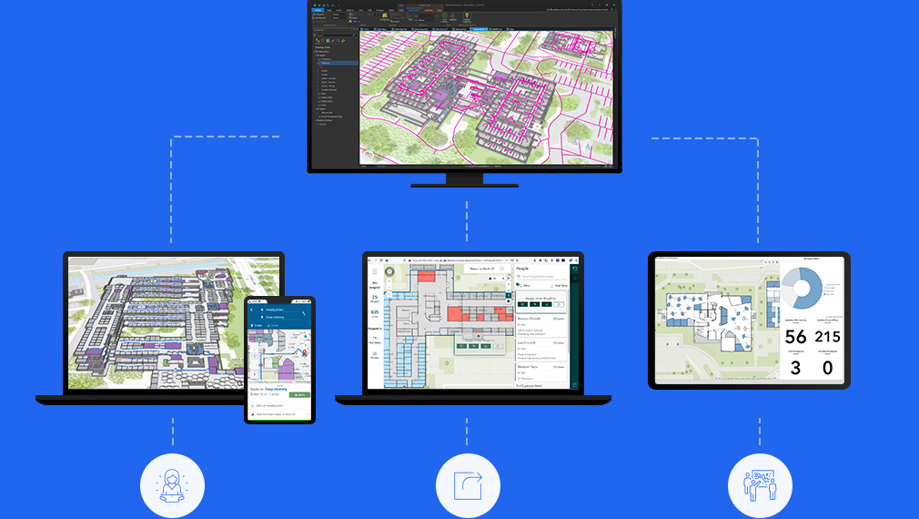
Share across your organization
Create shareable 2D and 3D indoor maps for use by anyone in your organization, including visitors to your workplace.
Empower the workforce
Empower employees with indoor maps and apps to locate amenities, find and book available workspace, navigate building, and report service issues.
Create indoor maps
Combine your disparate CAD and/or BIM files and all facility and asset information to create floor-aware indoor maps, for occupants and visitors.