Coon Rapids, Minnesota, Uses GIS to Tackle Rise in Vacant Properties
Coon Rapids, Minnesota, is located 20 minutes north of Minneapolis and is home to about 61,000 residents. With more than 850 acres of public green space within its 40 parks and a 20-mile trail system, including trails along the Mississippi River, the city is a recreational-minded community. Residents boast of Coon Rapids’ unique combination of urban excitement and small-town friendliness. With so much to offer its citizens, the City of Coon Rapids is committed to sustaining a desirable community in which to live.
Coon Rapids has had between 450 and 600 foreclosed properties per year since the housing crisis began in 2008. The sudden rise in vacant properties presented a difficult challenge for the city as water pipes burst, grass went uncut, and other problems accumulated due to the vacancies. Increased efficiency was needed to organize repair work.

Prior to 2008, a simple spreadsheet was used to track the handful of vacant properties and rental properties around the city. But when the housing crisis began and the number of vacancies rose, issues regarding the properties became much more complex, and this method was no longer effective. Documents and letters pertaining to properties were difficult to track and organize. Digital copies were stored among staff members’ computers, and paper copies were filed in folders, which were scattered between staff desks, file drawers, and the field staff, making the papers difficult to locate.
The sudden increase of vacant properties threatened property values and quality of life for many neighborhoods in Coon Rapids. The city council wished to see which neighborhoods were affected, and a quick way of seeing what was happening in the City of Coon Rapids was needed, along with a way to track the complex issues of these properties.
Cityworks, by Esri Platinum Tier Partner Azteca Systems, Inc., of Sandy, Utah, was already in use in the city’s Public Works Department. Cindy Hintze, administrative specialist for Coon Rapids, saw that the same software could be utilized for tracking vacant properties.

Cityworks and ArcGIS provided the solution Coon Rapids needed. The combination of these platforms now helps the city preserve these vacant properties—maintaining them as assets rather than allowing them to become liabilities. The solution also helps Coon Rapids track and fix problems with rental homes.
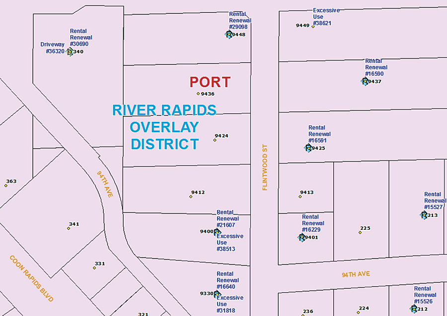
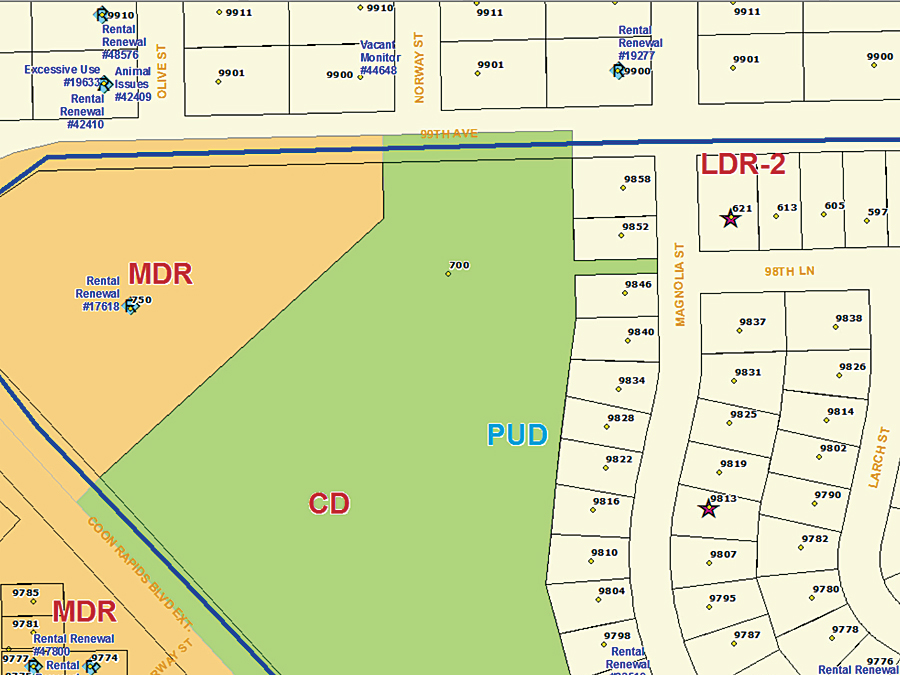
Now, through obtaining a clearer picture of where properties are and what is happening to them, the city is better able to mitigate issues associated with these homes. An address point is used to attach all Cityworks code enforcement work orders to the property, including vacant, rental, long grass, and other yard and lot work order templates. Tasks within the work orders track information regarding the property, for instance, posting the property for water shutoff or turning water on, communicating with the owner/agent, abatement, and property status.
“We use the GIS map as our go-to source for anything that’s going on,” says Hintze. “When we get a phone call about a property, the first thing we do is pull up our map and see if we might have other things going on there.” The work orders provide valuable data about the history of each property—when issues occurred, how they were fixed, what was observed during inspections, and much more.
Abating Problems with Rental Properties
ArcGIS also helps the city track and fix problems with rental properties.

“Landlords need to run a good business, and if they’re running a poor business, we need to respond to that so the neighborhood doesn’t deteriorate,” says Hintze. “Rental properties need to be licensed each year, which may or may not include a visual inspection by our housing inspector. The inspection process is based on how well the property is managed and whether issues have been found at the rental property. Work orders generated by the new system help track the history of rental properties, licensing, inspections, and communications, which also includes being used by our Police Department if police respond to issues at rental properties.”
By displaying all the data on a map using Cityworks and ArcGIS, the city can easily see the big picture—and the details. By mapping these properties, the city has made great strides in fixing issues, organizing inspections, maintaining properties, and even sharing information. “We can easily show our city council what’s going on in neighborhoods, because all this information is tied to the address point,” Hintze says.
About the Authors
Lindsay Ferguson is a writer for Azteca Systems, Inc. She has a degree in communication from the University of Utah. Cindy Hintze is administrative specialist with the City of Coon Rapids.
For more information, contact Cindy Hintze, administrative specialist, City of Coon Rapids, or Lindsay Ferguson, PR & Marketing, Azteca Systems, Inc..
