This article is part of an ongoing series honoring individuals who have made a difference in the world by applying a GIS solution to conservation or community challenges. Since these unique individuals have been selected for their innovations or special achievements, the series is appropriately named GIS Heroes. Esri recognizes Travis W. Engstrom as a GIS hero.

With six siblings and a journeyman police chief for a dad, Travis W. Engstrom, manager of information systems at the San Francisco Bay Area Rapid Transit District (BART), learned independence at a young age. That independence drove his work ethic early on, inoculating him to the pressure of large-scale projects. The career path that eventually led him to overhaul the BART GIS began in 1999.
That’s when the City of Lakeport, California, hired him to lead its fledgling GIS effort using hardware and software acquired from a grant. Engstrom was assigned to map the city’s water, sewer, and storm drain infrastructure. Engstrom confidently dove right in with no previous GIS training or experience.
In three months, Engstrom built an entire water, sewer, and storm drain layout for Lakeport’s community of 5,000 residents. The effort included manually capturing utility assets using an ArcPad enabled GPS receiver on more than 62 miles of curb, all on foot.

Later in his career, Engstrom applied his GIS expertise in a more nontraditional context for a nonprofit in Durban, South Africa, organizing volunteers and relief aid using GIS. There, he performed analysis with Esri demographic data tools and made maps in ArcGIS while managing a staff of 120.
“The organization I worked for was massively GIS-centric,” says Engstrom. “It used geospatial technology to focus its mission, find people in need, and plan the distribution of its outreach services. This was a great experience in teaching me how to use GIS creatively, and it paid huge dividends later on.”
Consultation
Engstrom went on to earn a law degree from Berkeley and simultaneously work as a private GIS consultant with North Star Precision Mapping, LLC. For 10 years, Engstrom performed a mix of municipal consultation and staff training for more than 1,000 government agencies. The work could be grueling. At times, Engstrom averaged 20 to 30 training sessions a month, educating agency staff on everything from how to jump-start GIS services to how to manage assets more efficiently. At the same time, he was also performing GIS builds from scratch for numerous Native American tribal governments throughout the Southwest.
Eventually, Engstrom, who was married with two sons, tired of living out of a suitcase and working on the weekends. When the opportunity came to overhaul the GIS of one of the most sophisticated public transportation systems in North America, he jumped at the chance.
BART
In 2011, BART contacted professional services firm Universal Field Services, Inc., to create an enterprise GIS pilot project. The firm passed the request on to Engstrom, well aware of his record and ability to create successful GIS builds from the bottom up. Being within driving distance of his Bay Area residence, the new opportunity was just the move he wanted. Although it was only a 10-month contract to perform a total assessment of BART’s needs and develop a long-term enterprise GIS strategy for the network, Engstrom recognized an opportunity to build something great.

“BART wanted me to come up with budget suggestions, staffing suggestions, and business cases to do a full return-on-investment analysis,” says Engstrom. “I was confident that the project would be a success simply because BART said they’d continue the effort if the proof of concept worked. I had enough experience under my belt to know proof would be ably demonstrated in a short amount of time.”
Engstrom enjoyed the BART assignment and the freedom it offered to develop innovative enterprise solutions. When the opportunity arose to manage the IT division, he applied for and was given the job.
A Babel Problem
With 3,200 employees, 103 miles of infrastructure, and 44 stations, BART presented some significant communication challenges. One of the agency’s biggest obstacles was the years-long accumulation of nonstandardized terminology by different groups, which led to information silos. Different offices used different names for the same objects, which hindered communication and made uniform mapping impossible.
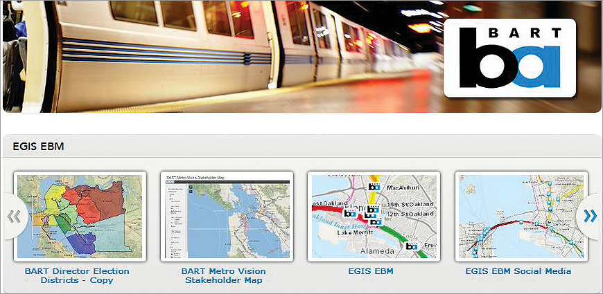
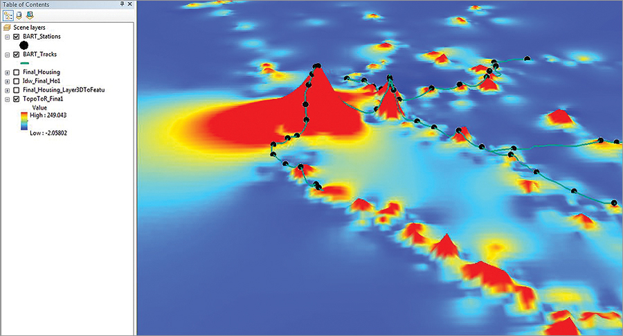
To put that in perspective, at the time of Engstrom’s hiring, the main maps used by BART were simple station maps to help orient the public. No maps existed to show the communities and jurisdictions through which trains ran. BART track schematics consisted of straight-line drawings without the benefit of scale or orientation. Engstrom’s first major achievement at the agency was to create a uniform map with the exact geographic position of the entire system—including track centerlines, mileposts, and critical facilities. The map served as a key to “unsilo” the information between departments.
“That first map showed the potential of a comprehensive view with layers that could be toggled on and off according to the needs of every department,” says Engstrom. “In very short order, major decisions were made to convert to a standardized system where everyone spoke the same language.”

Putting the ROI in Irony
Being initially hired as a GIS contractor, it’s ironic that Engstrom ultimately helped BART achieve independence from GIS contractors. Prior to Engstrom’s enterprise developments, consultants would be hired to perform expensive research required by the federal government to understand the demography of the citizens BART served. Experienced in demographic analysis since his work in South Africa, Engstrom used Esri Community Analyst to conduct the same research. Community Analyst not only provided superior demographic reporting compared to the outsourced services BART previously paid for; it also integrated into the ArcGIS system, allowing demographic information to easily be included in any map-based report BART generated.
A significant portion of BART’s budget is spent on asset life cycle replacement programs, including dive teams to replace underwater infrastructure on the network’s Trans-Bay Tube that connects Oakland to San Francisco. Performing maintenance on this equipment involved sending out divers to manually inspect and carry out repairs. With little to no assistance from location technology, this work took a considerable amount of time and money.
“BART was able to convert existing AutoCAD drawings of the tube to GIS, reference this data against known survey records, and equip the diving teams with GPS coordinates showing exactly what features needed to be inspected and replaced,” says Engstrom. “That alone saved us $800,000.”
Subsequent analysis revealed that, within five years, BART’s enterprise GIS will generate a net present value of $6.6 million. Those numbers led BART to establish a permanent GIS team. The figures also forced a major shift in organizational perspective at BART, essentially making GIS the linchpin of the enterprise and expanding Engstrom’s role to include advanced anti-terrorism applications and cyber defense. Engstrom’s reorganization of BART’s GIS project has since spawned more than 100 other major projects at the agency, resulting in a new enterprise license agreement for all the Esri software BART uses.
For more information, contact Travis W. Engstrom, manager of information systems, BART—Office of the Chief Information Officer.

