Free with an ArcGIS Online organizational account
The latest and greatest Landsat 8 scenes are available from Esri as a new set of image services in ArcGIS Online. A subscription to ArcGIS Online for Organizations is required to access the services, but there is no charge for usage.
These Landsat 8 scenes from the US Geological Survey are accessible as image services that can be used in web maps, ArcGIS for Desktop, and other applications.
Each day, Esri downloads approximately 300 of the most recent Landsat 8 scenes and adds them to a set of image services that make 50,000 of the best Landsat 8 scenes available to users. The best scenes are determined by weighting cloud coverage and scene age. Users can reorder the scenes based on metadata attributes, lock to a specific scene, or use a time slider to see how an area changes with time.
Landsat 8 image services join the other Landsat imagery that Esri has made accessible. Esri first released more than eight terabytes of Landsat imagery services in ArcGIS Online two years ago. These image services made the collection of Landsat Global Land Survey (GLS) scenes spanning the epochs of 1980, 1990, 2000, 2005, and 2010 accessible as more than 20 dynamic, multispectral, and multitemporal image services. These dynamic services enable a wide range of client applications temporal access to any of the band combinations and products without downloading or locally processing any data. All these Landsat scenes are hosted on Esri’s cloud infrastructure.
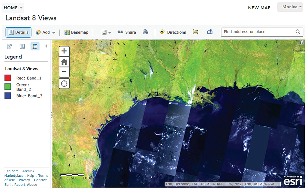
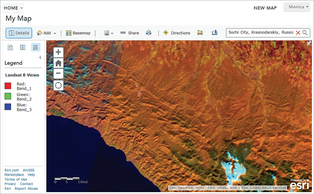
The Landsat 8 imagery, available in ArcGIS Online, provides several image services from the same source. Most popular is the Landsat 8 Views services, which allow users to view a range of different band combinations including Natural Color (bands 4, 3, 2) and Color Infrared (bands 5, 4, 3). The Agriculture band combination (bands 6, 5, 2) highlights differences in different crop types. The SWIR band combination (bands 7, 6, 5) provides better penetration for clouds. The bathymetric option (bands 4, 2, 1) provides better water penetration and is especially useful for coastal applications.
Users can also select any user-defined band combination. Functions can be applied with fixed enhancements or with Dynamic Range Adjustment Stretch, which requests the server to maximize the contrast so as to get the most out of the extended dynamic range of sensors.
The Landsat 8 Views service also provides two indexes: the colorized Normalized Difference Vegetation Index (NDVI) and the colorized Normalized Difference Water Index. NDVI provides information on the health of vegetation. The colorized Normalized Difference Water Index highlights areas that have high moisture content.
The PanSharpened service provides enhanced natural color imagery by sharpening the natural color bands (4, 3, 2) with 15-meter panchromatic imagery and giving direct access to the panchromatic imagery.
While all services return 8-bit rendered versions of different products, the Analytic service enables applications to access the full range of data values that are sometimes required by analysis applications. This service contains similar band options and indexes but returns computed apparent reflectance values versus colored renderings.
These services are powered by ArcGIS for Server and ArcGIS Image Extension. Processing and dynamic mosaicking are performed on the fly directly on the source data. All processing is applied on the source imagery as it is accessed by the server, enabling the creation of multiple products as well as enabling the full dynamic range of imagery that can be accessed even when using browsers that are limited to only 8 bits.
The server also applies user-controllable lossless compression, ensuring that the data is transmitted back to the client application quickly, even over low-bandwidth networks.
For more than 40 years, the United States government has invested billions in the collection and archiving of continuous worldwide Landsat imagery for earth observation. Through ArcGIS Online, Esri has made 30-meter spatial resolution Landsat imagery much more widely available. Imagery at this scale is excellent for mapping regional trends in climate change, agriculture, wildlife habitat, forestry, regional planning, coastal zones, and national security. Because data is collected in nonvisible wavelengths such as the infrared and optical (natural color) portions of the electromagnetic spectrum, Landsat satellite images allow researchers to see also more than the human eye can. Delivering imagery as services extends monitoring of the landscape to Internet users worldwide.
To access the services, search for Landsat 8 in ArcGIS Online or visit