Here are some of the new features and enhancements that were released in the December 2013 update to ArcGIS Online.
More Control with Map Viewer
You can make a copy of a layer in your map and configure the properties of that copied layer, such as pop-up windows and symbols, and save it as a new layer. Layers imported into maps such as CSV files and map notes can also be saved.
Map authors can choose whether or not to allow others to save a copy of their map. The Modify Map option does not appear in the map viewer if a map author has enabled Save As protection on the map. Also, there is no option to save the map unless the user is signed in.
Administrators can set default map units for the scale bar, measure tool, directions, and analysis. ArcGIS Online members can modify these units on their own profile page.
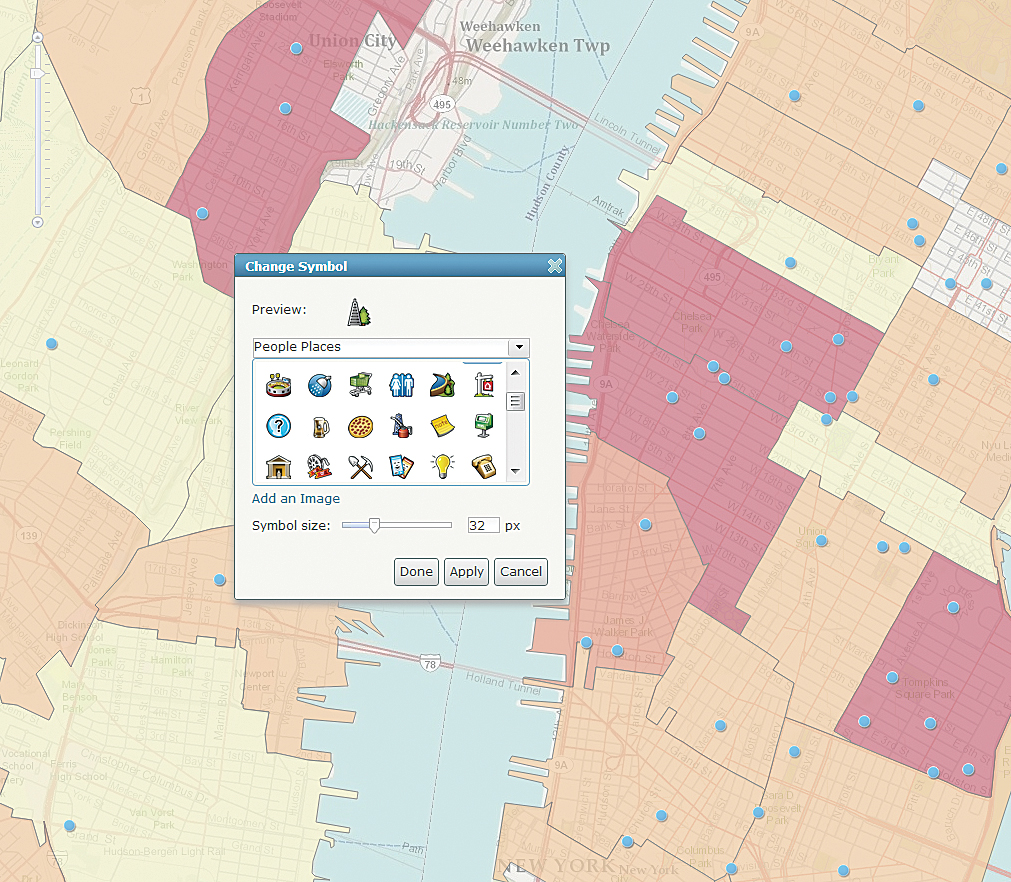
Additional symbology options allow you to rotate point symbols, normalize your data, change the width of lines, and display a graduated point symbol over a polygon. Optionally, time animation on time-enabled layers can be disabled so the time slider does not appear on the map.
For organizations that allow anonymous access, a simplified map viewer opens even if a user is not signed in, encouraging casual users to explore maps. However, there is no option to modify the map. The simplified viewer includes tools to show tables, edit features, change symbols, share, view data through time, and so on.
Get Web App Template Codes
App template code can now be downloaded from GitHub so you can create customized apps hosted on your own server. You can create configurable apps and group gallery apps from Esri-featured app templates in the gallery. The Basic Viewer, Social Media, Legend, and Panels Geocoder templates now show a list of suggestions as search terms are typed.
The GPX template has been retired from the Esri default map viewer template gallery. You can still use this or other retired templates to create and publish apps by sharing them (and any other Esri template) to your custom template gallery.
Updated Services
The profile template has been updated with the latest ArcGIS Online Elevation profile service (a free service). This worldwide service is based on General Bathymetric Chart of the Oceans (GEBCO) data at 30 arc-second spacing (approximately 1,000 meter) resolution and is worldwide between 60 degrees north and 56 degrees south based on the 3 arc-second (approximately 90 meter) resolution of the Shuttle Radar Topography Mission (SRTM) dataset. In the continental United States, the service is available at 10-meter and 30-meter resolution based on the USGS National Elevation Dataset (NED).
More Analysis Tools
Spatial Analysis
With the Enrich Layers tool, you can now select a group of data variables (data packs) or individual variables from each group. You can map the results from the Summarize Data tool using the new proportional symbols and get better visual clues for understanding your organization’s data.
You can use the Extract Data tool to export a CSV file of feature attributes from area and line layers.
A new tool, Find Existing Locations, has been added that allows you to query both spatial and nonspatial attributes in your data. And finally, you’ll now see the consumption of service credits ahead of time for Enrich Layers and Create Drive-Time Areas.
Network Analysis
Multi-Vehicle Route service credits usage has been reduced by 50 percent. Content has been updated and enhanced for India and Thailand. Live traffic is now available for visualization and analysis in Argentina.
The Location-Allocation service is in beta. Developers can include this service in their applications, and ArcGIS for Desktop users will see it as one of the ready-to-use services. There is an option to use live traffic in the Directions tool, including Drive Time Areas, Finding Nearest, and Summarize Nearby.
Account Administration
To make it easier to manage your ArcGIS Online subscription, Esri has added a number of enhancements. You now have the ability to use your own custom geocoding services to find places and addresses. Custom geocoders can be useful for batch geocoding or geocoding your own data. A setting has been added for the default basemap in the map viewer to open at a default extent set by the organization. And you now have a setting to add Esri basemaps and templates to configure groups so you can automatically include the Esri default basemaps and default templates. A custom contact link has also been added in the footer of your ArcGIS Online website. Under My Organization, administrators can now see the date when members last logged in. Administrators also have a new tool for resending and removing invitations and disabling member log-ins.
CityEngine Web Viewer
Several enhancements have been made to the CityEngine Web Viewer. Search has been improved to deliver search results faster, and search results are now highlighted in 3D view. New search tokens for attribute filtering, a new screen shot tool, and a new dedicated comments pane with filter for author and nonauthor comments have also been added. The share dialog has been improved. Experimental support for Internet Explorer 11 has been added.
Geocomments created by the web scene author in the CityEngine Web Viewer that are symbolized differently can now be displayed independently of other comments. You will also see faster performance when working with scenes that contain many features.
Featuring and Organizing Content
The gallery has been redesigned to include an Esri featured content section and your organization’s own featured content section. The gallery also includes better tools for sorting and filtering items.
ArcGIS Online organization members will now see items they’ve designated as favorites in their My Favorites section. You can add search result items to your favorites or the gallery. You can view your favorites in a new My Favorites section of the gallery and search your favorites to add layers to your map.
You can change the URL of an ArcGIS for Server service layer you’ve moved to a different server by editing its details.
Use a CSV URL
When you add a CSV file to ArcGIS Online and share it with everybody (public), the details page now displays the URL. You can then use the URL to reference the CSV file as a layer in web apps, pop-up windows, and so on.
Item details now include an option to protect against deleting the item. And now you can store items with the same title in the same folder.
Dark Canvas Basemap
This new basemap is currently in beta at small scale (~1:577 kilometers). It will be updated and coverage will be expanded to larger scales worldwide in future releases. The Dark Canvas basemap lets you use a different color palette for all types of maps.
More Helpful Help
Help has been reorganized to better highlight the main workflows of ArcGIS Online. This is part of an ongoing effort to improve the usability and attractiveness of the site.